Bluejacket, Oklahoma
| Bluejacket, Oklahoma | |
|---|---|
| Town | |
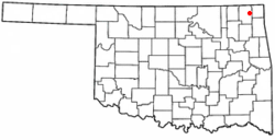 Location of Bluejacket, Oklahoma | |
| Coordinates: 36°48′2″N 95°4′25″W / 36.80056°N 95.07361°WCoordinates: 36°48′2″N 95°4′25″W / 36.80056°N 95.07361°W | |
| Country | United States |
| State | Oklahoma |
| County | Craig |
| Area | |
| • Total | 0.4 sq mi (1.0 km2) |
| • Land | 0.4 sq mi (1.0 km2) |
| • Water | 0.0 sq mi (0.0 km2) |
| Elevation | 781 ft (238 m) |
| Population (2010) | |
| • Total | 339 |
| • Density | 847.5/sq mi (339/km2) |
| Time zone | Central (CST) (UTC-6) |
| • Summer (DST) | CDT (UTC-5) |
| FIPS code | 40-06950[1] |
| GNIS feature ID | 1090300[2] |
Bluejacket is a town in eastern Craig County, Oklahoma, United States. The population was 339 at the 2010 census, an increase of 23.7 percent from 274 at the 2000 census.[3] Bluejacket was named for its first postmaster, the Rev. Charles Bluejacket, one-time chief of the Shawnee and grandson of noted leader Blue Jacket.[4]
History
Bluejacket was founded as a station designated by the Missouri, Kansas and Texas Railway (KATY) in 1871, as it built a line through Indian Territory from Kansas to Texas. A post office was established in 1882, and Chief Bluejacket was appointed as the first postmaster. The town was incorporated in the Cherokee Nation in 1894.[4]
During the late 1930s, two tornadoes severely damaged Bluejacket. The first, on May 4, 1938, destroyed some barns and killed a farmer and several head of livestock. The second, on August 24, 1939, destroyed much of the business district. This storm killed two young men and caused an estimated half million dollars' worth of damage in the county.[4]
Geography
According to the United States Census Bureau, the town has a total area of 0.4 square miles (1.0 km2), all of it land. It is about 17 miles (27 km) northeast of Vinita, the county seat.[4]
Demographics
| Historical population | |||
|---|---|---|---|
| Census | Pop. | %± | |
| 1900 | 303 | — | |
| 1910 | 508 | 67.7% | |
| 1920 | 442 | −13.0% | |
| 1930 | 271 | −38.7% | |
| 1940 | 349 | 28.8% | |
| 1950 | 274 | −21.5% | |
| 1960 | 245 | −10.6% | |
| 1970 | 234 | −4.5% | |
| 1980 | 247 | 5.6% | |
| 1990 | 175 | −29.1% | |
| 2000 | 274 | 56.6% | |
| 2010 | 339 | 23.7% | |
| Est. 2015 | 335 | [5] | −1.2% |
census[1] of 2000, there were 274 people, 99 households, and 69 families residing in the town. The population density was 692.2 people per square mile (264.5/km2). There were 112 housing units at an average density of 283.0 per square mile (108.1/km2). The racial makeup of the town was 66.42% White, 18.25% Native American, 1.09% African American, and 14.23% from two or more races.
There were 99 households out of which 40.4% had children under the age of 18 living with them, 49.5% were married couples living together, 13.1% had a female householder with no husband present, and 30.3% were non-families. 28.3% of all households were made up of individuals and 18.2% had someone living alone who was 65 years of age or older. The average household size was 2.72 and the average family size was 3.33.
In the town the population was spread out with 31.8% under the age of 18, 9.1% from 18 to 24, 24.5% from 25 to 44, 21.5% from 45 to 64, and 13.1% who were 65 years of age or older. The median age was 34 years. For every 100 females there were 81.5 males. For every 100 females age 18 and over, there were 81.6 males.
The median income for a household in the town was $26,458, and the median income for a family was $33,250. Males had a median income of $26,000 versus $23,750 for females. The per capita income for the town was $11,755. About 11.3% of families and 14.3% of the population were below the poverty line, including 17.3% of those under the age of eighteen and 30.6% of those sixty five or over.
Notable residents
- Fern Holland, a lawyer who was killed in the Iraq conflict
References
- 1 2 "American FactFinder". United States Census Bureau. Archived from the original on 2013-09-11. Retrieved 2008-01-31.
- ↑ "US Board on Geographic Names". United States Geological Survey. 2007-10-25. Retrieved 2008-01-31.
- ↑ CensusViewer: Population of the City of Bluejacket (Blue Jacket), Oklahoma.
- 1 2 3 4 Craig County Genealogical Society, "Bluejacket," Encyclopedia of Oklahoma History and Culture. Accessed April 18, 2015.
- ↑ "Annual Estimates of the Resident Population for Incorporated Places: April 1, 2010 to July 1, 2015". Retrieved July 2, 2016.
- ↑ "Census of Population and Housing". Census.gov. Archived from the original on May 11, 2015. Retrieved June 4, 2015.
Municipalities and communities of Craig County, Oklahoma, United States | ||
|---|---|---|
| City | 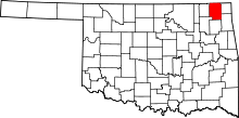 | |
| Towns | ||
| CDP | ||
| Unincorporated community | ||