Boiling Springs, South Carolina
| Boiling Springs, South Carolina | |
|---|---|
| CDP | |
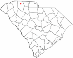 Location of Boiling Springs, South Carolina | |
| Coordinates: 35°2′35″N 81°58′31″W / 35.04306°N 81.97528°WCoordinates: 35°2′35″N 81°58′31″W / 35.04306°N 81.97528°W | |
| Country | United States |
| State | South Carolina |
| County | Spartanburg |
| Area | |
| • Total | 6.8 sq mi (17.6 km2) |
| • Land | 6.8 sq mi (17.6 km2) |
| • Water | 0.0 sq mi (0.0 km2) |
| Elevation | 925 ft (282 m) |
| Population (2010) | |
| • Total | 8,219 |
| • Density | 1,200/sq mi (470/km2) |
| Time zone | Eastern (EST) (UTC-5) |
| • Summer (DST) | EDT (UTC-4) |
| ZIP code | 29316 |
| Area code(s) | 864 |
| FIPS code | 45-07345[1] |
| GNIS feature ID | 1220877[2] |
Boiling Springs is a census-designated place (CDP) in Spartanburg County, South Carolina, United States. The population was 8,219 at the 2010 census.[3]
Namesake
The area became known as Boiling Springs because of a small spring in its heart[4] that, up until the land was commercially developed, actually appeared as if it were boiling and would sometimes shoot water 6 feet (1.8 m) into the air. The geyser diminished gradually over the years. In the 1930s it had become a shallow, barely bubbling stream and today the water is still. The spring is located at the corner of McMillian Boulevard and Highway 9 on the same lot as the Bi-Lo Shopping Center and the Verizon Mobile store. Once the land was developed and the shopping center was built, the springs ceased to boil. After the spring was cleaned up and dug out, a small park was built around it with benches, flags, and a memorial to a citizen of Boiling Springs. The spring has begun to boil again.
Geography
Boiling Springs is located at 35°2′35″N 81°58′31″W / 35.04306°N 81.97528°W (35.043151, -81.975381).[5]
According to the United States Census Bureau, the CDP has a total area of 6.8 square miles (18 km2), all of it land.
Demographics
As of the census[1] of 2000, there were 4,544 people, 1,714 households, and 1,336 families residing in the CDP. The population density was 666.9 people per square mile (257.6/km²). There were 1,801 housing units at an average density of 264.3/sq mi (102.1/km²). The racial makeup of the CDP was 90.82% White, 6.34% African American, 0.24% Native American, 1.50% Asian, 0.51% from other races, and 0.59% from two or more races. Hispanic or Latino of any race were 1.21% of the population.
There were 1,714 households out of which 38.4% had children under the age of 18 living with them, 65.1% were married couples living together, 9.4% had a female householder with no husband present, and 22.0% were non-families. 19.3% of all households were made up of individuals and 7.2% had someone living alone who was 65 years of age or older. The average household size was 2.62 and the average family size was 3.00.
In the CDP the population was spread out with 26.1% under the age of 18, 7.3% from 18 to 24, 33.1% from 25 to 44, 22.5% from 45 to 64, and 10.9% who were 65 years of age or older. The median age was 35 years. For every 100 females there were 93.4 males. For every 100 females age 18 and over, there were 91.1 males.
The median income for a household in the CDP was $65,640, and the median income for a family was $70,256. Males had a median income of $39,625 versus $33,279 for females. The per capita income for the CDP was $20,814. About 4.7% of families and 6.4% of the population were below the poverty line, including 7.7% of those under age 18 and 3.3% of those age 65 or over.
Education
Boiling Springs students are part of Spartanburg County School District 2.[6] For the 2013-2014 Academic Year, Spartanburg District 2 was named the top school district in the State of South Carolina by the Department of Education.[7] 63% of educators in Spartanburg District 2 have a master's degree or higher, and 19% are National Board certified, placing the district in the top 1% of school districts nationwide.
Notable people
- William McGirt, professional golfer
- Dylan Thompson, quarterback, University of South Carolina, San Francisco 49ers
- Brooks Foster, wide receiver, University of North Carolina, St. Louis Rams
- Tanner Saraceno, WWE Tough Enough Season 6 Contestant
References
- 1 2 "American FactFinder". United States Census Bureau. Archived from the original on 2013-09-11. Retrieved 2008-01-31.
- ↑ "US Board on Geographic Names". United States Geological Survey. 2007-10-25. Retrieved 2008-01-31.
- ↑ "Race, Hispanic or Latino, Age, and Housing Occupancy: 2010 Census Redistricting Data (Public Law 94-171) Summary File (QT-PL), Boiling Springs CDP, South Carolina". U.S. Census Bureau, American FactFinder 2. Archived from the original on September 11, 2013. Retrieved August 16, 2011.
- ↑ "Spartanburg County Public Libraries". History of Boiling Springs. Retrieved 29 March 2015.
- ↑ "US Gazetteer files: 2010, 2000, and 1990". United States Census Bureau. 2011-02-12. Retrieved 2011-04-23.
- ↑ "Spartanburg County District 2". Boiling Springs District 2. Retrieved 21 March 2015.
- ↑ "SCDOE". Federal Accountability System. Retrieved 28 August 2014.
Municipalities and communities of Spartanburg County, South Carolina, United States | ||
|---|---|---|
| Cities | 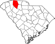 | |
| Towns | ||
| CDPs | ||
| Unincorporated communities | ||
| Ghost town | ||
| Footnotes | ‡This populated place also has portions in an adjacent county or counties | |