Inman, South Carolina
| Inman, South Carolina | |
|---|---|
| City | |
 Location of Inman, South Carolina | |
| Coordinates: 35°2′51″N 82°5′25″W / 35.04750°N 82.09028°WCoordinates: 35°2′51″N 82°5′25″W / 35.04750°N 82.09028°W | |
| Country | United States |
| State | South Carolina |
| County | Spartanburg |
| Area | |
| • Total | 0.9 sq mi (2.4 km2) |
| • Land | 0.9 sq mi (2.4 km2) |
| • Water | 0.0 sq mi (0.0 km2) |
| Elevation | 1,001 ft (305 m) |
| Population (2010) | |
| • Total | 2,321 |
| • Density | 2,600/sq mi (970/km2) |
| Time zone | Eastern (EST) (UTC-5) |
| • Summer (DST) | EDT (UTC-4) |
| ZIP code | 29349 |
| Area code(s) | 864 |
| FIPS code | 45-35755[1] |
| GNIS feature ID | 1223455[2] |
| Website | www.cityofinman.org |
Inman is a city in Spartanburg County, South Carolina, United States. The population was 2,321 at the 2010 census.[3]
Inman is a small community located in the Upstate region of South Carolina. The weather is temperate year-round, due to its location in the Isothermal Belt, a phenomenon that results when warmer air on the western side of the Appalachian Mountains blows over the mountains, leaving a 60-mile-wide (97 km) trough where significant temperature inversions of 20 degrees Fahrenheit or greater can occur.[4]
Greater Inman is within close proximity to the Spartanburg-Greenville-Asheville metroplex. Inman residents have access to nearby Lake Bowen that affords water recreational sports and fishing, and Inman is accessible by Interstate 26 and Interstate 85. The city contains a historic main street district, several houses of worship, and a school district.
History
The Bush House and Shiloh Methodist Church are listed on the National Register of Historic Places.[5]
Geography
Inman is located at 35°2′51″N 82°5′25″W / 35.04750°N 82.09028°W (35.047493, -82.090329).[6]
According to the United States Census Bureau, the city has a total area of 0.9 square miles (2.3 km2), all of it land.
Interstate 26 is an even-numbered highway and is considered an east-west route in its entirety, while Interstate 85 is an odd-numbered highway and is considered a north-south route in its entirety. U.S. Route 176 is a National Highway which should be referred to as US 176.
It is about 40 miles (64 km) northwest of Union, South Carolina.[7]
Demographics
| Historical population | |||
|---|---|---|---|
| Census | Pop. | %± | |
| 1890 | 134 | — | |
| 1900 | 294 | 119.4% | |
| 1910 | 474 | 61.2% | |
| 1920 | 694 | 46.4% | |
| 1930 | 969 | 39.6% | |
| 1940 | 1,115 | 15.1% | |
| 1950 | 1,514 | 35.8% | |
| 1960 | 1,714 | 13.2% | |
| 1970 | 1,661 | −3.1% | |
| 1980 | 1,554 | −6.4% | |
| 1990 | 1,742 | 12.1% | |
| 2000 | 1,884 | 8.2% | |
| 2010 | 2,321 | 23.2% | |
| Est. 2015 | 2,273 | [8] | −2.1% |
As of the census[1] of 2000, there were 1,884 people, 750 households, and 486 families residing in the city. The population density was 2,015.8 people per square mile (782.2/km²). There were 829 housing units at an average density of 887.0 per square mile (344.2/km²). The racial makeup of the city was 69.27% White, 27.76% African American, 0.16% Native American, 1.38% Asian, 0.74% from other races, and 0.69% from two or more races. Hispanic or Latino of any race were 1.27% of the population.
There were 750 households out of which 29.7% had children under the age of 18 living with them, 42.1% were married couples living together, 19.5% had a female householder with no husband present, and 35.2% were non-families. 31.7% of all households were made up of individuals and 16.5% had someone living alone who was 65 years of age or older. The average household size was 2.39 and the average family size was 3.03.
In the city the population was spread out with 25.0% under the age of 18, 7.3% from 18 to 24, 27.8% from 25 to 44, 19.3% from 45 to 64, and 20.6% who were 65 years of age or older. The median age was 38 years. For every 100 females there were 79.4 males. For every 100 females age 18 and over, there were 72.9 males.
The median income for a household in the city was $40,403, and the median income for a family was $50,298. Males had a median income of $37,177 versus $30,399 for females. The per capita income for the city was $35,416. About 8.0% of families and 12.5% of the population were below the poverty line, including 10.7% of those under age 18 and 19.4% of those age 65 or over.
Notable people
James Hylton, NASCAR driver
Ron Culbreth, Actor
Fieldin Culbreth, MLB Umpire
References
- 1 2 "American FactFinder". United States Census Bureau. Retrieved 2008-01-31.
- ↑ "US Board on Geographic Names". United States Geological Survey. 2007-10-25. Retrieved 2008-01-31.
- ↑ "Race, Hispanic or Latino, Age, and Housing Occupancy: 2010 Census Redistricting Data (Public Law 94-171) Summary File (QT-PL), Inman city, South Carolina". U.S. Census Bureau, American FactFinder 2. Retrieved August 15, 2011.
- ↑ "Inman, South Carolina". SCIWAY.net.
- ↑ National Park Service (2010-07-09). "National Register Information System". National Register of Historic Places. National Park Service.
- ↑ "US Gazetteer files: 2010, 2000, and 1990". United States Census Bureau. 2011-02-12. Retrieved 2011-04-23.
- ↑ "Seven People Drown in S. Carolina Lake Where Susan Smith Killed 2 Sons." Associated Press at Los Angeles Times. September 2, 1996. "Also killed in the accident were Carl White, 29, of Campobello, S.C., and 3-year-old Austin Roodvoets of Inman, S.C. Both towns are about 40 miles northwest of Union."
- ↑ "Annual Estimates of the Resident Population for Incorporated Places: April 1, 2010 to July 1, 2015". Retrieved July 2, 2016.
- ↑ "Census of Population and Housing". Census.gov. Retrieved June 4, 2015.
External links
Municipalities and communities of Spartanburg County, South Carolina, United States | ||
|---|---|---|
| Cities | 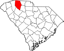 | |
| Towns | ||
| CDPs | ||
| Unincorporated communities | ||
| Ghost town | ||
| Footnotes | ‡This populated place also has portions in an adjacent county or counties | |