South Carolina Highway 9
| ||||
|---|---|---|---|---|
| Route information | ||||
| Maintained by SCDOT | ||||
| Length: | 258.3 mi[1] (415.7 km) | |||
| Existed: | 1922 – present | |||
| Major junctions | ||||
| South end: |
| |||
|
| ||||
| North end: |
| |||
| Location | ||||
| Counties: | Horry, Marion, Dillon, Marlboro, Chesterfield, Lancaster, Chester, Union, Spartanburg | |||
| Highway system | ||||
| ||||
South Carolina Highway 9 (SC 9) is a 258.3 mi (416 km)-long state highway in the U.S. state of South Carolina. The route runs from the North Carolina border upstate to North Myrtle Beach, near the Atlantic coast. The road is currently the longest state highway in South Carolina.[1]
Route description
SC 9 begins at the North Carolina-South Carolina border, where the road continues as NC 9. This is about twelve miles (19 km) northwest of Spartanburg.
The road slowly heads southeast to Spartanburg. Five miles into its existence SC 9 intersects SC 11 and then two miles (3 km) later, SC 9 intersects SC 292. After this, SC 9 enters Boiling Springs.
Finally, SC 9 enters the northeast section of Spartanburg and crosses over Interstate 85 and Interstate 585. Then SC 9 joins up with US Route 176. While concurrent, it intersects US Route 29 and a couple of other state highways. Finally, after the ten-mile concurrency with US Route 176 ends, SC 9 leaves the Spartanburg metro.
About 1.5 miles (2.5 km) east of this concurrency, SC 9 intersects SC 150 in downtown Pacolet. In another five miles (8 km) or so, SC 9 enters Jonesville, where SC 9 merges with SC 18. SC 9 merges off SC 18 nearly a mile out of town.
The next town, Lockhart, is nearly 7.5 miles (12.1 km) away. On the way there, SC 9 runs across SC 114 and SC 105. Once in downtown Lockhart, SC 9 merges with SC 49 for nearly a half-mile.
The next town is six miles to the east. That town is Chester. There SC 9 avoids the city by going south and merging with SC 97 and SC 121 Bypass.
Eight miles east of Chester, SC 9 crosses over Interstate 77 and enters Richburg. SC 9 merges with SC 901 for about a mile. Once in downtown, SC 9 turns left and out of Richburg. It then enters Fort Lawn, where it goes under US Route 21.
SC 9 then enters the rapidly growing city of Lancaster. Right before it enters town, SC 9 Business spreads off. SC 9 then meets/crosses over US Route 521 and SC 200.
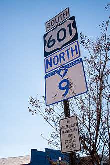
Finally, SC 9 enters the rural area of north central SC and rolls through the countryside at interstate speeds, with the biggest thing on the road to Pageland being an intersection with SC 522. While entering Pageland, SC 9 merges with US Route 601. US 601 merges off with SC 151 in downtown Pageland.
SC 9 is the northern terminus of SC 268 in Mt. Croghan It is another mile to Ruby, during which SC 9 is concurrent with SC 109.
SC 9 curves left when it serves as the eastern terminus to SC 265 one mile (1.6 km) from Ruby. Having turned east, SC 9 enters Chesterfield, South Carolina. Once again, it breaks off in a business route and then it meets SC 102 and SC 145.
SC 9 then proceeds onto Cheraw. While entering downtown, SC 9 merges with US Route 52 and then onto US Route 1 to get out of town. SC 9 merges off US 1 after downtown, and SC 9 heads east, where it shortly meets SC 177 and then SC 79.
Seven miles southeast of Cheraw, SC 9 runs into Bennettsville. SC 9 merges with SC 38 for one mile (1.6 km), entering downtown Bennettsville, where SC 9 runs eastward with US Route 401 for nearly a mile before merging off again. There is another SC 9 Business Route.
SC 9 then proceeds onto the tiny town of Clio where the main intersection is with SC 381.
Nearly seven miles later, after merging SC 57, SC 9/57 crosses under I-95 and enters Dillon. There SC 9/57 merges with US Route 301 before all three go their separate ways.
A further ten miles (16 km) to the east, SC 9 meets up with SC 41 in Lake View, South Carolina. Here SC 9 comes very close to the NC border (about two miles (3 km) south), but as soon as SC 9 leaves town, it heads due south into deep rural land for nine to ten miles (16 km).
Finally, SC 9 enters Nichols where it merges with US Route 76 for a little more than a mile. Another six miles (10 km) goes by before SC 9 begins to enter the beach zone, as another SC 9 Business Route merges off. With SC 9 Bus, SC 9 is able to avoid downtown Loris, go by the Twin City Airport, and have an interchange with US Route 701.
After meeting back up with its Business Route, SC 9 heads towards the NC border, this time as close as a mile. Yet again, SC 9 bends south where it meets SC 905 in Longs, an interchange with SC 31; and then heads into downtown North Myrtle Beach. There it crosses over US Route 17 and SC 90 and goes through one mile (1.6 km) of beach, where it continues as SC 65 along the beachfront.
Alternate names
- Sea Mountain Highway
- N. Main St.
- Nichols Highway
- Dillon Highway
- E. Main St.
- Radford Blvd.
- S. Main St.
- Tyson Ave.
- Cheraw St.
- Powe St.
- Market St.
- East Blvd.
- Chesterfield Highway
- West Blvd.
- Main St.
- W. McGregor St.
- Pageland Highway
- Lancaster Bypass
- Chester Highway
- Pinckney Rd.
- Jonesville – Lockhart Highway
- Spartanburg Highway
- Pine St.
- Boiling Springs Rd.
History
Established in 1922 as an original state highway, it traversed from SC 23, in Dillon, west to SC 10, in Enoree. By 1926, SC 9 was extended east to Lake View, then replacing SC 47 to Green Sea, then southeast on new primary routing to Little River. On its northern end, SC 9 rerouted from Kelly to SC 19, near Spartanburg, replacing SC 92. The route from Kelly to Enoree was renumbered SC 92.
In 1927, SC 9 was rerouted between Pageland to Lancaster on a more southern route, avoiding the Tradesville area; The old alignment was briefly downgraded to secondary before being renumbered as SC 906. In 1933, SC 9 was realigned on a straight path from Loris to Little River; most of the old route was downgraded to secondary, with exception to Wampee and eastward becoming SC 90. In 1936, SC 9 was extended north through Spartanburg and Boiling Springs to its current northern terminus at the North Carolina state line; replacing SC 177.
In 1940, SC 9 was extended south as a new primary routing to Cherry Grove Beach. Between 1943-1946, SC 9 was rerouted onto Pine Street between Pacolet to Spartanburg; the old route was downgraded to secondary, but then later became SC 295 in 1948. In 1948, SC 9 south end was truncated at US 17, at Nixons Crossroads; the route to Cherry Grove Beach was downgraded. In 1949, SC 9 was given a southern bypass of Chesterfield, leaving its first business loop through the downtown (since decommissioned). Also in that same year, SC 9 was moved on a more direct routing between Pageland to Lancaster, replacing SC 906; the old routing was renumbered as SC 902 and SC 903 (today US 601).
In 1956, SC 9 was given a southern bypass of Chester, leaving a business loop through downtown. By 1962, SC 9 was rerouted in Spartanburg, utilizing Pine Street to Interstate 585, then north along Boiling Springs Road. Part of the old routing through the downtown area beame part of SC 56. By 1967, SC 9 was given a northern bypass of Lancaster, leaving a business loop through downtown. In 1974, SC 9 was rerouted north into Dillon via US 301/US 501; leaving 3rd Avenue (later becoming Martin Luther King Jr. Boulevard).
From 1982-1985, SC 9 moved onto bypass route from Loris to Green Sea, leaving a business loop through downtown Loris. Also around that same time, SC 9 was moved onto a western bypass of Bennettsville, leaving a business loop through downtown. By 1988, SC 9 was re-extended to its current southern terminus at Cherry Grove Beach, replacing part of SC 65.[2]
Junction list
| County | Location | mi[1] | km | Destinations | Notes |
|---|---|---|---|---|---|
| Horry | Cherry Grove Beach | 0.0 | 0.0 | ||
| North Myrtle Beach | 1.5 | 2.4 | South end of US 17 overlap | ||
| Little River | 2.3 | 3.7 | |||
| 2.6 | 4.2 | North end of US 17 overlap; no southbound exit | |||
| 4.5 | 7.2 | ||||
| Longs | 9.7 | 15.6 | |||
| | 16.8 | 27.0 | |||
| Loris | 23.3 | 37.5 | |||
| Green Sea | 29.8 | 48.0 | |||
| | 41.1 | 66.1 | East end of US 76 overlap | ||
| Marion | Nichols | 42.8 | 68.9 | West end of US 76 overlap | |
| Dillon | Lake View | 51.3 | 82.6 | ||
| Dillon | 63.6 | 102.4 | South end of SC 57 overlap | ||
| 64.4 | 103.6 | South end of US 301/501 overlap | |||
| 65.3 | 105.1 | North end of US 301/501 overlap | |||
| 66.5 | 107.0 | I-95 exit 193 | |||
| Little Rock | 69.8 | 112.3 | North end of SC 57 overlap | ||
| Marlboro | Clio | 81.6 | 131.3 | ||
| | Proposed interchange[3][4] | ||||
| Bennettsville | 89.1 | 143.4 | North end of US 15/401 overlap | ||
| 90.2 | 145.2 | South end of SC 38 overlap | |||
| 91.1 | 146.6 | South end of US 15/401 overlap | |||
| 91.6 | 147.4 | ||||
| 93.4 | 150.3 | North end of SC 38 overlap | |||
| | 97.4 | 156.8 | |||
| | 98.6 | 158.7 | |||
| Wallace | 103.8 | 167.0 | |||
| 104.6 | 168.3 | North end of US 1 overlap | |||
| Chesterfield | Cheraw | 106.5 | 171.4 | North end of US 52 overlap | |
| 107.7 | 173.3 | South end of US 1/52 overlap | |||
| Chesterfield | 119.0 | 191.5 | |||
| 119.3 | 192.0 | ||||
| Ruby | 123.2 | 198.3 | |||
| 125.1 | 201.3 | South end of SC 109 overlap | |||
| Mount Croghan | 128.2 | 206.3 | North end of SC 109 overlap | ||
| Pageland | 137.4 | 221.1 | |||
| 137.9 | 221.9 | North end of US 601 overlap | |||
| 138.4 | 222.7 | ||||
| 141.5 | 227.7 | South end of US 601 overlap | |||
| Lancaster | Buford | 152.0 | 244.6 | ||
| Lancaster | 159.3 | 256.4 | South end of US 521 overlap | ||
| 161.0 | 259.1 | ||||
| 161.2 | 259.4 | North end of US 521 overlap | |||
| 164.3 | 264.4 | ||||
| Chester | Fort Lawn | 168.3 | 270.9 | ||
| | 173.2 | 278.7 | |||
| Richburg | 176.5 | 284.0 | South end of SC 901 overlap | ||
| 176.9 | 284.7 | To Landsford Canal State Park | |||
| | 178.0 | 286.5 | North end of SC 901 overlap | ||
| | 178.4 | 287.1 | I-77 exit 65 | ||
| | 181.5 | 292.1 | |||
| Chester | 188.2 | 302.9 | East end of SC 72 and north end of SC 97/121 overlap | ||
| 189.4 | 304.8 | South end of US 321 and SC 97 overlap | |||
| 191.2 | 307.7 | West end of SC 72 and south end of SC 121 overlap | |||
| 192.0 | 309.0 | ||||
| 192.3 | 309.5 | North end of US 321 overlap | |||
| | 206.5 | 332.3 | North end of SC 49 overlap | ||
| Union | Lockhart | 207.2 | 333.5 | South end of SC 49 overlap | |
| | 209.6 | 337.3 | |||
| | 218.6 | 351.8 | |||
| | 220.5 | 354.9 | South end of SC 18 overlap | ||
| Jonesville | 221.6 | 356.6 | North end of SC 18 overlap | ||
| Spartanburg | Pacolet | 228.4 | 367.6 | ||
| 230.3 | 370.6 | East end of US 176 overlap | |||
| 230.6 | 371.1 | ||||
| Spartanburg | 238.8 | 384.3 | |||
| 239.2 | 385.0 | ||||
| 240.5 | 387.0 | South end of I-585 overlap; exit 25B | |||
| 240.7 | 387.4 | North end of I-585 and west end of US 176; exit 25A Access to northbound via Milliken Road | |||
| 242.2 | 389.8 | I-85 Business exit 6 | |||
| Boiling Springs | 243.6 | 392.0 | I-85 exit 75 | ||
| | 250.8 | 403.6 | |||
| New Prospect | 253.7 | 408.3 | |||
| State line | 258.3 | 415.7 | |||
1.000 mi = 1.609 km; 1.000 km = 0.621 mi
| |||||
Bannered routes
Loris business loop
| |
|---|---|
| Location: | Loris, South Carolina |
| Length: | 13.5 mi[5] (21.7 km) |
| Existed: | 1982–present |
SC 9 Business begins nearly 5 miles (8.0 km) northwest of Loris, heading due south from SC 9. However, it only goes south for about a mile, before turning eastward at the eastern terminus of SC 917. SC 9 BUS then makes the run into downtown Loris, the downtown being at the intersection with U.S. 701. As soon as SC 9 Business passes US 701, it heads a mile and a half back to SC 9.
Bennettsville business loop
| |
|---|---|
| Location: | Bennettsville, South Carolina |
| Length: | 2.4 mi[6] (3.9 km) |
| Existed: | 1985–present |
SC 9 Business begins one mile (1.6 km) north of Bennettsville when SC 9 merges with SC 38. SC 9 Business heads straight into downtown Bennettsville, where just before downtown SC 9 merges with SC 385. There it runs just north of downtown before moving south in the outskirts of town and ends again at SC 9.
Chesterfield business loop
| |
|---|---|
| Location: | Chesterfield, South Carolina |
| Length: | 2.2 mi[7] (3.5 km) |
| Existed: | 1949–1956 |
South Carolina Highway 9 Business was a business loop along Main Street in Chesterfield. Established in 1949, when SC 9 was moved onto new road, bypassing south of Main Street; however, by 1956, SC 9 Business was already decommissioned. Though official maps from the state show that Main Street is a secondary road (SC-S-13-1), some online mapping sites still label it as a branch of SC 9.[2][8]
Lancaster business loop
| |
|---|---|
| Location: | Lancaster, South Carolina |
| Length: | 5.3 mi[9] (8.5 km) |
| Existed: | 1967–present |
SC 9 Business merges off SC 9 Bypass (F.W. McWhirter Expressway) about 2 miles (3.2 km) northwest of Lancaster. After going south for half a mile, SC 9 Business bends eastwards and heads straight eastwards. SC 9 Business merges onto US 521 for one block and then merges back off, crosses over SC 200, and quickly SC 9 Business is out of downtown on E. Arch St. A half mile after crossing over SC 200, SC 9 Business ends at SC 9 Bypass. Other than Spartanburg, the City of Lancaster is the largest urban area SC 9 runs through before reaching the North Myrtle Beach area.
Chester business loop
| |
|---|---|
| Location: | Chester, South Carolina |
| Length: | 2.7 mi[10] (4.3 km) |
| Existed: | 1956–present |
Like all the numbered highways in Chester, SC 9 Business goes straight through downtown, and the bypass route makes a half-moon path around Chester. SC 9 Business shares a brief concurrency with US 321 Business and SC 97 Business, and then with SC 72/121 Business.
References
- 1 2 3 Google (February 7, 2013). "South Carolina Highway 9" (Map). Google Maps. Google. Retrieved February 7, 2013.
- 1 2 "Mapmikey's South Carolina Highways Page". Retrieved February 6, 2013.
- ↑ Staff. "Project Status: Northern Project". I-73 Environmental Impact Study. South Carolina Department of Transportation. Retrieved February 7, 2013.
- ↑ I-73 Northern Map (PDF) (Map). South Carolina Department of Transportation. Bennettsvile inset. Retrieved February 7, 2013.
- ↑ Google (February 6, 2013). "South Carolina Highway 9 Business - Loris" (Map). Google Maps. Google. Retrieved February 6, 2013.
- ↑ Google (February 6, 2013). "South Carolina Highway 9 Business - Bennettsville" (Map). Google Maps. Google. Retrieved February 6, 2013.
- ↑ Google (February 6, 2013). "South Carolina Highway 9 Business - Chesterfield" (Map). Google Maps. Google. Retrieved February 6, 2013.
- ↑ Chesterfield City (PDF) (Map). South Carolina Department of Transportation. July 2009. Retrieved February 6, 2013.
- ↑ Google (February 6, 2013). "South Carolina Highway 9 Business - Lancaster" (Map). Google Maps. Google. Retrieved February 6, 2013.
- ↑ Google (February 6, 2013). "South Carolina Highway 9 Business - Chester" (Map). Google Maps. Google. Retrieved February 6, 2013.
External links
 Media related to South Carolina Highway 9 at Wikimedia Commons