Bombo, Uganda
| Bombo | |
|---|---|
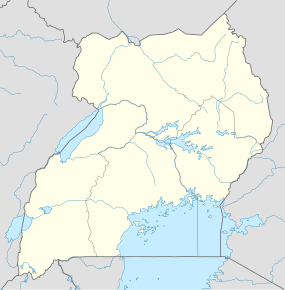 Bombo Location in Uganda | |
| Coordinates: 00°34′40″N 32°32′42″E / 0.57778°N 32.54500°E | |
| Country |
|
| Region | Central Uganda |
| District | Luweero District |
| Population (2014 Census) | |
| • Total | 26,370[1] |
Bombo is a town in Luweero District in the Central Region of Uganda.
Location
Bombo is located approximately 37 kilometres (23 mi), by road, north of Uganda's capital, Kampala.[2] The coordinates of Bombo are:0°34'36.0"N, 32°32'42.0"E (Latitude:0.576667; Longitude:32.545000).[3]
Overview
Bombo is one of three town councils in Luweero District, the other two being Luweero and Wobulenzi. All three municipalities are located on the Kampala - Masindi highway, that continues to Gulu and Arua in Northern Uganda. The town has a large Nubian minority, the Nubians having settled there when they came from Sudan to serve in the British Colonial army. Bombo remains the location of an army barracks, and was the headquarters of the Ugandan Ministry of Defense until December 2007, when they were moved to Mbuya, in Nakawa Division in southeastern Kampala. Bombo, however, remains the headquarters of the Uganda Land Forces[4]
Bombo District (now defunct)
Ugandan districts are often named after main municipal centres. The area in which Bombo town is a main township became Bombo District, one of the first regions that initially received district status when Uganda became independent in October 1962. In 1967 the district was renamed East Mengo. In 1974, Uganda reorganized from districts into provinces, and East Mengo became the Province of Bombo. Provinces were reorganized into districts in 1980, and the district of Luwero was created, with Bombo town as one of the main town councils.[5]
Population
In 2002, the national census estimated the population the town to be 16,699. In 2010, the Uganda Bureau of Statistics (UBOS), estimated the population of Bombo at 20,500. In 2011, UBOS estimated the mid-year population of Bombo at 21,000.[6] In August 2014, the national population census put Bombo's population at 26,370.[1]
Points of interest
The following points of interest lie within Bombo or near the town limits:
- The headquarters of the Uganda Land Forces, a division of the Uganda People's Defense Force
- A branch of Wazalendo Sacco - Located within Bombo UPDF Barracks
- A branch of Equity Bank
- A branch of PostBank Uganda
- Bombo Military Hospital - Located inside Bombo Military Barracks
- Don Bosco Catholic Mission Bombo - Branch of international Salesian Missions
- St. Mary's Senior Secondary School, Namaliga-Bombo
- Don Bosco Vocational Training Centre, Bombo.
- St. Josephine Bakhita Children's Home, Bombo.
- Don Bosco Old Students' Association, Bombo.(DOSA)
- The main campus of Ndejje University - Located on Ndejje Hill, 8 kilometres (5.0 mi), northwest of Bombo.
- Namaliga Catholic Mission, Kasana-Luwero Catholic Diocese
Nubian Cultural Information Centre, an NGO located at 21 miles
- Reach Out Wives Of Soldiers Association, ICT Center Located in Bombo Town, Kampala Road Opposite Bombo Common P/S.
See also
References
- 1 2 UBOS, . (27 August 2014). "The Population of The Regions of the Republic of Uganda And All Cities And Towns of More Than 15,000 Inhabitants". Citypopulation.de Quoting Uganda Bureau of Statistics (UBOS). Retrieved 22 February 2015.
- ↑ "Road Distance Between Kampala And Bombo With Interactive Map". Globefeed.com. Retrieved 22 February 2015.
- ↑ Google (3 July 2015). "Location of Bombo At Google Maps" (Map). Google Maps. Google. Retrieved 3 July 2015.
- ↑ Defense Headquarters moved from Bombo to Mbuya Archived December 26, 2007, at the Wayback Machine., The Monitor, December 25, 2007
- ↑ Ocwich, Denis (7 August 2005). "Can Uganda's Economy Support More Districts?". New Vision (Kampala). Retrieved 22 February 2015.
- ↑ UBOS, . (2012). "Estimated Population of Bombo In 2002, 2010 & 2011" (PDF). Uganda Bureau of Statistics (UBOS). Archived from the original (PDF) on 7 July 2014. Retrieved 22 February 2015.
External links
Capital: Luweero | ||
| Towns and villages | ||
| Economy | ||
| Notable landmarks | ||
| Health | ||
| Transport |
| |
| Education | ||
| Notable people | ||
Coordinates: 00°34′36″N 32°32′42″E / 0.57667°N 32.54500°E