Breesport, New York
| Breesport, New York | |
|---|---|
| Hamlet & CDP | |
 Breesport Location within the state of New York | |
| Coordinates: 42°10′24″N 076°44′02″W / 42.17333°N 76.73389°WCoordinates: 42°10′24″N 076°44′02″W / 42.17333°N 76.73389°W[1] | |
| Country | United States |
| State | New York |
| County | Chemung County |
| Town | Horseheads |
| Area[2] | |
| • Total | 1.640 sq mi (4.25 km2) |
| • Land | 1.628 sq mi (4.22 km2) |
| • Water | 0.012 sq mi (0.03 km2) |
| Elevation[1] | 1,099 ft (335 m) |
| Population (2010)[3] | |
| • Total | 626 |
| • Density | 382/sq mi (147/km2) |
| Time zone | Eastern (EST) (UTC-5) |
| • Summer (DST) | EDT (UTC-4) |
| ZIP code[4] | 14816 |
| Area code | 607 |
| FIPS code[2][5] | 36-08004 |
| GNIS feature ID[5] | 944682 |
Breesport is a hamlet and census-designated place in the town of Horseheads in Chemung County, New York, United States. The population was 626 at the 2010 census.[3]
It is the home of the Twin Tiers Christian Academy.
Geography
Breesport is located on the eastern side of the town of Horseheads at 42°10′24″N 076°44′02″W / 42.17333°N 76.73389°W (42.173408, -76.733841). Its elevation is 1,099 feet (335 m).[1] Its eastern edge is the border between Horseheads and the town of Erin. New York State Route 223 passes through the center of Breesport, leading west 3 miles (5 km) to NY-13 near the village of Horseheads and east 3.5 miles (5.6 km) to Erin.
According to the United States Census Bureau, Breesport has a total area of 1.640 square miles (4.25 km2), of which 1.628 square miles (4.22 km2) is land and 0.012 square miles (0.03 km2) is water.[2]
References
- 1 2 3 "Breesport". Geographic Names Information System. United States Geological Survey. Retrieved January 12, 2013.
- 1 2 3 "Places: New York". 2010 Census Gazetteer Files. United States Census Bureau. Retrieved January 12, 2013.
- 1 2 "2010 Demographic Profile Data: Breesport CDP, New York". Profile of General Population and Housing Characteristics: 2010. United States Census Bureau. Retrieved January 12, 2013.
- ↑ "Post Offices By County: Chemung County, New York". United States Postal Service. Retrieved January 12, 2013.
- 1 2 "FIPS55 Data: New York". FIPS55 Data. United States Geological Survey. February 23, 2006. Archived from the original on October 19, 2006.
Municipalities and communities of Chemung County, New York, United States | ||
|---|---|---|
| City | 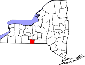 | |
| Towns | ||
| Villages | ||
| CDPs | ||
| Hamlets | ||