Erin (CDP), New York
| Erin, New York | |
|---|---|
| Census-designated place | |
 Erin Location within the state of New York | |
| Coordinates: 42°11′09″N 76°40′11″W / 42.18583°N 76.66972°WCoordinates: 42°11′09″N 76°40′11″W / 42.18583°N 76.66972°W[1] | |
| Country | United States |
| State | New York |
| County | Chemung County |
| Town | Erin |
| Area[2] | |
| • Total | 0.76 sq mi (1.96 km2) |
| • Land | 0.75 sq mi (1.94 km2) |
| • Water | 0.008 sq mi (0.02 km2) |
| Elevation[1] | 1,265 ft (386 m) |
| Population (2010)[2] | |
| • Total | 483 |
| • Density | 646/sq mi (249.5/km2) |
| Time zone | Eastern (EST) (UTC-5) |
| • Summer (DST) | EDT (UTC-4) |
| ZIP code | 14838 |
| Area code | 607 |
| FIPS code | 36-24625 |
| GNIS feature ID | 944682 |
Erin is a hamlet and census-designated place in the town of Erin in Chemung County, New York, United States. The population of the CDP was 483 at the 2010 census,[2] out of a total town population of 1,962.
Geography
Erin is located in northeastern Chemung County in the center of the town of Erin. It is in the valley of Newtown Creek, a west-flowing (and later south-flowing) tributary of the Chemung River, which in turn is a tributary of the Susquehanna River. New York State Route 223 passes through the center of Erin, leading west 3.5 miles (5.6 km) to Breesport and 7 miles (11 km) to NY-13 near the village of Horseheads. Route 223 leads northeast 5.7 miles (9.2 km) to NY-224 in the valley of Cayuta Creek, which then leads 2.5 miles (4.0 km) farther east to Van Etten.
According to the United States Census Bureau, Erin has a total area of 0.76 square miles (1.96 km2), of which 0.75 square miles (1.94 km2) is land and 0.008 square miles (0.02 km2), or 1.26%, is water.[2]
References
- 1 2 "Erin". Geographic Names Information System. United States Geological Survey.
- 1 2 3 4 "Geographic Identifiers: 2010 Demographic Profile Data (G001): Erin CDP, New York". U.S. Census Bureau, American Factfinder. Retrieved November 4, 2014.
Municipalities and communities of Chemung County, New York, United States | ||
|---|---|---|
| City | 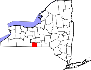 | |
| Towns | ||
| Villages | ||
| CDPs | ||
| Hamlets | ||