Brewster, Kansas
| Brewster, Kansas | |
|---|---|
| City | |
 Location within Thomas County and Kansas | |
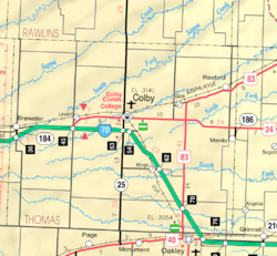 KDOT map of Thomas County (legend) | |
| Coordinates: 39°21′46″N 101°22′36″W / 39.36278°N 101.37667°WCoordinates: 39°21′46″N 101°22′36″W / 39.36278°N 101.37667°W | |
| Country | United States |
| State | Kansas |
| County | Thomas |
| Area[1] | |
| • Total | 0.26 sq mi (0.67 km2) |
| • Land | 0.26 sq mi (0.67 km2) |
| • Water | 0 sq mi (0 km2) |
| Elevation | 3,428 ft (1,045 m) |
| Population (2010)[2] | |
| • Total | 305 |
| • Estimate (2015)[3] | 302 |
| • Density | 1,200/sq mi (460/km2) |
| Time zone | Central (CST) (UTC-6) |
| • Summer (DST) | CDT (UTC-5) |
| ZIP code | 67732 |
| Area code(s) | 785 |
| FIPS code | 20-08425 [4] |
| GNIS feature ID | 0471255 [5] |
Brewster is a city in Thomas County, Kansas, United States. As of the 2010 census, the city population was 305.[6]
History
Brewster was named for L. D. Brewster, a railroad official.[7] Brewster was a station and shipping point on the Chicago, Rock Island and Pacific Railroad.[8]
The first post office in Brewster was established in September 1888.[9]
Geography
Brewster is located at 39°21′46″N 101°22′36″W / 39.362878°N 101.376552°W (39.362878, -101.376552).[10] According to the United States Census Bureau, the city has a total area of 0.26 square miles (0.67 km2), all of it land.[1]
Climate
According to the Köppen Climate Classification system, Brewster has a semi-arid climate, abbreviated "BSk" on climate maps.[11]
Demographics
| Historical population | |||
|---|---|---|---|
| Census | Pop. | %± | |
| 1930 | 487 | — | |
| 1940 | 408 | −16.2% | |
| 1950 | 467 | 14.5% | |
| 1960 | 317 | −32.1% | |
| 1970 | 320 | 0.9% | |
| 1980 | 327 | 2.2% | |
| 1990 | 296 | −9.5% | |
| 2000 | 285 | −3.7% | |
| 2010 | 305 | 7.0% | |
| Est. 2015 | 302 | [3] | −1.0% |
| U.S. Decennial Census | |||
2010 census
As of the census[2] of 2010, there were 305 people, 122 households, and 87 families residing in the city. The population density was 1,173.1 inhabitants per square mile (452.9/km2). There were 142 housing units at an average density of 546.2 per square mile (210.9/km2). The racial makeup of the city was 92.5% White, 2.0% Native American, 0.3% Asian, 0.3% Pacific Islander, 3.9% from other races, and 1.0% from two or more races. Hispanic or Latino of any race were 9.8% of the population.
There were 122 households of which 33.6% had children under the age of 18 living with them, 56.6% were married couples living together, 10.7% had a female householder with no husband present, 4.1% had a male householder with no wife present, and 28.7% were non-families. 26.2% of all households were made up of individuals and 14.8% had someone living alone who was 65 years of age or older. The average household size was 2.50 and the average family size was 2.97.
The median age in the city was 40.4 years. 29.2% of residents were under the age of 18; 5.3% were between the ages of 18 and 24; 22.2% were from 25 to 44; 22.6% were from 45 to 64; and 20.7% were 65 years of age or older. The gender makeup of the city was 51.8% male and 48.2% female.
2000 census
As of the census[4] of 2000, there were 285 people, 115 households, and 81 families residing in the city. The population density was 1,131.2 people per square mile (440.2/km2). There were 136 housing units at an average density of 539.8 per square mile (210.0/km2). The racial makeup of the city was 95.44% White, 2.46% from other races, and 2.11% from two or more races. Hispanic or Latino of any race were 4.56% of the population.
There were 115 households out of which 35.7% had children under the age of 18 living with them, 66.1% were married couples living together, 3.5% had a female householder with no husband present, and 28.7% were non-families. 26.1% of all households were made up of individuals and 17.4% had someone living alone who was 65 years of age or older. The average household size was 2.48 and the average family size was 3.01.
In the city the population was spread out with 29.5% under the age of 18, 3.2% from 18 to 24, 22.5% from 25 to 44, 21.4% from 45 to 64, and 23.5% who were 65 years of age or older. The median age was 40 years. For every 100 females there were 99.3 males. For every 100 females age 18 and over, there were 95.1 males.
The median income for a household in the city was $34,063, and the median income for a family was $40,139. Males had a median income of $27,917 versus $24,375 for females. The per capita income for the city was $14,562. About 7.4% of families and 11.1% of the population were below the poverty line, including 7.7% of those under the age of eighteen and 11.7% of those sixty five or over.
References
- 1 2 "US Gazetteer files 2010". United States Census Bureau. Archived from the original on 2012-01-24. Retrieved 2012-07-06.
- 1 2 "American FactFinder". United States Census Bureau. Retrieved 2012-07-06.
- 1 2 "Annual Estimates of the Resident Population for Incorporated Places: April 1, 2010 to July 1, 2015". Retrieved July 2, 2016.
- 1 2 "American FactFinder". United States Census Bureau. Archived from the original on 2013-09-11. Retrieved 2008-01-31.
- ↑ "US Board on Geographic Names". United States Geological Survey. 2007-10-25. Retrieved 2008-01-31.
- ↑ "2010 City Population and Housing Occupancy Status". U.S. Census Bureau. Archived from the original on July 21, 2011. Retrieved September 1, 2011.
- ↑ Heim, Michael (2007). Exploring Kansas Highways. p. 27.
- ↑ Blackmar, Frank Wilson (1912). Kansas: A Cyclopedia of State History, Embracing Events, Institutions, Industries, Counties, Cities, Towns, Prominent Persons, Etc. Standard Publishing Company. p. 233.
- ↑ "Kansas Post Offices, 1828-1961". Kansas Historical Society. Archived from the original on October 9, 2013. Retrieved 27 June 2014.
- ↑ "US Gazetteer files: 2010, 2000, and 1990". United States Census Bureau. 2011-02-12. Retrieved 2011-04-23.
- ↑ Climate Summary for Brewster, Kansas
External links
| Wikimedia Commons has media related to Brewster, Kansas. |
- City
- Schools
- USD 314, local school district
- Maps
- Brewster City Map, KDOT
Municipalities and communities of Thomas County, Kansas, United States | ||
|---|---|---|
| Cities | 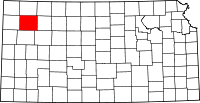 | |
| CDP | ||
| Unincorporated communities | ||
| Footnotes | ‡This populated place also has portions in an adjacent county or counties | |