Brickell station
| |||||||||||||||||||||||||
|---|---|---|---|---|---|---|---|---|---|---|---|---|---|---|---|---|---|---|---|---|---|---|---|---|---|
|
Metrorail rapid transit station Metromover people mover station | |||||||||||||||||||||||||
 Brickell Metrorail platform seen from the adjoining Metromover platform | |||||||||||||||||||||||||
| Location |
1001 SW 1st Avenue Miami, FL 33130 | ||||||||||||||||||||||||
| Coordinates | 25°45′49″N 80°11′43″W / 25.76361°N 80.19528°WCoordinates: 25°45′49″N 80°11′43″W / 25.76361°N 80.19528°W | ||||||||||||||||||||||||
| Owned by | MDT | ||||||||||||||||||||||||
| Line(s) | |||||||||||||||||||||||||
| Platforms | 2 island platforms (1 per service) | ||||||||||||||||||||||||
| Tracks | 4 (2 per service) | ||||||||||||||||||||||||
| Connections |
| ||||||||||||||||||||||||
| Construction | |||||||||||||||||||||||||
| Parking | No | ||||||||||||||||||||||||
| Disabled access | Yes | ||||||||||||||||||||||||
| Other information | |||||||||||||||||||||||||
| Station code | BKL | ||||||||||||||||||||||||
| History | |||||||||||||||||||||||||
| Opened |
May 20, 1984 (Metrorail) May 26, 1994 (Metromover) | ||||||||||||||||||||||||
| Traffic | |||||||||||||||||||||||||
| Passengers (2012) |
1.317 million[1] (Metrorail) | ||||||||||||||||||||||||
| Services | |||||||||||||||||||||||||
| |||||||||||||||||||||||||
Brickell station is a Metrorail rapid transit station in Miami, Florida, serving the system's Green and Orange Lines. One of the core stations of Miami's public transport network, it serves the financial district of Brickell. Combined, the Metrorail and Metromover station complex at Brickell sees roughly 8,430 boardings each weekday, making it the system's second-busiest station.[1]
Location
The Brickell station is located in the median of SW 1st Avenue at its intersection with SW 11th Street in the central Miami neighborhood of Brickell. Excluding nearby Metromover stations, it is the closest rail stop to attractions such as Brickell Key, Mary Brickell Village, Brickell Avenue and Simpson Park.
Transit-oriented development
Like other rail stations in Miami's central business district, Brickell has been the focal point for significant transit-oriented development (TOD), particularly in the real estate boom of the 2000s and 2010s. New developments such as Axis at Brickell Village, Infinity at Brickell and Plaza on Brickell are all within a short distance of the station, as are numerous other residential and commercial projects. Once considered a failed example of TOD, and referred to as only "transit-adjacent development", over the past few years Brickell (Metromover) ridership has risen from approximately fifth place to as high as second place for some months in 2015 and 2016. Metrorail ridership growth at this station also outpaced most other stations, and by June 2016, it was the second highest ridership station on the Metrorail as well amid heavy losses at some stations, namely Dadeland South and Dadeland North.[2]
History
One of the original Metrorail stations, Brickell opened along with the initial stretch of the system from Dadeland South to Historic Overtown/Lyric Theatre, then called "Overtown."[3] The Metromover station opened ten years later on May 26, 1994.
Station layout
The Metrorail station and Metromover station are located next to each other and are connected by an overhang. The Metrorail station can hold up to six cars and has a canopy covering most of the platform. The Metromover platform can hold up to two Metromover cars and is completely covered and gives access to the Metrorail station and nearby places of interest.
Connecting bus services
| Route # | Route Name | Route Map | Note | |
|---|---|---|---|---|
| 6 | NW 29 St ar 17 Ave ↔ Coconut Grove via Downtown Miami | Map | ||
| 8 | Miami Dade College (Wolfson Campus) ↔ Florida International University (Modesto Maidique Campus) via Tamiami Trail (South 8 St), SW 82 Ave, Coral Way, and West 107 Ave | Map | 8A does not service SW 82 Ave | |
| B (102) | Brickell Metrorail Station ↔ Key Biscayne to Crandon Blvd or Harbor Dr via Rickenbacker Causeway | Map | Route no longer serves Downtown Miami use the free Metromover or metrorail to go Downtown | |
| 207 | Little Havana Connection (Downtown Miami ↔ Little Havana via SW 7 St & 1 St) | Map | ||
| 208 | Little Havana Connection (Downtown Miami ↔ Little Havana via Flagler Street & SW 8 St) | Map | ||
| 500 | Government Center Downtown Bus Terminal ↔ Dadeland South station | Map | Overnight service only | |
| 24 | Coral way limited (Brickell Metrorail Station ↔ Westchester/137 Ave; Select trips operate to 152 Ave via FIU | Map |
Gallery
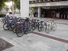 A busy bike and ride rack at Brickell station
 North entrance to the Brickell Metrorail station
 Decorated roof of the Metrmover station
 Invader's addition to the station
 Metrorail and Metromover arriving at the station
 New exercise park under the station in 2016, and MetroPath sign
References
- 1 2 "Ridership Technical Reports". Miami-Dade County. Retrieved August 22, 2016.
- ↑ "Ridership Technical Report (June 2016)" (PDF). Miami-Dade County. Retrieved August 22, 2016.
- ↑ Holle, Gena. "Two of a Kind: Miami's Metrorail & Metromover" (PDF). Community Transportation Association. Retrieved 2012-01-14.
External links
| Wikimedia Commons has media related to Brickell (MDT station). |
- MDT – Metrorail Stations
- MDT – Metromover Stations
- Metromover Station from Google Maps Street View
- Metrorail entrance from Google Maps Street View
