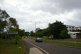
Brinkin, Northern Territory
| Brinkin Darwin, Northern Territory | |||||||||||||
|---|---|---|---|---|---|---|---|---|---|---|---|---|---|
 | |||||||||||||
|
Brinkin | |||||||||||||
| Coordinates | 12°22′12″S 130°52′01″E / 12.37°S 130.867°ECoordinates: 12°22′12″S 130°52′01″E / 12.37°S 130.867°E | ||||||||||||
| Population | 1,156 (2006)[1] | ||||||||||||
| • Density | 826/km2 (2,140/sq mi) | ||||||||||||
| Established | 1984 | ||||||||||||
| Postcode(s) | 0810[2] | ||||||||||||
| Area | 1.4 km2 (0.5 sq mi) | ||||||||||||
| Location | 12 km (7 mi) from Darwin | ||||||||||||
| LGA(s) | City of Darwin | ||||||||||||
| Territory electorate(s) | Casuarina | ||||||||||||
| Federal Division(s) | Solomon | ||||||||||||
| |||||||||||||
Brinkin is a northern suburb of Darwin, the capital city of the Northern Territory, Australia. It is located 12 kilometres (7 mi) north of Darwin's central business district, and is home to the Casuarina campus of Charles Darwin University (formerly Northern Territory University's campus).
History
Brinkin is named after an Aboriginal tribe who inhabited an area to the south of the Daly River mouth. The streets in Brinkin are named after boats which serviced the coast of northern Australia.[3]
The suburb was constructed in 1984, and the University followed several years later.
Geography
Brinkin is located on Timor Sea at the southern end of Casuarina Beach, and is bounded by Trower Road to the north, Ellengowen Drive to the east and part of Rapid Creek and a stormwater drain to the south. The suburb consists of a few residential blocks to the north of the university, the university itself, a coastal reserve and part of the Rapid Creek Wetlands.[4]
Demographics
At the 2006 census, Brinkin had a population of 1,040,[1] a median age of 30, and a median individual income of $681 per week, compared with $682 per week in Darwin generally, and $466 nationally. The population of Brinkin was predominantly Australian-born - 63.05% as at the 2006 census - while 4.41% were born in the United Kingdom. Other significant groups include those of Greek (9.2%), Chinese, Italian, Indian and South East Asian descent. 3.4% of residents identified as Indigenous Australians. The main occupations of Brinkin residents are in the public service, education and health.
The most popular religious affiliations in descending order in the 2006 census were Roman Catholic, no religion, Anglican, Greek Orthodox and Uniting.
Ellengowan Drive in Brinkin was named after the SS Ellengowan, the oldest known shipwreck in Darwin harbour.[5][6]
References
- 1 2 Australian Bureau of Statistics (25 October 2007). "Brinkin (State Suburb)". 2006 Census QuickStats. Retrieved 15 December 2007.
- ↑ Bonzle Digital Atlas of Australia: Brinkin, Northern Territory. Retrieved 2007-12-16
- ↑ Northern Territory Lands Group (21 June 2007). "The origin of suburbs, localities, towns and hundreds in the Greater Darwin area". Archived from the original on 23 January 2008. Retrieved 15 December 2007.
- ↑ Gregory's (2003). Darwin and Central Australia Street Directory (3rd edition). Universal Press. pp. Maps 7, 17. ISBN 0-7319-1276-4.
- ↑ Ellengowan Drive (2010). Northern Territory Government: NT Place Names Register. Retrieved 22 February 2010.
- ↑ Heritage: SS Ellengowan (2007). Northern Territory Government. Department of Natural Resources, Environment and The Arts. Retrieved 31 January 2010.