Brinnon, Washington
| Brinnon, Washington | |
|---|---|
| CDP | |
 Location of Brinnon, Washington | |
| Coordinates: 47°39′56″N 122°55′30″W / 47.66556°N 122.92500°WCoordinates: 47°39′56″N 122°55′30″W / 47.66556°N 122.92500°W | |
| Country | United States |
| State | Washington |
| County | Jefferson |
| Area | |
| • Total | 10.1 sq mi (26.1 km2) |
| • Land | 9.9 sq mi (25.6 km2) |
| • Water | 0.2 sq mi (0.5 km2) |
| Elevation | 56 ft (17 m) |
| Population (2000) | |
| • Total | 803 |
| • Density | 81.3/sq mi (31.4/km2) |
| Time zone | Pacific (PST) (UTC-8) |
| • Summer (DST) | PDT (UTC-7) |
| ZIP code | 98320 |
| Area code(s) | 360 |
| FIPS code | 53-08080[1] |
| GNIS feature ID | 1516959[2] |
Brinnon is a census-designated place (CDP) in Jefferson County, Washington, United States. The population was 803 at the 2000 census. The community is named for Elwell P. Brinnon, who, in 1860, took a donation land claim at the river's mouth.[3] Brinnon is the home of Camp Parsons, the oldest Boy Scout camp west of the Mississippi River. It was visited by Lord Baden-Powell in 1926.
Approximately 61 miles (98 km) north of Olympia, Brinnon is located on the Olympic Peninsula's east side, along Hood Canal on the eastern edge of the Olympic National Forest.
Geography
Brinnon is located at 47°39′56″N 122°55′30″W / 47.66556°N 122.92500°W (47.665652, -122.924952).[4]
According to the United States Census Bureau, the CDP has a total area of 10.1 square miles (26.1 km2), of which 9.9 square miles (25.6 km2) is land and 0.2 square miles (0.5 km2) (1.89%) is water.
Climate
Brinnon experiences an oceanic climate (Köppen climate classification Cfb) and is almost categorised as part of the Csb climate category, receiving slightly more than 30 millimetres (1.2 in), the threshold for Cfb inclusion.
| Climate data for Brinnon | |||||||||||||
|---|---|---|---|---|---|---|---|---|---|---|---|---|---|
| Month | Jan | Feb | Mar | Apr | May | Jun | Jul | Aug | Sep | Oct | Nov | Dec | Year |
| Average high °F (°C) | 45 (7) |
50 (10) |
56 (13) |
61 (16) |
67 (19) |
72 (22) |
77 (25) |
79 (26) |
73 (23) |
62 (17) |
51 (11) |
44 (7) |
61 (16) |
| Average low °F (°C) | 31 (−1) |
33 (1) |
35 (2) |
38 (3) |
43 (6) |
48 (9) |
51 (11) |
50 (10) |
46 (8) |
40 (4) |
35 (2) |
31 (−1) |
40 (4) |
| Average precipitation inches (mm) | 7.39 (187.7) |
7.38 (187.5) |
5.93 (150.6) |
3.81 (96.8) |
2.82 (71.6) |
2.13 (54.1) |
1.29 (32.8) |
1.24 (31.5) |
1.60 (40.6) |
4.13 (104.9) |
7.99 (202.9) |
8.65 (219.7) |
54.36 (1,380.7) |
| Source: [5] | |||||||||||||
Demographics
As of the census[1] of 2000, there were 803 people, 413 households, and 258 families residing in the CDP. The population density was 81.3 people per square mile (31.4/km²). There were 912 housing units at an average density of 92.4/sq mi (35.7/km²). The racial makeup of the CDP was 92.65% White, 0.25% African American, 1.49% Native American, 0.62% Asian, 0.25% Pacific Islander, 1.00% from other races, and 3.74% from two or more races. Hispanic or Latino of any race were 1.99% of the population.
There were 413 households, out of which 10.7% had children under the age of 18 living with them, 55.2% were married couples living together, 5.1% had a female householder with no husband present, and 37.5% were non-families. 32.0% of all households were made up of individuals and 14.5% had someone living alone who was 65 years of age or older. The average household size was 1.94 and the average family size was 2.36.
In the CDP the population was spread out with 10.7% under the age of 18, 3.1% from 18 to 24, 15.6% from 25 to 44, 34.9% from 45 to 64, and 35.7% who were 65 years of age or older. The median age was 58 years. For every 100 females there were 110.2 males. For every 100 females age 18 and over, there were 110.9 males.
The median income for a household in the CDP was $27,885, and the median income for a family was $34,375. Males had a median income of $31,250 versus $16,500 for females. The per capita income for the CDP was $19,820. About 9.9% of families and 13.8% of the population were below the poverty line, including 23.3% of those under age 18 and 6.7% of those age 65 or over.
References
| Wikimedia Commons has media related to Brinnon, Washington. |
- 1 2 "American FactFinder". United States Census Bureau. Archived from the original on 11 September 2013. Retrieved 2008-01-31.
- ↑ "Brinnon". Geographic Names Information System. United States Geological Survey.
- ↑ Ruth Kirk and Carmela Alexander. Exploring Washington's past: a road guide to history. University of Washington Press, 1995.
- ↑ "US Gazetteer files: 2010, 2000, and 1990". United States Census Bureau. 2011-02-12. Retrieved 2011-04-23.
- ↑ "Average Weather for Brinnon". Weather.com. Retrieved 13 May 2008.
Municipalities and communities of Jefferson County, Washington, United States | ||
|---|---|---|
| City | 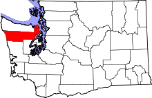 | |
| CDPs | ||
| Other unincorporated communities | ||
| Indian reservation | ||
| Ghost town | ||
| Footnotes | ‡This populated place also has portions in an adjacent county or counties | |