Broadgreen
| Broadgreen | |
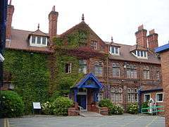 The original entrance to Broadgreen Hospital |
|
 Broadgreen |
|
| Population | 14,889 (2001 Census)[1] |
|---|---|
| OS grid reference | SJ405903 |
| Metropolitan borough | Liverpool |
| Metropolitan county | Merseyside |
| Region | North West |
| Country | England |
| Sovereign state | United Kingdom |
| Post town | LIVERPOOL |
| Postcode district | L14 |
| Dialling code | 0151 |
| Police | Merseyside |
| Fire | Merseyside |
| Ambulance | North West |
| EU Parliament | North West England |
| UK Parliament | Liverpool Wavertree |
|
|
Coordinates: 53°24′22″N 2°53′47″W / 53.4062°N 2.8965°W
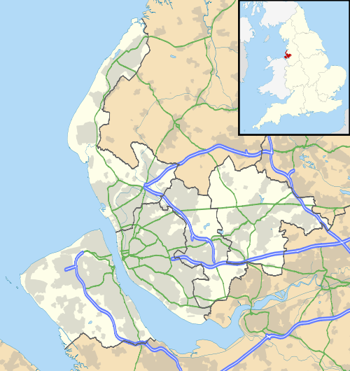
Broadgreen is a suburb of Liverpool, Merseyside, England. Located on the eastern edge of the city, it is bordered by Old Swan to the north west, Knotty Ash to the north east, Childwall to the south and, further east, Bowring Park in the borough of Knowsley. Until 2004, it was a Liverpool City Council Ward.
Description
Historically a part of Lancashire, Broadgreen is primarily a residential area, made up of semi-detached and detached houses. As a small district, it often merged with Childwall, a larger suburb of the city. It is home to Broadgreen Hospital and Broadgreen International School
Broadgreen covers an area of just over a square mile (2.97 km2) and in the 2001 Census had a population of 14,889 (6,919 males, 7,970 females).[1]
Transport
Situated close to the end of the M62, the area is served by Broad Green railway station, where regular trains depart for Liverpool city centre, Manchester, Wigan and St Helens.
Education
- Broadgreen International School
References
- 1 2 "2001 Census: Broad Green". Office for National Statistics. Retrieved 26 May 2008.
External links
| Wikimedia Commons has media related to Broadgreen. |