Broch of Borwick
Coordinates: 59°01′52″N 3°21′12″W / 59.031023°N 3.353398°W
 Broch of Borwick | |
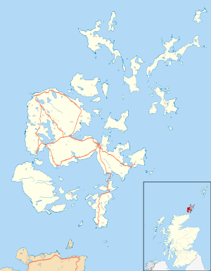
 Shown within Orkney Islands | |
| Location | Mainland, Orkney |
|---|---|
| Coordinates | 59°01′52″N 3°21′12″W / 59.031023°N 3.353398°W |
| Type | Broch |
| History | |
| Periods | Iron Age |
The Broch of Borwick is an Iron Age broch located on Mainland, Orkney, Scotland (grid reference HY22411678).
Location
The Broch of Borwick is located 8 kilometres southwest of Dounby on Mainland, Orkney.[1] The broch stands on top of a cliff-top promontory 20 metres above the sea.[2] A small stream runs past the site immediately to the east.[2]
Description
The broch has an external diameter of 17 metres and an internal diameter of 8 metres.[2] The walls which are 3.5 to 5 metres thick currently stand to a maximum height of 2.6 metres.[2] The eastern half of the broch and the entrance passage are well preserved, but the western half has been destroyed by erosion.[1] The entrance passage, which is still lintelled over, is 5.6 metres long with door-checks each formed of a slab set on edge 3 metres from the outside.[2] A guard cell opened off the right of the passage.[2]
The broch was once cut off from the flat land beyond by an outer wall, and there were outbuildings between the wall and the broch.[2]
Excavations
The site was excavated in 1881 by W. G. T. Watt, and the interior was cleared of debris.[2] Ashes, bones and shells mixed with clay were found under the rubble.[2] Beneath this was a layer of small flat stones and under this the broch floor.[2] Finds included several combs, a small whale vertebra cup, a spindle whorl, a stone gaming piece, a whetstone, hammerstones, some stone knives and choppers, an iron rod, and some querns.[2]
References
External links
![]() Media related to Broch of Borwick at Wikimedia Commons
Media related to Broch of Borwick at Wikimedia Commons