Clumlie Broch
Coordinates: 59°56′46″N 1°16′40″W / 59.946028°N 1.277694°W
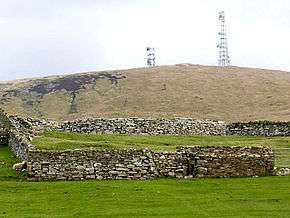 Clumlie Broch, behind a field wall | |
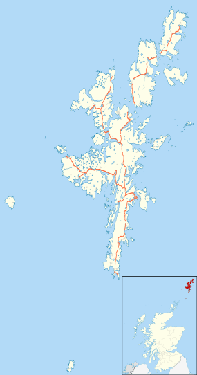 Shown within Shetland | |
| Location | Mainland, Shetland |
|---|---|
| Coordinates | 59°56′46″N 1°16′40″W / 59.946028°N 1.277694°W |
| Type | Broch |
| History | |
| Periods | Iron Age |
Clumlie Broch is an Iron Age broch located on Mainland, Shetland, in Scotland (grid reference HU40451811).
Location
Clumlie Broch is located in Dunrossness, on the southern part of Mainland, Shetland about 8 kilometres north of Sumburgh Airport.[1] It stands on a low rise on flat arable ground.[2] The broch is at the centre of an abandoned croft,[1] which encroaches upon the ruins.[2]
Description
The broch has an external diameter of 21 metres and an internal diameter of about 8 metres.[2] Much of the western side of the site is hidden by a stone dyke, but the entrance passage and a guard cell are visible.[2] The walls currently stand around 2 metres high.[1]
Excavations
Clumlie Broch was partially excavated by Gilbert Goudie in 1887, who also restored part of the walling.[2] Goudie discovered a stone cist 75 centimetres above the floor of the broch and concluded that the broch had been used for burials after it had fallen into disuse.[2] Finds included stone implements, quern stones, whetstones, spindle whorls, and hammer stones.[2] There were also many pottery fragments and animal bones, shells, as well as a fragment of a painted Roman bowl.[2]
References
External links
![]() Media related to Clumlie Broch at Wikimedia Commons
Media related to Clumlie Broch at Wikimedia Commons