Bud, Norway
| Bud herad | |
|---|---|
| Former Municipality | |
| Country | Norway |
| Region | Western Norway |
| County | Møre og Romsdal |
| District | Romsdal |
| Adm. Center | Bud |
| ISO 3166 code | NO-1549 |
| Created as | Formannskapsdistrikt in 1838 |
| Merged into | Fræna in 1964 |
| Bud | |
|---|---|
| Village | |
|
View of Bud | |
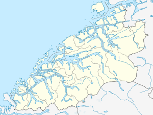 Bud Location in Møre og Romsdal | |
| Coordinates: 62°54′23″N 06°54′47″E / 62.90639°N 6.91306°ECoordinates: 62°54′23″N 06°54′47″E / 62.90639°N 6.91306°E | |
| Country | Norway |
| Region | Western Norway |
| County | Møre og Romsdal |
| District | Romsdal |
| Municipality | Fræna Municipality |
| Area[1] | |
| • Total | 0.69 km2 (0.27 sq mi) |
| Elevation[2] | 10 m (30 ft) |
| Population (2013)[1] | |
| • Total | 760 |
| • Density | 1,101/km2 (2,850/sq mi) |
| Time zone | CET (UTC+01:00) |
| • Summer (DST) | CEST (UTC+02:00) |
| Post Code | 6430 Bud |
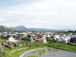
Bud is a fishing village (and former municipality) in Fræna Municipality in Møre og Romsdal county in western Norway. The village is located on the Romsdal peninsula along the Atlanterhavsveien, west of the village of Hustad, north of the village of Tornes, and east of the Bjørnsund islands. The 0.69-square-kilometre (170-acre) village has a population (2013) of 760. This gives it a population density of 1,101 inhabitants per square kilometre (2,850/sq mi).[1]
Bud Municipality existed from 1838 until 1964 when it was merged into Fræna Municipality. The old municipality encompassed the northern part of the present-day Fræna Municipality. The administrative centre of the municipality was the village of Bud where Bud Church is still located.[3]
History
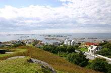
Due to a good natural harbor and rich fisheries, Bud grew to become the largest village between the towns of Trondheim and Bergen during the Middle Ages. At the death of King Frederick I in 1533, it was the site of the last independent Norwegian Privy Council, organized by Olav Engelbrektsson, Archbishop of Nidaros. The meeting led to a failed attempt to break away from the Kalmar Union and King Christian III, and claim Norway's independence by rejecting the Protestant Reformation. The council was the last of its kind in Norway for 270 years.
During World War II, the Germans heavily fortified Bud and the nearby Hustadvika coastal area in anticipation of an Allied invasion, as a part of the Atlantic Wall.
Municipality
On 1 January 1838, the parish of Bud was established as a municipality (see formannskapsdistrikt). On 1 January 1878, one area of Bud (population: 15) was transferred to neighboring Kvernes Municipality. Then on 1 January 1891, the Bollien farm area (population: 15) was also transferred to Kvernes Municipality. On 1 July 1918, the eastern part of Bud became the new Hustad Municipality. This left Bud with 1,397 inhabitants. On 1 January 1964, the municipalities of Bud and Hustad were merged with Fræna to the south to form a new, larger Fræna Municipality. At the end of its existence, Bud had a population of 1,610.[4]
References
- 1 2 3 Statistisk sentralbyrå (1 January 2013). "Urban settlements. Population and area, by municipality.".
- ↑ "Bud" (in Norwegian). yr.no. Retrieved 2010-11-14.
- ↑ Store norske leksikon. "Bud – tidl. kommune" (in Norwegian). Retrieved 2013-05-11.
- ↑ Jukvam, Dag (1999). "Historisk oversikt over endringer i kommune- og fylkesinndelingen" (PDF) (in Norwegian). Statistisk sentralbyrå.