Buffalo Gap, South Dakota
| Buffalo Gap, South Dakota pté tȟathíyopa otȟúŋwahe | |
|---|---|
| Town | |
|
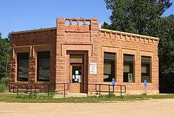
Buffalo Gap Town Hall | |
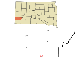 Location in Custer County and the state of South Dakota | |
| Coordinates: 43°29′33″N 103°18′51″W / 43.49250°N 103.31417°WCoordinates: 43°29′33″N 103°18′51″W / 43.49250°N 103.31417°W | |
| Country | United States |
| State | South Dakota |
| County | Custer |
| Area[1] | |
| • Total | 0.31 sq mi (0.80 km2) |
| • Land | 0.31 sq mi (0.80 km2) |
| • Water | 0 sq mi (0 km2) |
| Elevation | 3,261 ft (994 m) |
| Population (2010)[2] | |
| • Total | 126 |
| • Estimate (2012[3]) | 126 |
| • Density | 406.5/sq mi (157.0/km2) |
| Time zone | MST (UTC-7) |
| • Summer (DST) | MDT (UTC-6) |
| Zip Code | 57722 |
| Area code(s) | 605 |
| FIPS code | 46-08340[4] |
| GNIS feature ID | 1254122[5] |
Buffalo Gap (Lakota: pté tȟathíyopa otȟúŋwahe;[6] "buffalo gap village") is a town in Custer County, South Dakota, United States. The population was 126 at the 2010 census.
History
Buffalo Gap was laid out in 1885.[7] The town was named for a natural gap near the town site.[8]
Geography
Buffalo Gap is located at 43°29′33″N 103°18′51″W / 43.49250°N 103.31417°W (43.492562, -103.314267).[9]
According to the United States Census Bureau, the town has a total area of 0.31 square miles (0.80 km2), all of it land.[1]
Buffalo Gap has been assigned the ZIP code 57722 and the FIPS place code 08460.
Demographics
| Historical population | |||
|---|---|---|---|
| Census | Pop. | %± | |
| 1910 | 280 | — | |
| 1920 | 132 | −52.9% | |
| 1930 | 183 | 38.6% | |
| 1940 | 182 | −0.5% | |
| 1950 | 186 | 2.2% | |
| 1960 | 194 | 4.3% | |
| 1970 | 155 | −20.1% | |
| 1980 | 186 | 20.0% | |
| 1990 | 173 | −7.0% | |
| 2000 | 164 | −5.2% | |
| 2010 | 126 | −23.2% | |
| Est. 2015 | 121 | [10] | −4.0% |
2010 census
As of the census[2] of 2010, there were 126 people, 66 households, and 32 families residing in the town. The population density was 406.5 inhabitants per square mile (157.0/km2). There were 85 housing units at an average density of 274.2 per square mile (105.9/km2). The racial makeup of the town was 91.3% White, 7.1% Native American, 0.8% from other races, and 0.8% from two or more races. Hispanic or Latino of any race were 0.8% of the population.
There were 66 households of which 16.7% had children under the age of 18 living with them, 39.4% were married couples living together, 3.0% had a female householder with no husband present, 6.1% had a male householder with no wife present, and 51.5% were non-families. 43.9% of all households were made up of individuals and 19.7% had someone living alone who was 65 years of age or older. The average household size was 1.91 and the average family size was 2.63.
The median age in the town was 53 years. 16.7% of residents were under the age of 18; 2.5% were between the ages of 18 and 24; 15.2% were from 25 to 44; 41.2% were from 45 to 64; and 24.6% were 65 years of age or older. The gender makeup of the town was 57.1% male and 42.9% female.
2000 census
As of the census[4] of 2000, there were 164 people, 75 households, and 44 families residing in the town. The population density was 842.9 people per square mile (333.3/km²). There were 88 housing units at an average density of 452.3 per square mile (178.8/km²). The racial makeup of the town was 90.85% White, 6.71% Native American, and 2.44% from two or more races. Hispanic or Latino of any race were 4.88% of the population.
There were 75 households out of which 26.7% had children under the age of 18 living with them, 48.0% were married couples living together, 8.0% had a female householder with no husband present, and 41.3% were non-families. 40.0% of all households were made up of individuals and 10.7% had someone living alone who was 65 years of age or older. The average household size was 2.19 and the average family size was 2.91.
In the town the population was spread out with 25.0% under the age of 18, 4.9% from 18 to 24, 18.3% from 25 to 44, 35.4% from 45 to 64, and 16.5% who were 65 years of age or older. The median age was 46 years. For every 100 females there were 84.3 males. For every 100 females age 18 and over, there were 86.4 males.
The median income for a household in the town was $25,000, and the median income for a family was $28,750. Males had a median income of $21,250 versus $16,250 for females. The per capita income for the town was $14,680. About 18.0% of families and 18.7% of the population were below the poverty line, including 29.6% of those under the age of eighteen and 12.5% of those sixty five or over.
Notable people
References
- 1 2 "US Gazetteer files 2010". United States Census Bureau. Archived from the original on 2012-01-24. Retrieved 2012-06-21.
- 1 2 "American FactFinder". United States Census Bureau. Retrieved 2012-06-21.
- ↑ "Population Estimates". United States Census Bureau. Archived from the original on 2013-06-17. Retrieved 2013-05-29.
- 1 2 "American FactFinder". United States Census Bureau. Archived from the original on 2013-09-11. Retrieved 2008-01-31.
- ↑ "US Board on Geographic Names". United States Geological Survey. 2007-10-25. Retrieved 2008-01-31.
- ↑ Ullrich, Jan F. (2014). New Lakota Dictionary (2nd ed.). Bloomington, IN: Lakota Language Consortium. ISBN 978-0-9761082-9-0.
- ↑ Chicago and North Western Railway Company (1908). A History of the Origin of the Place Names Connected with the Chicago & North Western and Chicago, St. Paul, Minneapolis & Omaha Railways. p. 49.
- ↑ Federal Writers' Project (1940). South Dakota place-names, v.1-3. University of South Dakota. p. 28.
- ↑ "US Gazetteer files: 2010, 2000, and 1990". United States Census Bureau. 2011-02-12. Retrieved 2011-04-23.
- ↑ "Annual Estimates of the Resident Population for Incorporated Places: April 1, 2010 to July 1, 2015". Retrieved July 2, 2016.
- ↑ "Census of Population and Housing". Census.gov. Archived from the original on April 22, 2013. Retrieved June 4, 2015.
Municipalities and communities of Custer County, South Dakota, United States | ||
|---|---|---|
| City | 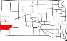 | |
| Towns | ||
| Unincorporated communities | ||
| Ghost towns | ||