Bulleen, Victoria
| Bulleen Melbourne, Victoria | |||||||||||||
|---|---|---|---|---|---|---|---|---|---|---|---|---|---|
 Yarra Valley Boulevard estate | |||||||||||||
 Bulleen | |||||||||||||
| Coordinates | 37°46′S 145°05′E / 37.77°S 145.09°ECoordinates: 37°46′S 145°05′E / 37.77°S 145.09°E | ||||||||||||
| Population | 10,868 (2011)[1] | ||||||||||||
| • Density | 1,622/km2 (4,201/sq mi) | ||||||||||||
| Postcode(s) | 3105 | ||||||||||||
| Area | 6.7 km2 (2.6 sq mi) | ||||||||||||
| Location | 13 km (8 mi) from Melbourne | ||||||||||||
| LGA(s) | City of Manningham | ||||||||||||
| State electorate(s) | Bulleen | ||||||||||||
| Federal Division(s) | Menzies | ||||||||||||
| |||||||||||||
Bulleen is a suburb of Melbourne, Victoria, Australia, 13 km north-east of Melbourne's Central Business District. Its local government area is the City of Manningham. At the 2011 Census, Bulleen had a population of 10,868.
Etymology
The name Bulleen originates from the nearby Bolin Bolin Billabong. Buln-Buln translates to lyrebird,[2] which is generally accepted to be the suburb's name meaning.
Geography
Climate
Temperatures in Bulleen are known to fluctuate. During the 2009 Southeastern Australia heat wave the suburb was reportedly around one degree cooler (at 43°C) than in the city, but during a heat wave just the next month it peaked at a record 49°C, on 7 February — compared to 46°C in the city.[3]
History
Pre European settlement

The Bulleen billabongs were an important territory for the Manna Gum people for approximately 5,000 years.[4] Generations had lived on the river flats when wild fish and ducks were abundant. Bolin was the largest lake/billabong in the area and was a significant ritual meeting place for the aborigines, where numerous corroborees were held either by the billabong or on the hills. But by 1841, manager and protector of the aborigines William Thomas received different orders.
Post-European settlement
In 1841 Frederic Unwin, a Sydney solicitor, purchased 5,120 acres, or eight square miles of land, including all of the present suburb of Bulleen. The land was purchased from the Crown for one pound an acre under the terms of the short-lived Special Survey regulations. The area was sometimes known as Unwin's Special Survey.
The first Bulleen Post Office opened on 1 April 1952, was renamed Bulleen West in 1960 and closed in 1976. Bulleen South office opened in 1959, was renamed Bulleen in 1960 and again named Bulleen South in 1969 when the current Bulleen office opened.[5]
Facilities
Shopping
Bulleen Plaza is the main shopping complex, located on Manningham Road. It includes a library (Bulleen Branch of the Whitehorse Manningham Regional Library), post office, medical centre, business centre, a Coles Supermarket and various specialty shops, cafes.
Education
- [St. Clement of Rome] - A Prep-Grade 6 Catholic primary school.
- Marcellin College - A Catholic secondary school.
- Bulleen Special School - A special school for students requiring additional assistance.
Bulleen is home to extensive sporting facilities belonging to the private schools of Carey and Trinity.
Transport
Major roads in Bulleen include:
- Manningham Road (40)
- Thompsons Road (42)
- Bulleen Road (52)
- Templestowe Road (52)
- Eastern Freeway (M3)
Public transport in Bulleen is limited to bus services, many of them running to the Melbourne CBD via dedicated bus lanes on the Eastern Freeway and Hoddle Street. Bus routes in Bulleen are operated by Ventura Bus Lines and operate primarily on main roads, though Templestowe Road in the north of the suburb is a notable exception of proper bus services.
Throughout the 1970s the Doncaster line was planned by the State Government to run down the middle of the Eastern Freeway and serve the suburb. Land was acquired for the line but was sold in the 1980s.[6] Various plans have also been made for extension of the tram route 48 north to Doncaster.[7]
Attractions
On Bulleen's northern border is the Yarra River, which adjoins parklands, including Banksia Park with its bike paths and picnic facilities. Adjacent to Banksia Park is the newly refurbished Heide Museum of Modern Art. Other important reserves include the Bulleen Park sporting grounds and approximately in the centre of the suburb, Yarraleen and Morris Williams reserves, which offer an adventure playground and general open space.
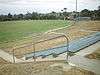
To the west of Bulleen Road is the Yarra Flats Park, with bike tracks, walking tracks, picnic tables, shelter, wood barbecues, birdlife, wild berries, billabongs and views of the Yarra River. Yarra Flats Park adjoins Bulleen and Banksia Parks. The Bulleen Park complex has a number of grounds suitable for Australian rules football, cricket and soccer, as well as an archery range and model aeroplane club. The Yarraleen Cricket Club, which plays in the Box Hill Reporter District Cricket Association, is located in the Bulleen Park pavilions at the rear of the complex.
Sport

Ted Ajani Reserve, home of the Bullen Templestowe Amateur Football Club,[8] is located on Thompson Road. The "Bullants" are a proud family club, who had some recent premiership success at senior level (2004, 2008, 2012). The Reserves side were also Premiers in 2012 making it a very successful year for the Club after building upon the success of the Under 19's who were Premiers in 2011. The Club have been promoted to Division 1 of the Victorian Amateur Football Association for the 2013 season[9]
Koonung Park, home of the Bulleen Cricket Club and the Manningham Cobras Football Club, is located just off Thompsons Road, near the Eastern Freeway.
Koonung Park regularly hosts the Dunstan Shield Grand Final, the highest grade of turf cricket in the Eastern Cricket Association.
Golfers play at the course of the Yarra Valley Golf Club, on Templestowe Road.[10]
Other reserves include:
- Sheahans Rd Reserve (basketball, tennis, play)
- Swanston St Reserve (play)
- Bulleen Park (Australian rules football in winter and cricket in summer - Yarraleen CC)

The Boorondara Tennis Centre and a swimming centre are located on Bulleen Road and a Golf driving range is located on Templestowe Road.
FC Bulleen Lions play at the Veneto Club.
The most well known club in the area is the WNBL team, the Bulleen Boomers, based at the Veneto Club on Bulleen Road, opposite Marcellin College.
Notable residents
- Stephen Mayne – Journalist, Councillor for Heide Ward from 2009 to present
- Jade Rawlings – Former AFL player
- Bruce Redman – Film and television producer / director; ABC radio personality
See also
| Wikimedia Commons has media related to Bulleen, Victoria. |
- City of Doncaster and Templestowe - the former local government area of which Bulleen was a part
- Electoral district of Bulleen
References
- ↑ Australian Bureau of Statistics (31 October 2012). "Bulleen (State Suburb)". 2011 Census QuickStats. Retrieved 2012-07-22.
- ↑ Grandpa Pencil. "Australia Aboriginal Words". Retrieved 2010-08-21.
- ↑ Evans, Gavin (2009-02-07). "Australian Firefighters Battling Bushfires, Heatwave (Update1)". Bloomberg.com. Retrieved 2009-02-07.
- ↑ Green, The Aborigines of Bulleen.
- ↑ Premier Postal History. "Post Office List". Retrieved 2008-04-11.
- ↑ Stephen Cauchi (February 1998). "Whatever Happened to the Proposed Railway to Doncaster East". Newsrail. Vol. 26 no. 2. Australian Railway Historical Society (Victorian Division). pp. 40–44.
- ↑ Moynihan, Stephen (18 October 2006). "The Age - 'Rail line would replace 10,000 cars' - October 18, 2006". Melbourne. Retrieved 2007-07-30.
- ↑ http://www.btafc.com.au
- ↑ http://www.vafa.com.au
- ↑ Golf Select. "Yarra Valley". Retrieved 2009-05-11.