Warrandyte, Victoria
| Warrandyte Melbourne, Victoria | |||||||||||||
|---|---|---|---|---|---|---|---|---|---|---|---|---|---|
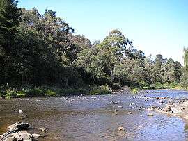 The Yarra River flowing through Warrandyte | |||||||||||||
 Warrandyte | |||||||||||||
| Coordinates | 37°44′17″S 145°13′23″E / 37.738°S 145.223°ECoordinates: 37°44′17″S 145°13′23″E / 37.738°S 145.223°E | ||||||||||||
| Population | 5,520 (2011 census)[1] | ||||||||||||
| • Density | 456.2/km2 (1,182/sq mi) | ||||||||||||
| Postcode(s) | 3113 | ||||||||||||
| Elevation | 113 m (371 ft) | ||||||||||||
| Area | 12.1 km2 (4.7 sq mi) | ||||||||||||
| Location | 24 km (15 mi) from Melbourne | ||||||||||||
| LGA(s) | City of Manningham | ||||||||||||
| State electorate(s) | Warrandyte | ||||||||||||
| Federal Division(s) | Menzies | ||||||||||||
| |||||||||||||
Warrandyte is a suburb of Melbourne, Victoria, Australia, 24 km north-east of Melbourne's Central Business District. Its local government area is the City of Manningham. At the 2011 census, Warrandyte had a population of 5,520.
Warrandyte is bounded in the west by the Mullum Mullum Creek and Target Road, in the north by the Yarra River, in the east by Jumping Creek and Anzac Road, and in the south by an irregular line from Reynolds Road, north of Donvale, Park Orchards and Warrandyte South.
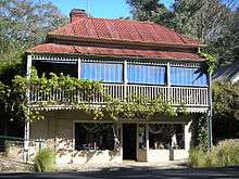
Warrandyte was founded as a Victorian town, located in the once gold-rich rolling hills east of Melbourne, and is now on the north-eastern boundary of suburban Melbourne. Gold was first discovered in the town in 1851 and together, with towns like Bendigo and Ballarat, led the way in gold discoveries during the Victorian gold rush. Today Warrandyte retains much of its past in its surviving buildings of the Colonial period and remains a twin community with North Warrandyte, which borders the Yarra River to its north.
Etymology
In Australian Aboriginal mythology (see dreamtime), a Wurundjeri dreamtime story tells of a great eagle; "the all powerful, ever watchful creator of the world", named Bunjil, who "once gazed down upon his people from the star Altair and saw their wrong doing. Awaiting their return, with a mighty crash of thunder, he hurled down a star to destroy them". Where the star struck created a gorge in which much of the town today is located. Bunjil's people remembered the spot, and referred to it as Warrandyte, speculated to mean "that which is thrown".[2]
History
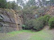
In 1851, gold was first discovered in Victoria, in Warrandyte, at Anderson's Creek, by Louis Michel, the approximate location of the site is marked by a cairn on Fourth Hill, in the Warrandyte State Park. While some mining did occur in the area throughout the peak of the gold rush, it was not until the late 19th century, after gold discoveries reduced in the more popular regions, that the area around Warrandyte was intensively mined, particularly around Fourth Hill and Whipstick Gully. Some areas continued to be mined up until the 1960s. Warrandyte Post Office opened on 1 August 1857.[3]
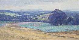
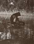
In the early 20th century, Warrandyte became a popular destination for artists of the Heidelberg School, who sought subject matter further into the bush. This led to the development of an artists camp and small colony. Though not as substantial as the older colonies at Heidelberg and Box Hill, several artists, such as Clara Southern and Walter Withers, who were associated with the Heidelberg School, took up residence in Warrandyte.[4] Others followed, including Penleigh Boyd, Harold Herbert and Jo Sweatman.
Bushfires
Major bushfires have swept through Warrandyte throughout history, and the town was at the centre of the Black Friday bushfires in 1939, in which 71 people lost their lives. As well, the Black Saturday fires in Kinglake were 15 minutes away from North Warrandyte, in 2009. Major bushfires to have swept through Warrandyte include:
- 1851 - 6 February "Black Thursday"
- 1939 - 13 January "Black Friday"
- 1962 - 14–16 January
Geography
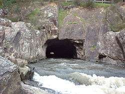
Warrandyte is situated on the southern banks of the Yarra River. The river and hills surrounding the town were once rich in gold and the ruins of mineshafts and tunnels can be found throughout the Warrandyte State Park, amongst other locations. While the central town itself is nestled into a gorge on the river, the suburb covers a reasonably large area of land and can be divided up into the following sections:
Central Warrandyte comprises the main street of Ringwood-Warrandyte Road and Heidelberg-Warrandyte Road (Yarra Street), Pound Bend and the southern banks of the Yarra River.
Andersons Creek flows from neighbouring South Warrandyte and Warranwood into the Yarra just before the beginning of Pound Bend. This area is where several gullies converge and create a geographical hole, with Fourth Hill to the east and the hills on the eastern banks of the Mullum Mullum Creek to the west. This becomes evident when driving through Warrandyte on Heidelberg-Warrandyte Road, as the hills guide the road down towards Andersons Creek.
The Eastern banks of the Mullum Mullum Creek were home to vast orchards overflowing from neighbouring East Doncaster and as a result, much of the vegetation has been cleared. Today the area is covered in large residential properties due to local council regulations allowing land to be subdivided into larger sites.
Transportation
Warrandyte is serviced primarily by the private car, however a bus service actively operates along the main roads of Ringwood-Warrandyte Road and Heidelberg-Warrandyte Road (Yarra Street).
Community
The Warrandyte Festival, one of the last remaining volunteer-run festivals in Victoria, is held every year in mid March. Typically, the festival features a variety of attractions. Many stalls sell local produce or crafts and there are numerous historical exhibits, as well as safety demonstrations by the CFA.
Facilities
Warrandyte contains a general post office, tennis courts, a community centre, an RSL, several Bed and Breakfasts, restaurants, a police station, a CFA Fire Station, two kindergartens, two recreational ovals (AFL Football and Cricket), Warrandyte Community Church, Uniting and Anglican places of worship, Andersons Creek Cemetery and a Scout hall, canoe launching ramps, a skatepark, nurseries and tearooms and the Crystal Brook Holiday Centre.[5]
Educational Facilities in Warrandyte:
- Warrandyte High School
- Andersons Creek Primary School
- Warrandyte Primary School
Places of Worship:
St Stephen's Anglican Church, Stiggants Road [6]
Shopping Strips & Centres:
- Goldfields Plaza
- Street Shops either side of the Main Roads, around the main bridge.
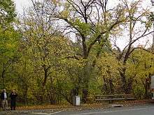
Parklands and recreation
Activities include walking, bike riding, mountain biking, tennis, basketball, football (AFL), cricket, swimming in the Yarra River, canoeing, kayaking, skateboarding and bushwalking, among many others.
Parks, Gardens and Reserves in Warrandyte:
- Warrandyte State Park (including Pound Bend, Fourth Hill, Black Flat, Mount Lofty and other areas)
- Pound Bend Reserve
- Stiggants Reserve
- Warrandyte Reserve/Taroona Reserve (Home to the Warrandyte Cricket Club, which was formed in 1855, Warrandyte "The Bloods" Football Club, competing in the Eastern Football League[7] and Junior Football Clubs and Warrandyte Netball Club)
- Longridge Farm
- Alexander Reserve
- Currawong Bush Park (Environment Centre and Wildlife Enclosure)
- Wildflower Reserve
- Andersons Creek Streamside Reserve
See also
- City of Doncaster and Templestowe - the former local government area of which Warrandyte was a part
- Electoral district of Warrandyte
- List of Melbourne suburbs
- Victorian gold rush
- Manningham Municipal Council Offices (see City of Manningham)
References
- ↑ Australian Bureau of Statistics (31 October 2012). "Warrandyte (State Suburb)". 2011 Census QuickStats. Retrieved 20 August 2012.
- ↑ Warrandyte Diary, Number 389, August 2006."
- ↑ Premier Postal History, Post Office List, retrieved 11 April 2008
- ↑ Hammond, Victoria; Peers, Juliet. Completing the Picture: Women Artists and the Heidelberg Era. Artmoves, 1992. ISBN 0-646-07493-8, p. 26
- ↑ Melways Street Directory, 33rd Edition 2006.
- ↑ The Church by the River, St Stephen's Church, retrieved 11 February 2014
- ↑ Full Point Footy, Eastern Football League, retrieved 21 October 2008