Burnsall
| Burnsall | |
 Village of Burnsall, from east above, showing bridge, Wharfe, chapel, Dalesway path (2008) |
|
 Burnsall |
|
| Population | 110 (2011 Census)[1] |
|---|---|
| OS grid reference | SE031615 |
| – London | 190 mi (310 km) SSE |
| Civil parish | Burnsall |
| District | Craven |
| Shire county | North Yorkshire |
| Region | Yorkshire and the Humber |
| Country | England |
| Sovereign state | United Kingdom |
| Post town | SKIPTON |
| Postcode district | BD23 |
| Police | North Yorkshire |
| Fire | North Yorkshire |
| Ambulance | Yorkshire |
| EU Parliament | Yorkshire and the Humber |
| UK Parliament | Skipton and Ripon |
Coordinates: 54°02′59″N 1°57′11″W / 54.049590°N 1.953070°W
Burnsall is a village and civil parish in the Craven district of North Yorkshire, England. It is situated on the River Wharfe in Wharfedale, and is in the Yorkshire Dales National Park.
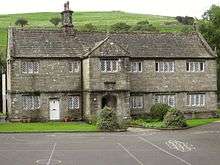
The village is approximately 2 miles (3 km) south-east from Grassington. It has a parish church, a chapel, two hotels with restaurants, a public house, and a primary school. The school, Grade II listed, is in the original 1602 grammar school building, a legacy of William Craven of nearby Appletreewick.[2] There is a five-arched bridge over which the Dalesway passes. A path along the river from Burnsall to Hebden, 1 mile (2 km) to the north-west, dates to Viking times.
The historic parish of Burnsall occupied a large part of upper Wharfedale. It included the townships of Appletreewick, Bordley, Conistone with Kilnsey, Cracoe, Hartlington, Hetton, Rylstone and Thorpe, all of which became separate civil parishes in 1866.[3] The parish was in Staincliffe Wapentake and in the West Riding of Yorkshire until 1974, when it was transferred to North Yorkshire. The 2001 Census gave Burnsall parish a population of 112 increasing to 110 at the 2011 census.[4]
The ecclesiastical parish of Burnsall is in the Diocese of Leeds.[5] The parish church of St Wilfrid's, a Grade I listed building, is almost entirely Perpendicular. It contains an 11th-century font carved with bird and beasts, twelve Anglo-Saxon sculpture fragments and a 14th-century alabaster panel depicting the Adoration of the Magi. The church-yard is entered from the main road by a lychgate.
Burnsall is a centre for walking, trout fishing, picnics, and weddings. An annual feast day games in August includes amateur competitions, tug of war and fell races. The village cricket pitch is below Burnsall Fell and is half enclosed by the river.
References
- ↑ "2013 Population Estimates Parishes" (PDF). North Yorkshire County Council. North Yorkshire County Council. Retrieved 17 February 2016.
- ↑ "Burnsall Grammar School", Yorkshire Dales National Park Authority. Retrieved 5 April 2015
- ↑ "Burnsall CP/AP", A Vision of Britain through time
- ↑ "Civil Parish population 2011". Neighbourhood Statistics. Office for National Statistics. Retrieved 25 July 2015.
- ↑ "Burnsall: St Wilfrid, Burnsall", The Church of England. Retrieved 5 April 2015
External links
 Media related to Burnsall at Wikimedia Commons
- Historic England. "St Wilfrid's church, Grade I (323747)". Images of England.
- Historic England. "The bridge, Grade II (323740)". Images of England.
- Historic England. "The school, Grade II (323746)". Images of England.
- The ancient parish of Burnsall: historical and genealogical information at GENUKI.
- St Wilfrid's Church web site
- Walk from Burnsall to Grassington