Caracaraí
| Caracaraí | |||
|---|---|---|---|
| Municipality | |||
| The Municipality of Caracaraí | |||
|
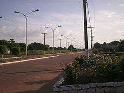
An avenue in Caracaraí | |||
| |||
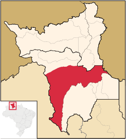 Location of Caracaraí in the State of Roraima | |||
| Coordinates: 01°48′57″S 61°07′40″W / 1.81583°S 61.12778°WCoordinates: 01°48′57″S 61°07′40″W / 1.81583°S 61.12778°W | |||
| Country |
| ||
| Region | North | ||
| State |
| ||
| Founded | 1955 | ||
| Government | |||
| • Mayor | Antonio Eduardo Filho (PR) | ||
| Area | |||
| • Total | 47,410.891 km2 (18,305.447 sq mi) | ||
| Elevation | 52 m (171 ft) | ||
| Population (2012) | |||
| • Total | 19,019 | ||
| • Density | 0.40/km2 (1.0/sq mi) | ||
| [1] | |||
| Time zone | UTC-4 (UTC-4) | ||
| HDI (2000) | 0.702 – medium[2] | ||
| Website | www.caracarai.rr.gov.br | ||

Caracaraí is a municipality located in the state of Roraima in Brazil. Its population is 17,746 and its area is 47,411 square kilometres (18,305 sq mi), making it the largest municipality in Roraima state.
The word caracaraí means "little hawk", a very common bird in the region.[3] The municipality contains the Caracaraí Ecological Station and the Niquiá Ecological Station.[3][4] Its territory cuts Roraima's in two and keeps boundaries with both the Brazilian state of Amazonas and Venezuela. It is not the only municipality in the state to do so; Caroebe also borders both the state and the country, and has boundaries with Pará too.
References
- ↑ "2012 Populational Estimate" (PDF). Censo Populacional 2012. Instituto Brasileiro de Geografia e Estatística (IBGE). July 2012. Retrieved September 8, 2012.
- ↑ "Archived copy". Archived from the original on 2009-10-03. Retrieved 2009-12-17. - UNDP
- 1 2 Estação Ecológica de Caracaraí (in Portuguese), Via Rural, retrieved 2016-04-23
- ↑ "Estação Ecológica de Níquia", Ambiente Brasil, retrieved 2016-04-16
Capital: Boa Vista | ||
| Boa Vista | 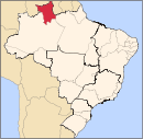 | |
| Nordeste de Roraima | ||
| Caracarai | ||
| Sudeste de Roraima | ||
This article is issued from Wikipedia - version of the 12/3/2016. The text is available under the Creative Commons Attribution/Share Alike but additional terms may apply for the media files.