Cascade, Wisconsin
| Cascade, Wisconsin | |
|---|---|
| Village | |
|
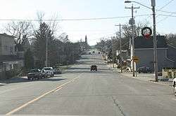
Looking west in downtown Cascade | |
 Location of Cascade, Wisconsin | |
| Coordinates: 43°39′31″N 88°0′30″W / 43.65861°N 88.00833°WCoordinates: 43°39′31″N 88°0′30″W / 43.65861°N 88.00833°W | |
| Country | United States |
| State | Wisconsin |
| County | Sheboygan |
| Area[1] | |
| • Total | 0.82 sq mi (2.12 km2) |
| • Land | 0.81 sq mi (2.10 km2) |
| • Water | 0.01 sq mi (0.03 km2) |
| Elevation[2] | 869 ft (265 m) |
| Population (2010)[3] | |
| • Total | 709 |
| • Estimate (2012[4]) | 703 |
| • Density | 875.3/sq mi (338.0/km2) |
| Time zone | Central (CST) (UTC-6) |
| • Summer (DST) | CDT (UTC-5) |
| Area code(s) | 920 |
| FIPS code | 55-12825[5] |
| GNIS feature ID | 1562757[2] |
Cascade is a village in Sheboygan County, Wisconsin, United States. The population was 709 at the 2010 census. It is included in the Sheboygan, Wisconsin Metropolitan Statistical Area. Wisconsin Highway 28 passes through Cascade.
History
With the construction of two 100-kilowatt wind turbines in June 2010, Cascade became the first community in Wisconsin to use locally produced wind energy to power its municipal wastewater treatment plant.[6]
Geography
Cascade is located at 43°39′31″N 88°0′30″W / 43.65861°N 88.00833°W (43.658541, -88.008412).[7]
According to the United States Census Bureau, the village has a total area of 0.82 square miles (2.12 km2), of which, 0.81 square miles (2.10 km2) of it is land and 0.01 square miles (0.03 km2) is water.[1]
Demographics
| Historical population | |||
|---|---|---|---|
| Census | Pop. | %± | |
| 1880 | 255 | — | |
| 1920 | 362 | — | |
| 1930 | 286 | −21.0% | |
| 1940 | 358 | 25.2% | |
| 1950 | 403 | 12.6% | |
| 1960 | 449 | 11.4% | |
| 1970 | 603 | 34.3% | |
| 1980 | 615 | 2.0% | |
| 1990 | 620 | 0.8% | |
| 2000 | 666 | 7.4% | |
| 2010 | 709 | 6.5% | |
| Est. 2015 | 701 | [8] | −1.1% |
2010 census
As of the census[3] of 2010, there were 709 people, 274 households, and 206 families residing in the village. The population density was 875.3 inhabitants per square mile (338.0/km2). There were 291 housing units at an average density of 359.3 per square mile (138.7/km2). The racial makeup of the village was 97.7% White, 0.4% African American, 0.3% Native American, 0.4% Pacific Islander, 0.7% from other races, and 0.4% from two or more races. Hispanic or Latino of any race were 3.8% of the population.
There were 274 households of which 35.8% had children under the age of 18 living with them, 58.0% were married couples living together, 9.9% had a female householder with no husband present, 7.3% had a male householder with no wife present, and 24.8% were non-families. 20.1% of all households were made up of individuals and 9.5% had someone living alone who was 65 years of age or older. The average household size was 2.59 and the average family size was 2.93.
The median age in the village was 39.2 years. 24.8% of residents were under the age of 18; 7.4% were between the ages of 18 and 24; 25.5% were from 25 to 44; 30.8% were from 45 to 64; and 11.3% were 65 years of age or older. The gender makeup of the village was 51.9% male and 48.1% female.
2000 census
As of the census[5] of 2000, there were 666 people, 255 households, and 190 families residing in the village. The population density was 895.8 people per square mile (347.5/km²). There were 269 housing units at an average density of 361.8 per square mile (140.4/km²). The racial makeup of the village was 98.80% White, 0.15% African American, 0.90% Native American, and 0.15% from two or more races. Hispanic or Latino of any race were 1.65% of the population.
There were 255 households out of which 34.9% had children under the age of 18 living with them, 65.9% were married couples living together, 6.7% had a female householder with no husband present, and 25.1% were non-families. 22.4% of all households were made up of individuals and 9.4% had someone living alone who was 65 years of age or older. The average household size was 2.61 and the average family size was 3.06.
In the village the population was spread out with 25.8% under the age of 18, 7.2% from 18 to 24, 30.9% from 25 to 44, 21.6% from 45 to 64, and 14.4% who were 65 years of age or older. The median age was 37 years. For every 100 females there were 102.4 males. For every 100 females age 18 and over, there were 94.5 males.
The median income for a household in the village was $47,232, and the median income for a family was $52,500. Males had a median income of $38,214 versus $25,139 for females. The per capita income for the village was $20,617. About 4.3% of families and 6.6% of the population were below the poverty line, including 15.2% of those under age 18 and none of those age 65 or over.
Notable people
- George H. Brickner, politician and businessman
- Daniel LeMahieu, politician
Images
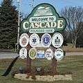 Cascade sign
 Looking west at the sign for Cascade on WIS 28
References
| Wikimedia Commons has media related to Cascade, Wisconsin. |
- 1 2 "US Gazetteer files 2010". United States Census Bureau. Archived from the original on 2012-07-14. Retrieved 2012-11-18.
- 1 2 "US Board on Geographic Names". United States Geological Survey. 2007-10-25. Retrieved 2008-01-31.
- 1 2 "American FactFinder". United States Census Bureau. Retrieved 2012-11-18.
- ↑ "Population Estimates". United States Census Bureau. Archived from the original on 2013-06-17. Retrieved 2013-06-24.
- 1 2 "American FactFinder". United States Census Bureau. Archived from the original on 2013-09-11. Retrieved 2008-01-31.
- ↑ "Archived copy". Archived from the original on 2012-03-08. Retrieved 2010-06-12.
- ↑ "US Gazetteer files: 2010, 2000, and 1990". United States Census Bureau. 2011-02-12. Retrieved 2011-04-23.
- ↑ "Annual Estimates of the Resident Population for Incorporated Places: April 1, 2010 to July 1, 2015". Retrieved July 2, 2016.
- ↑ "Census of Population and Housing". Census.gov. Archived from the original on April 22, 2013. Retrieved June 4, 2015.
External links
- Village of Cascade information from Sheboygan County website
Municipalities and communities of Sheboygan County, Wisconsin, United States | ||
|---|---|---|
| Cities | 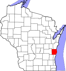 | |
| Villages | ||
| Towns | ||
| CDPs | ||
| Unincorporated communities | ||
| Ghost towns | ||
| Footnotes | ‡This populated place also has portions in an adjacent county or counties | |