Castella, Victoria
| Castella Victoria | |||||||||||||
|---|---|---|---|---|---|---|---|---|---|---|---|---|---|
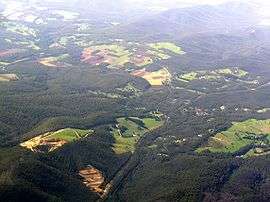 Aerial view from north | |||||||||||||
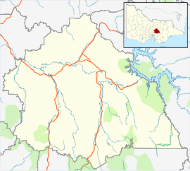 Castella Location in Shire of Murrindindi | |||||||||||||
| Coordinates | 37°31′29″S 145°26′00″E / 37.52472°S 145.43333°ECoordinates: 37°31′29″S 145°26′00″E / 37.52472°S 145.43333°E | ||||||||||||
| Population | 344 (2011 census)[1] | ||||||||||||
| Postcode(s) | 3777[2] | ||||||||||||
| LGA(s) | Shire of Murrindindi | ||||||||||||
| State electorate(s) | Eildon | ||||||||||||
| Federal Division(s) | Indi[2] | ||||||||||||
| |||||||||||||
Castella is a small town in Victoria Australia. It lies to the east of Kinglake at the intersection of the Melba Highway and the Healesville Kinglake Road.[3] At the 2011 Census, Castella had a population of 344.[1]
The Castella Quarries produces sandstone and crushed rock.[4] One of the quarries was used to dump the drillings from a tunnel under the Toolangi State Forest.[5] This tunnel is part of the Sugarloaf Pipeline, carrying freshwater to Melbourne from the Goulburn River.
References
- 1 2 Australian Bureau of Statistics (31 October 2012). "Castella (State Suburb)". 2011 Census QuickStats. Retrieved 30 November 2014.
- 1 2 http://apps.aec.gov.au/esearch/LocalitySearchResults.aspx?filter=3777&filterby=Postcode Australian Electoral Commission
- ↑ http://postcodes.qpzm.com.au/postcode/vic/melbourne/yarra-dandenong-ranges/castella
- ↑ http://www.dvc.vic.gov.au/web20/rwpgslib.nsf/GraphicFiles/ReviewPavementMaterialAvailability/$file/ReviewPavementMaterialAvailability.pdf
- ↑ http://trenchlessinternational.com/news/tunnelling_projects_protect_australian_water_supplies/004606/
This article is issued from Wikipedia - version of the 11/30/2015. The text is available under the Creative Commons Attribution/Share Alike but additional terms may apply for the media files.