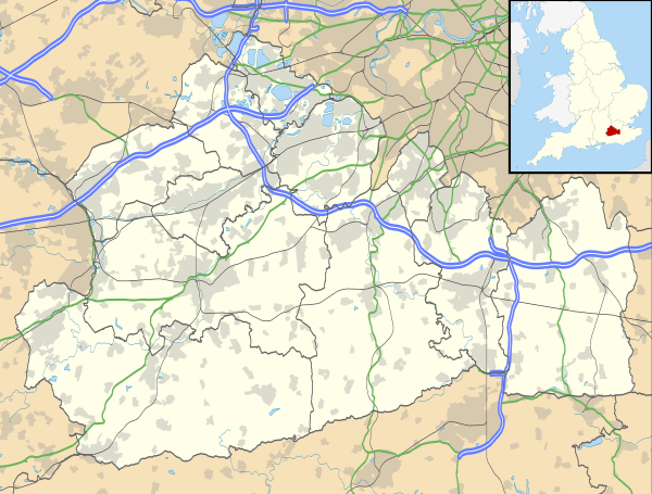
Caterham
| Caterham | |
 Roundabout in the centre of Caterham valley |
|
 Caterham |
|
| Area | 9.41 km2 (3.63 sq mi) |
|---|---|
| Population | 21,030 (2011 census)[1] |
| – density | 2,235/km2 (5,790/sq mi) |
| OS grid reference | TQ3456 |
| Civil parish | Caterham on the Hill |
| Caterham Valley | |
| District | Tandridge |
| Shire county | Surrey |
| Region | South East |
| Country | England |
| Sovereign state | United Kingdom |
| Post town | Caterham |
| Postcode district | CR3 |
| Dialling code | 01883 |
| Police | Surrey |
| Fire | Surrey |
| Ambulance | South East Coast |
| EU Parliament | South East England |
| UK Parliament | East Surrey |
Coordinates: 51°16′49″N 0°04′54″W / 51.2803°N 0.0816°W
Caterham (/ˈkeɪtᵊrəm/) is a town in the Tandridge District of Surrey, England. The town is administratively divided into two: Caterham on the Hill, and Caterham Valley, which includes the main town centre in the middle of a dry valley but rises to equal heights to the south. The town lies close to the A22, 21 miles (34 km) from Guildford and 6 miles (9.7 km) south of Croydon, in an upper valley cleft into the dip slope of the North Downs. Caterham on the Hill is above the valley to the west. Due to its proximity to London, Caterham is a commuter town, with small-to-medium-sized businesses of its own but relatively few business/industrial parks. It has a significant area of retail and restaurants in Caterham Valley as well as pubs dotted throughout.
History
An encampment on the top of White Hill, in Caterham Valley south of Caterham School, between Bletchingley and the town centre is called The Cardinal's Cap[2][3] which was excavated and inspected in designating it a Scheduled Ancient Monument. With close ramparts forming two or more lines, archaeologists describe the fort as a "large multivallate hillfort at War Coppice Camp".[4]
Its inner bank is about 0.5m wide and 0.4m high with a ditch 7m wide and 0.3m deep situated 2m below its crest. To the west of the ditch is the second bank, 8m wide and 0.5m high. Beyond this the second ditch has become completely infilled over the years but survives as a buried feature approximately 8m wide, visible as a terrace. Traces of a second, slighter terrace are situated further down the slope, representing evidence of additional scarping. The defences to the north east include an inner bank 5m wide and up to 0.5m high from the interior and 4m high from the exterior with a surrounding ditch 8m wide and 0.6m deep. Beyond this is a counterscarp bank 6m wide and up to 1m high. A 35m long section of a second ditch, which has become partially infilled over the years, survives 25m further out to the north east. In the southern and south eastern areas of the monument, sections of the hillfort have been disturbed by later quarrying activity. Although the monument was originally thought to be either Roman or Neolithic in date, excavations in 1950 showed it to be Iron Age and what had previously been thought to be a fragment of an earthwork was almost complete with the banks of the ramparts having been palisaded and revetted to strengthen their defence.[4]
The town lies within the Anglo-Saxon feudal division of Tandridge hundred.
Post Norman Conquest
Caterham's church of St Lawrence is of Norman construction and retains a rector as its incumbent. In the reign of King John, Roger son of Everard de Gaist gave this including its church lands to the monastery of Waltham Holy Cross. Everard's grandfather was Geoffery of Caterham who gave land to his son in the 12th century.[5] This monastery ran the glebe as a manor, receiving a grant of free warren in their demesne lands of Caterham in 1253;[3] holding it until the dissolution of the monasteries.
Caterham's original village centre consisted in the nearest part of the ridge of Caterham on the Hill to the railway station in Caterham Valley, including at the street ascending the relatively steep, short hill, Church Hill. Although no conservation area has been designated in either civil parish,[6][7] four secular buildings, including The King and Queen public house, three churches as well as a vault and tomb in St Lawrence's churchyard are listed; these are along Hill Street/ Church Hill in Caterham on the Hill.
The combined manors of Caterham, Porkele, Upwode, Gatiers and Halyngbury
Porkele had been formerly included in the manor given to Waltham Abbey; together the latter manors comprised 1,000 acres (400 ha). Humphrey Stafford, 1st Duke of Buckingham (1402–1460) held these manors leaving them in 1458 to his third son John Stafford, 1st Earl of Wiltshire when his son died without issue in 1499, under the terms of grant the elder branch, the following Duke of Buckingham inherited. His heirs sold them on the dissolution to Lord Berners who died in debt in 1533 resulting in bona vacantia and seizure by the Crown. In 1570 Thomas Sackville, 1st Earl of Dorset (as Lord Buckhurst, later Lord High Treasurer, held the 'manor of Caterham and Portele farm,' which he conveyed in that year to Henry Shelley; Sir Thomas's Sondes's widow leased the lands in 1599 to her half-brother, Main Plot seditionist Henry Brooke, 11th Baron Cobham. Then in 1615 her daughter Frances Leveson gave the rest of that lease, due the tenant's attainder to Sir Edward Barrett and Walter Barrett while the reversion was held by Sir Richard Sondes. George Ede purchased this massive estate in 1612 and it passed to Jasper Ockley in 1616. Sir Isaac Shard who was one of two Sheriffs of the City of London in 1730 who conveyed it to Thomas Clark and then passed as with the other manors; in 1911 W. L. Williams its owner lived at Portley in what remained of the estate.[3] De Stafford School in Caterham on the Hill occupies a small part of the estate and is named after the earlier known owner. Adjoining Sunnydown School, state-run, is at what was Portley House[7] and is for secondary education for boys with a Statement of Special Educational Needs.
The Manor of Salmons
The only manor did not have as high-profile owners. In 1339 John de Horne released some land Caterham (and more in Warlingham) to Roger Salaman, who at his death in 1343 was "seised of a tenement". A manor of Salmons appears in 1605 by William Jordan, who soon afterwards acquired the second manor of Caterham (see above) with which Salmons afterwards descended. It was bought out of Chancery, into which it went on the death of Charles Day, by George Drew, who sold to members of the Horne family, who owned the relatively small estate in 1911.[3]
Post Reformation
In 1544, the King granted the main rectorial manor was granted (in fee) to William Sackville JP[8] In 1553 William Sackville and Eleanor passed the manor to Robert Hartopp, goldsmith of London, dying two years later succeeded by Elias his son, who was left it to his nephew John, whose widow Joan sold the manor in 1609 to George Evelyn who gave it to his son Sir John Evelyn on his marriage to Elizabeth Cocks.[3] Later owners of the manor were Sir John's purchaser James Linch, his issue including Susan Hussey and her son James who sold the manor in 1699 to George Roffey. His nephew inherited it of the same name and in 1770 his sons sold the title alone and perhaps house to Matthew Robinson. Richard Hewetson bought it in 1780 passing it to his nephew Henry Hewetson holding until the Regency period. Henry's nephew William Hewetson ceased to lay claim to any manorial rights however in any event the lands had been separately sold to Henry Rowed, whose son Henry settled the estate on his wife Susan Glover in 1765.[3] Their daughter Katherine Glover inherited these lands.[3]
A second manor Manning and Bray report on was the main tenant's under the monastery and was held by for example buyers: William Jordan in 1607; Sir Isaac Shard (see above), who held his first court in 1726; after 1825 Charles Day of the firm of Day & Martin held but leaving no clear heirs this estate ended up in the hands of the chancery. Taxing (costs) judge George Henry Drew held the main lands and title followed by W. L. Williams in 1911.[3]
Post Industrial Revolution
Under Rev. James Legrew in the early 19th century the church tithes were commuted for £400, retaining a glebe of 5 acres (2.0 ha).[2]
In 1840 Caterham contained a total of 477 residents (figures taken from that census, compiled in an 1848 topographical encyclopedia) and in 1848 468 acres (189 ha) of its 2,386 acres (966 ha) were common land.[2] Similar to today, 175 acres (71 ha) mostly steeper acres were woodland.[2][9]
The more modern locality of Caterham Valley in a wide dry valley opening to the north (to Warlingham) and along its slopes is a product of the Victorian age and the coming of the Caterham railway line in 1856, which is still a terminus.
Victorian expansion of the town required the building of a much larger parish church, leading to the Church of St Mary the Virgin's building in 1866, directly across the road from St Lawrence's. As it also grew Caterham Valley gained its own Anglican church, to St. John the Evangelist, which was consecrated in 1882.
From 1877 Caterham Barracks on the hill was a depot for the footguards regiments.[10] The barracks were closed in 1995 and the site was redeveloped for housing.[11]
Two high streets therefore serve two very close yet substantial and affluent communities (see demographics), one with the railway station and more modern buildings, one with more historic buildings as soon as the closest hill (to the northwest) is climbed from the heart of Caterham Valley.[7] This set-up means that localism is present in that the Godstone Road during the middle of the 20th century bypassed Caterham Valley staying high and using Tillingdown, along the east of Caterham Valley from St John's School to the Croydon Road roundabout, thereby removing A22 traffic, while businesses set up and thrived in the valley itself.
On 6 July 1974 PC John Schofield was shot and killed while on patrol in Caterham.[12]
In 1975 an IRA bomb exploded in the Caterham Arms public house injuring 10 off-duty soldiers and 23 civilians. The pub was popular with the Welsh Guards, who had recently returned to Caterham Barracks after serving in Northern Ireland. The men responsible for the bombing were later jailed for a string of murders and bombings; they were released in April 1999 following the Good Friday Agreement.[13]
Landmarks
The North Downs Way, a National trail popular with walkers, passes very close to the town and is readily accessible from either Harestone Valley Road or Tupwood Lane, the Celtic hillfort promontory of the Downs mentioned above, The Cardinal's Cap, and Fosterdown or Pilgrims' Fort, a London Defensive Fort at the top of part of the ridge forming Godstone Hill, in Caterham Valley.[7]
Local Government

Surrey County Council, headquartered in Kingston, elected every four years, has two councillors from Caterham. David Hodge, leader of the county council and representative of Warlingham lives in Caterham.[14]
| Election | Member[15] |
Ward | |
|---|---|---|---|
| 2009 | John Alexander Orrick | Caterham Hill | |
| 2009 | Sally Ann Barbara Marks | Caterham Valley | |
Caterham has 10 representatives on Tandridge District Council, headquartered in Oxted:
| Election | Member[16] |
Ward | |
|---|---|---|---|
| 2009 | Beverley Connolly | Harestone | |
| 2010 | Michael Cooper | Harestone | |
| 2012 | Christopher Botten | Portley | |
| 2011 | Hilary Turner | Portley | |
| 2012 | Geoffrey Duck | Queens Park | |
| 2010 | Rod Stead | Queens Park | |
| 2010 | Alexandra Caudle | Valley | |
| 2012 | Jane Ingham | Valley | |
| 2012 | David Gosling | Westway | |
| 2010 | Eithne Webster | Westway | |
Caterham has two civil parish councils: Caterham on the Hill and Caterham Valley. Caterham Valley parish has two wards, Harestone and Caterham Valley, each electing three elected parish councillors.[17] The parish council clerk is Maureen Gibbins.[18] Caterham on the Hill has three wards, Portley, Queen's Park and Westway, each electing three parish councillors.[19] The parish council clerk is Helen Broughton.[20]
Geography
Administrative Geography
Before 1889 Caterham was the most eastern market town of a Surrey that stretched north to Southwark. North eastern parts of the county were absorbed gradually, in part by the County of London in 1889 (to South Norwood and Wimbledon which as a result have London Postcodes) and then to towns and villages within the present boundaries that form Greater London in 1965. From 1885 Oxted and Godstone developed from villages to towns. Tandridge District formed on 1 April 1974, under the Local Government Act 1972, by the merger of Caterham and Warlingham urban district along with Godstone Rural District.[21]
Physical Geography
Caterham is 21 miles (34 km) from the county town of Guildford and 15.5 miles (24.9 km) south of London.[22]
Caterham on the Hill is located on a considerable area of upland extending north past adjoining Kenley Aerodrome to Kenley and Hartley Hill in Reedham. This elevated area carries on west until Hooley/Old Merstham and forms a very narrow, fairly steep ridge south of Caterham Valley's centre; east of the centre of Caterham Valley are marginally higher rolling pastures of the North Downs on top of a more crevassed smaller mass of upland which forms the village of Woldingham followed by a much larger area of upland stretching from Biggin Hill to Downe and Knockholt, Kent.[7]
The M25 motorway (between junctions 6 and 7) is 80 to 90m below and less than 200m south of the North Downs path and the southern border of Caterham Valley civil parish and is linked by an uninterrupted hilltop dual carriageway to the north of Caterham and its lowest point, Croydon Road roundabout. [23]
In the south of Caterham are the following hills:
| Hill | Elevation | Rank within Surrey | Range |
|---|---|---|---|
| Gravelly Hill | 236m | 7th | North Downs |
| White Hill | 233m | 10th | North Downs[24] |
Elevation, soil and geology
Elevations range from the height above in the southwest extreme at "Whitehill Tower, War Coppice Road in Caterham Valley" to 110m Above Ordnance Datum along the railway track, immediately below Croydon Road roundabout, a tripoint partly in Woldingham, Whyteleafe and Caterham.[25]
Caterham lies within the North Downs and Caterham Valley's southern border is immediately south of the North Downs Way, part of a national trail network, which is here on top of the southern edge of the North Downs.[26]
Soil here has the expected shallow, lime-rich soil over chalk or limestone of the escarpment with lower parts of the escarpment summit here, where the topsoil has eroded, having slightly acid, loamy and clayey soils with impeded drainage, which makes that soil particularly fertile.[27]
The gault clay and the middle chalk that lies under the North Downs are both at their thickest around the valley that occupies the centre of Caterham Valley.[28] While earlier cretaceous clays and greensand and sandy material, underlying, is evident where terrain has eroded, 90 million years ago the North Downs hard chalk was deposited, a white limestone comprising over 95% calcium carbonate. It contains thin beds of marl and nodules of flint, either scattered or in bands. The North Downs extending from Farnham to Dover are formed by this chalk. They now have an often white, almost vertical south-facing slope. In lower slopes flints washed up by early seas come more to the surface and appear closer to the surface.[2][29]
 |
Old Coulsdon | Whyteleafe across Kenley Aerodrome: Kenley |
Warlingham | |
| Chaldon | |
across Tillingdown Woldingham | ||
| ||||
| | ||||
| across or down the North Downs Warwick Wold, Bletchingley |
across or down the North Downs Godstone |
across or down the North Downs Oxted |
Localities
Caterham Valley
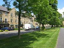
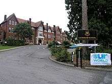
The civil parish of Caterham Valley has the more developed High Street presenting the main town centre for the whole community and has a population of 7,581.[30] The parish church of St. John the Evangelist was consecrated in 1882. The railway station is a terminus in the central, dry valley at the heart of this very large neighbourhood. Traffic to and from the London and Croydon to the north heading towards the M25 motorway is routed around the town on the A22 over the Caterham Bypass, opened in 1939 as one of the earliest such roads in the country. Caterham School is a large independent co-educational day and boarding school situated along the sides of the Harestone Valley. North Downs Hospital is small private establishment on the outskirts of the town run by the Ramsay Health Care UK.[31]
Caterham on the Hill
Caterham on the Hill is the second of the two civil parishes. This clustered development or village is directly to the northwest of the other entire Valley part of the town and does not have steep slopes or a wide divide between upland and downland developments unlike Caterham Valley. It has a population of 11,555;[32] it was the original development in the area so has more listed buildings compared to Caterham Valley, which has a few early Victorian outlying homes and its church listed. Most of the state run primary and secondary schools are in this part of the town, including de Stafford School.
- Former barracks
The Caterham Barracks Trust[33] run some facilities at the site of the former Caterham Barracks Guards Depot. The site is occupied by a supermarket, housing and various leisure facilities, including an arts centre (The Arc) an indoor Skate park (wittily called Skaterham) housed in the former Guard's chapel.[34]
Terry Waite[35] and David Stirling (the founder of the SAS) trained at the barracks.
A number of films / TV series were fully or partially filmed at the barracks. They Were Not Divided filmed by Two Cities Films[36] and Invasion: Earth series filmed by the BBC.
- Mental Hospitals
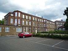
Caterham Asylum, later known as Caterham Mental Hospital and later still as Saint Lawrence's Hospital, was a very large establishment for the treatment of the mentally ill. Patients came from all over London to this well known institution that by 1930 grew to over 2,000 beds.[37] Joey Deacon lived in the hospital or its grounds for over 50 years. Most of the site has now been redeveloped as housing but a few buildings remain, although they are now empty and planning permission has been given for the buildings to be demolished and 161 homes built on the site. Joey Deacon's bungalow 'Holland House' is scheduled for demolition but the 'Blue Peter' bungalow 'Woodview' is to remain as a care home.
- Hospital
Caterham on the Hill has its own small NHS hospital, Caterham Dene, run by First Community Health and Care CIC offering a range of inpatient and outpatient services, including a minor injury unit.[38]
Demography and housing
At the 2011 census, Caterham has a total population of 21,090 people among 8,543 households, an increase of 130 households in 10 years.
| Output area | Detached | Semi-detached | Terraced | Flats and apartments | Caravans/temporary/mobile homes | Shared between households[1] |
|---|---|---|---|---|---|---|
| Caterham on the Hill | 1,185 | 1,666 | 963 | 1,208 | 0 | 0 |
| Caterham Valley | 1,034 | 854 | 229 | 1,393 | 11 | 0 |
The average level of accommodation in the region composed of detached houses was 28%, the average that was apartments was 22.6%.
| Output area | Population | Households | % Owned outright | % Owned with a loan | hectares[1] |
|---|---|---|---|---|---|
| Caterham on the Hill | 12,742 | 5,022 | 31.2% | 44.7% | 353 |
| Caterham Valley | 8,348 | 3,521 | 33.6% | 40.2% | 588 |
The proportion of households in the civil parish who owned their home outright compares to the regional average of 35.1%. The proportion who owned their home with a loan compares to the regional average of 32.5%. The remaining % is made up of rented dwellings (plus a negligible % of households living rent-free).[1]
Commerce

Church Walk
Church Walk Shopping Centre is a small shopping mall situated opposite Caterham railway station in Caterham Valley. Church Walk was built on the site of the Valley Hotel, which was demolished in 1988. Long before the Valley Hotel was built (to cater for visitors arriving on the new railway trains) there used to be a tennis court, croquet lawn, rose garden, fountain, and Mr. Woollet's nursery.
Local companies
Caterham Cars, makers of the Caterham 7 sports car no longer have a presence in the town - having moved to Crawley in February 2013. The building that they occupied is now being turned into more homes for retired people.
The house building company, Croudace, have their head office in Caterham. Caterham and DeStafford Schools and several supermarket chains are also large local employers. The Town also has lots of vacant buildings - most of which are behind hoardings.[39]
William Hill Interiors are a well known local furniture store selling furniture in Caterham since 1948. The site of the shop has in the past been a lunch hall and car garage, Much of the history can still be seen from the building.
Smaller specialised businesses include Caterham on the Hill's only traditional country Saddler, est 1988 known as Unicorn Leather Saddlery. They are responsible for manufacturing their own products to include the safety and first aid product called the Locata TM and hand made natural leather conditioner.
Transport
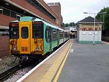
Caterham railway station is the modern terminus of the 1856-built Caterham Line from Purley. Trains operate into London Victoria station and London Bridge station.
Eight bus routes operate through Caterham, with half being operated by Metrobus. They run buses from Caterham to places such as East Grinstead, Croydon, Redhill and Oxted. Of the remaining four routes, buses are run by: Quality Line to Old Coulsdon; Abellio London to Sutton; Arriva London to Addington Village; and Southdown PSV to East Grinstead.[40]
Sport
Caterham has two youth football clubs, Caterham Pumas FC and Queens Park FC. The Old Caterhamians Rugby Football Club, was established in 1928. Caterham Cricket Club previously played in Queen's Park and now share facilities with the rugby club. Caterham Sea Cadets, formed in 1942, also participate in a number of watersports activities.
Queens Park YFC play their home games in the heart of Caterham - at Queens Park in Caterham on the Hill. They have a number of youth teams and an adult team - Queens Park Seniors - was set up in the summer of 2013.
Caterham Pumas Football Club play their matches at Joliffe Playing Field. They have youth football teams for children under six to those under eighteen; they also have two adult teams.[41]
Education
Caterham has a mixture of state and private schools. The two most notable private schools in Caterham are Caterham School and Oakhyrst Grange School, both are on the outskirts of the town. The main state secondary school is de Stafford School. A secondary school for boys with special educational needs called Sunnydown School is also in Caterham on the Hill.[42]
Culture and community
A community arts centre and theatre situated in the old Caterham Barracks. The building is made out of the two converted gymnasiums. There is a skatepark called "Skaterham" in Caterham on The Hill. It has indoor and outdoor sections, built on the grounds of the former Guards Chapel.
Based in the town centre the Miller Centre is a theatre and community centre that puts on regular non-professional shows, films and is host to a number of clubs and community groups.
The small East Surrey Museum houses a local history collection.
An annual carnival is held in the town, with a procession of floats and a fete.[43]
Caterham has an online radio station for the community, called Ridge Radio.[44]
The first Caterham Festival was in 2009 and by 2014 there were 135 events spread over 5 weeks. There is a 2-day music fest, the high Street is closed for a town street party and the main road through the Valley is closed for a food fest. Other events include Shakespeare plays, an archaeological dig, open Caterham - where buildings and groups open their doors for the weekend, concerts and comedy nights. The annual Carnival takes place during the Festival.
The Festival has won a number of awards including the Action for Market Towns best community event and, on three occasions, the Surrey Mirror Heart of the Community award. Chairman Andy Parr has been awarded the M.B.E. for services to the Community of Caterham.
The committee members have also advised many other towns about holding similar Festivals.[45]
Religion
Caterham has churches representing a variety of Christian denominations. The oldest church remaining in use is the church of St. Lawrence, which was established around 1095. The church has been used by several different denominations, including Quakers and Romanian Orthodox.[46] It was largely replaced from 1866 onwards, following the consecration of the church of St. Mary the Virgin.[47]
As the town in the valley expanded after the railway was built, several churches were founded. Caterham United Reformed Church was built by nonconformists in 1863,[48] followed by the Church of St. John the Evangelist in 1881.[49]
Notable people
The television presenter Angus Deayton grew up in Caterham, he attended both Oakhyrst Grange and Caterham Schools.[50] Notable sportspeople from Caterham include the footballers Nicky Forster and David Price and Dar Lyon, first class cricketer, both of whom were born in the town. Actors Bill Nighy and Jon Finch were born in Caterham; Michael Robbins, another actor, died there.
See also
References
- 1 2 3 4 Key Statistics; Quick Statistics: Population Density United Kingdom Census 2011 Office for National Statistics Retrieved 21 November 2013
- 1 2 3 4 5 Samuel Lewis (editor) (1848). "Caston - Catterick". A Topographical Dictionary of England. Institute of Historical Research. Retrieved 6 November 2012.
- 1 2 3 4 5 6 7 8 9 H.E. Malden (editor) (1912). "Parishes: Caterham". A History of the County of Surrey: Volume 4. Institute of Historical Research. Retrieved 6 November 2012.
- 1 2 Large, multivallate hillfort at War Coppice Camp, Caterham Valley Historic England. "Details from listed building database (1008498)". National Heritage List for England.
- ↑ Stowe manuscript 942, folio 262b
- ↑ Conservation Areas in Tandridge District
- 1 2 3 4 5 Ordnance Survey map, courtesy of English Heritage Archived 24 April 2012 at the Wayback Machine.
- ↑ Patent Roll 36 Henry VIII, pt. xxviii, manuscript 30.
- ↑ "OpenStreetMap". OpenStreetMap. Retrieved 2012-11-07.
- ↑ Geoff Hare. "The Guards and Caterham". Caterham Barracks Community Trust. Retrieved 27 July 2012.
- ↑ "Caterham Barracks - a brief development summary". Caterham Barracks Community Trust. Retrieved 27 July 2012.
- ↑ "History of Surrey Police - Murder of PC John Schofield". Surrey Police. Retrieved 3 March 2012.
- ↑ History from the police Archives, Robert Bartlett
- ↑ "Hodge, Mr David". Surrey County Council. 10 November 2011. Retrieved 2 March 2012.
- ↑ "Surrey's County councillors". Surrey County Council. 3 February 2012. Retrieved 2 March 2012.
- ↑ "Councillors". Tandridge.gov.uk. Tandridge District Council. Retrieved 1 December 2013.
- ↑ "Your Councillors". Caterham Valley Parish Council. 2014. Retrieved 10 July 2014.
- ↑ Tandridge District Council
- ↑ "Your Parish Councillors". Caterham Hill Parish Council. 2014. Archived from the original on 14 July 2014. Retrieved 10 July 2014.
- ↑ Tandridge District Council
- ↑ Robert Simonson (29 February 2012). "The administrative boundaries of the county of Surrey". Surrey County Council. Retrieved 3 March 2012.
- ↑ "Miles between Guildford Surrey and Caterham N7 Surrey". Retrieved 3 March 2012.
- ↑ Dorking, Box Hill and Reigate: Leatherhead and Caterham (Map). 1 : 25,000. Explorer 146. Ordnance Survey. 2008. ISBN 978-0-319-24007-6.
- ↑ Database of British and Irish Hills Retrieved 2015-03-06
- ↑ Grid reference Finder measurement tools
- ↑ "Home - North Downs Way - National Trails website". Natural England. Retrieved 3 March 2012.
- ↑ Cranfield University National Soil Resources Institute
- ↑ "The geology of the county of Surrey". Surrey Museums. November 2006. Retrieved 3 March 2012.
- ↑ Natural England - Geodiversity Archived 2 October 2013 at the Wayback Machine.
- ↑ Census data
- ↑ "North Downs Hospital". Ramsay Health Care UK Operations Limited. 2014. Retrieved 10 July 2014.
- ↑ Census data
- ↑ Caterham Barracks Trust
- ↑ Skaterham
- ↑ The Guards and Caterham, The Soldiers Story. ISBN 0-9535905-0-X
- ↑ The Bourne Society, Village Histories: Caterham ISBN 0-900992-42-5
- ↑ The asylum described at AIM25
- ↑ The Caterham Dene
- ↑ "Principle Employers in Tandridge" (PDF). Surrey County Council. Retrieved 30 September 2012.
- ↑ "Redhill and East Surrey bus timetables". Surrey County Council. 28 August 2012. Archived from the original on 5 June 2012. Retrieved 5 September 2012.
- ↑ "Caterham Pumas - History". Caterham Pumas. 2011. Archived from the original on 5 April 2013. Retrieved 5 September 2012.
- ↑ "Sunnydown". Retrieved 2 March 2012.
- ↑ Peter Wood (1998). "My memories of Caterham Carnival". Caterham & District Carnival. Retrieved 24 September 2012.
- ↑ "Ridge Radio Website". Retrieved 24 February 2013.
- ↑ http://www.caterhamfestival.org
- ↑ "St. Lawrence's Ancient Church". St. Mary's - Caterham team ministry. Archived from the original on 13 April 2012. Retrieved 22 September 2012.
- ↑ "St. Mary's Church". St. Mary's - Caterham team ministry. Archived from the original on 24 December 2012. Retrieved 22 September 2012.
- ↑ "Transcript: Any Questions? 22 May 2006". BBC. 22 May 2006. Retrieved 22 September 2012.
- ↑ "Church of St John, Caterham Valley". British Listed Buildings. Retrieved 22 September 2012.
- ↑ Vanessa Thorpe (18 April 2004). "The Observer Profile: Angus Deayton". The Observer. Retrieved 22 September 2012.
External links
- History of Caterham Village
- Page for Caterham in Kelly's Directory of Kent, Surrey & Sussex, 1891
| Settlements (grouped by associated post town) |
|  | ||||||||||||||||||||||||||||||||||
|---|---|---|---|---|---|---|---|---|---|---|---|---|---|---|---|---|---|---|---|---|---|---|---|---|---|---|---|---|---|---|---|---|---|---|---|---|
| Places of worship | ||||||||||||||||||||||||||||||||||||
| Education | ||||||||||||||||||||||||||||||||||||
| Transport |
| |||||||||||||||||||||||||||||||||||
| Buildings and structures |
| |||||||||||||||||||||||||||||||||||
| Sport |
| |||||||||||||||||||||||||||||||||||
The administrative centre is Oxted. The largest town is Caterham. Three of the post towns have urban centres Caterham, Godstone and Oxted. Lingfield and Warlingham are major villages which have post town status. The others are outside the area. | ||||||||||||||||||||||||||||||||||||