Oxted
| Oxted | |
 The timber-framed stucco façades of buildings in Oxted |
|
 Oxted |
|
| Area | 15.15 km2 (5.85 sq mi) |
|---|---|
| Population | 11,314 (Civil Parish 2011)[1] |
| – density | 747/km2 (1,930/sq mi) |
| OS grid reference | TQ3953 |
| – London | 17.9 mi (28.8 km) |
| Civil parish | Oxted |
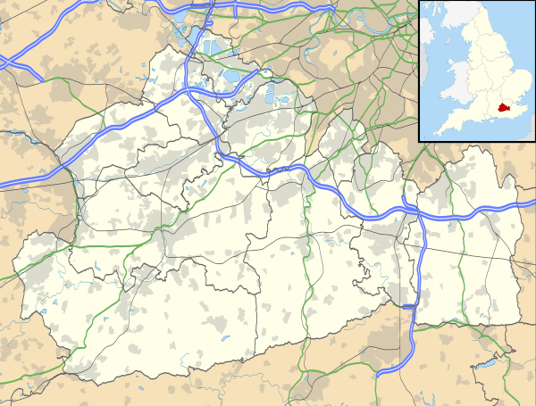
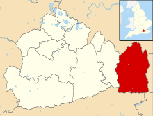
| District | Tandridge |
| Shire county | Surrey |
| Region | South East |
| Country | England |
| Sovereign state | United Kingdom |
| Post town | OXTED |
| Postcode district | RH8 |
| Dialling code | 01883 |
| Police | Surrey |
| Fire | Surrey |
| Ambulance | South East Coast |
| EU Parliament | South East England |
| UK Parliament | East Surrey |
Coordinates: 51°15′25″N 0°00′22″W / 51.257°N 0.006°W
Oxted is a town and civil parish in the Tandridge District of Surrey, England, at the foot of the North Downs north of East Grinstead and south-east of Croydon. Oxted is a commuter town which has a station with direct train services to London. Its main developed area is contiguous with the village of Limpsfield and Hurst Green The source of the River Eden, Kent, is just north at Titsey.
The settlements of Hurst Green and Holland are also within the civil parish.
History
Mills and manors
The town lay within the Anglo-Saxon Tandridge hundred. Oxted appears in the Domesday Book of 1086 as Acstede, meaning 'Place where oaks grew'. It was held by Eustace II of Boulogne. Its Domesday assets were: 5 hides; 1 church, 2 mills worth 12s 6d, 20 ploughs, 4 acres (1.6 ha) of meadow, pannage worth 100 hogs. It rendered £14 and 2d from a house in Southwark to its feudal overlords per year.[2]
Three mills are mentioned in the inquisition on Roland of Oxted, 1291–2. To a greater or lesser extent these were alienated from the main manor, which had become one of four, before 1689, when they were in the possession of Thomas Causton. In 1712 only one is mentioned as appertaining to the manor. The five manors were: Oxted, Barrow Green, Bursted/Bearsted, Broadham, Stocketts and Foyle.
The history of the first suggests wealthy tranche of the parish and is instructive as to social history; by marriage it became by agreed settlement a manor of Ralph Earl of Westmorland, with remainder to Thomas Cobham, his wife's uncle. Margaret died in 1460, leaving no children and her husband held the manor until his death in 1485, when it passed to Anne, only child and heir of Thomas Cobham, who had married Sir Edward Burgh. She died in 1526, and her husband, who 'became distracted of memorie,' died two years later, leaving a son and heir Thomas, afterwards created the Lord Burgh.[3]
Civil development and expansion from village into a commuter town
The original village of Oxted (now Old Oxted) is a small village centred on a short high street with four pubs (The Old Bell, The George Inn, The Crown Inn and The Wheatsheaf) just off the A25. Oxted's oldest church which still provides services, St Mary's, was built in a field, upstream from and north-east of the medieval heart of Oxted, near Master Park and the railway station. The Grade I listed church dates from at least Norman times and stands on a conspicuous mound.[4]
With the arrival of the railway in 1884 (after many years' delay caused by lack of funds) Oxted boomed in line with London's trade growth around its station, north-east of Old Oxted), and new buildings created "New Oxted". These new buildings were built in the Tudor style, particularly with stucco frontages. All Saints Catholic Church was built in 1913–1928 designed by Arts & Crafts architect James L. Williams (died 1926, his other work includes Royal School of Needlework, St George's in Sudbury, London (1926–27) and The Pound House in Totteridge (1907)).[5] The United Reformed Church's building followed in 1935, which is listed for its coloured glass and Byzantine design by architect Frederick Lawrence.[6]
In 2011 The Daily Telegraph listed Oxted as the twentieth richest town in Britain.[7]
Governance
There is one representative on Surrey County Council, conservative Nick Skellett CBE.[8] There are a total of six representatives on Tandridge District Council with much of Oxted South being Hurst Green :
| Member Since | Member[9] |
Ward | |
|---|---|---|---|
| 1994 | David Courtenay Weightman | Oxted North & Tandridge | |
| 1987 | Gordon Charles Keymer | Oxted North & Tandridge | |
| 2003 | Martin Fisher | Oxted North & Tandridge | |
| 2007 | Simon Ainsworth | Oxted South | |
| 2000 | Barry Charles Chittenden Compton | Oxted South | |
| 2004 | Elizabeth Parker | Oxted South | |
There is also a parish council with 11 members.[10]
Geography
The Greenwich Meridian runs through Oxted, passing through Oxted School. The parish encompasses a long divide between two ranges of hills, reaching up to the escarpments of the North Downs and the Greensand Ridge which is itself almost completely eroded at Hurst Green within the parish due to the action of the multiple headwaters of the River Eden, Kent.
The north of the parish is within the Vale of Holmesdale, which is drained by four, unconnected rivers. A nearby village is Tandridge, to the southwest, which sits on an edge of the Greensand Ridge.[3] Limpsfield, to the east, is contiguous with Oxted; both have a clustered community with the remainder of the land largely wooded or agricultural. Godstone is to the west and Crowhurst, Surrey to the south. Woldingham on the North Downs is to the north.
Demography and housing
| Output area | Detached | Semi-detached | Terraced | Flats and apartments | Caravans/temporary/mobile homes | shared between households[1] |
|---|---|---|---|---|---|---|
| (Civil Parish) | 1,427 | 1,282 | 911 | 799 | 3 | 1 |
The average level of accommodation in the region composed of detached houses was 28%, the average that was apartments was 22.6%.
| Output area | Population | Households | % Owned outright | % Owned with a loan | hectares[1] |
|---|---|---|---|---|---|
| (Civil Parish) | 11,314 | 4,423 | 36.6% | 36.5% | 1,515 |
The proportion of households in the civil parish who owned their home outright compares to the regional average of 35.1%. The proportion who owned their home with a loan compares to the regional average of 32.5%. The remaining % is made up of rented dwellings (plus a negligible % of households living rent-free).
Culture and community
Band and civic centre
Oxted is one of the few Surrey towns to retain its town brass band, Oxted Band, which has been a fixture within the town since 1901. The town became the administrative town of the Tandridge District when it was established in 1974.[11][12]
Pram race
Oxted is host to a charity pram race held annually. It was started in 1977 by Eric and Elsie Hallson, who ran it for nearly 20 years before retiring. Entrants wear fancy dress and must push a pram around the two-thirds of a mile course, stopping at each of the seven licensed premises on the way to quaff a drink as quickly as they can. The race ends in Old Oxted high street where the road is closed for the evening and a street party is held.[13]
Events in Master Park
The park hosts annual events such as that run by the local cricket club. Every year there is also the Oxted Beer Festival.[14]
Transport
Oxted is served by Oxted railway station and Hurst Green railway station on the Oxted Line.
Education
Oxted's main state secondary school is Oxted School (Oxted County School until 2000). Opened in 1929, it has over 2000 pupils and is one of the largest in the country. There are two other state schools in Oxted, Downs Way primary school and St Mary's C of E junior school.
Notable residents
- Since the 1970s businessman Mohamed Al-Fayed has lived at Barrow Green Court and farm near Oxted.[15]
- Palaeontologist, TV presenter and author, Alan Charig lived in Oxted from 1958 until his death in 1997.
- Thomas Ernest Bennett 'Tibby' Clarke lived in Oxted in the 1950s: his Ealing comedy The Titfield Thunderbolt derives its name from an almagamation of near-by villages Limpsfield and Titsey.
- English heavyweight boxer Sir Henry Cooper died of cardiac failure at his son Henry's home, Bourne House, Uvedale Road, Oxted, on 1 May 2011.[16]
- American writer and poet Stephen Crane lived in Oxted in 1897, where he met writers such as Joseph Conrad and Ford Madox Ford.
- Photographer Bert Hardy moved to Oxted in 1964 and died there in 1995.
- Artist Albert Houthuesen lived and painted in Oxted in 1950.
- Commander William Ibbett, submariner and broadcaster, was born in Oxted.[17]
- Singer Louise, formerly of the band Eternal and now married to footballer Jamie Redknapp, lived in Oxted during her childhood.
- Band Rooster come from the Oxted area.
- Distinguished English composer Michael Tippett lived in Oxted from 1929 to 1951.
- Television presenter Kim Woodburn lives in Old Oxted[18]
- Footballers who have lived in Oxted include Julián Speroni, goalkeeper for Crystal Palace Football Club, Ian Pearce who is currently assistant manager at Lincoln City Football Club, Hull City A.F.C. striker Nicky Forster, former Manchester City and Middlesbrough midfielder, Jamie Pollock.
See also
- List of places of worship in Tandridge (district)
- The Oxted Station Outrage, a farcical incident in which Harold Laski bombed the men's lavatory at Oxted railway station in a gesture of solidarity with the suffragettes.[19]
- Titsey Place
| Wikimedia Commons has media related to Oxted. |
References
- 1 2 3 Key Statistics; Quick Statistics: Population Density United Kingdom Census 2011 Office for National Statistics Retrieved 21 November 2013
- ↑ Surrey Domesday Book
- 1 2 H.E. Malden (editor) (1912). "Parishes: Oxted". A History of the County of Surrey: Volume 4. Institute of Historical Research. Retrieved 1 December 2013.
- ↑ Historic England. "Details from listed building database (1189608)". National Heritage List for England.
- ↑ All Saints Historic England. "Details from listed building database (1245423)". National Heritage List for England.
- ↑ The United Reformed Church, Oxted Historic England. "Details from listed building database (1388287)". National Heritage List for England.
- ↑ "Britain's richest towns: 20 – 11". The Daily Telegraph. London. 18 April 2008.
- ↑ "List of Surrey CC Councillors". Surrey County Council. Retrieved 28 April 2012.
- ↑ "Council Members". Tandridge District Council. Retrieved 28 April 2012.
- ↑ "Parish Council Members". Oxted Parish Council. Retrieved 28 April 2012.
- ↑ OxtedBand.co.uk
- ↑ Tandridge District Council
- ↑ Oxtedpramrace.co.uk
- ↑ oxtedandlimpsfieldbeerfestival.co.uk
- ↑ Bower, Tom (1998). Fayed: The Unauthorized Biography. Macmillan. p. 43. ISBN 978-0-333-74554-0.
- ↑ Source: Oxford Dictionary of National Biography
- ↑ "Royal Navy (RN) Officers 1939–1945 – I". Unit Histories. Retrieved 1 August 2014.
- ↑ Salmon, James. "Kim Woodburn: My Money". Daily Mail. Retrieved 17 September 2009.
- ↑ Torode, John (29 June 1993). "BOOK REVIEW / The art of collective irresponsibility: Harold Laski – Isaac Kramnick and Barry Sheerman: Hamish Hamilton, pounds 25". The Independent. London. Retrieved 7 May 2013.
| Settlements (grouped by associated post town) |
|  | ||||||||||||||||||||||||||||||||||
|---|---|---|---|---|---|---|---|---|---|---|---|---|---|---|---|---|---|---|---|---|---|---|---|---|---|---|---|---|---|---|---|---|---|---|---|---|
| Places of worship | ||||||||||||||||||||||||||||||||||||
| Education | ||||||||||||||||||||||||||||||||||||
| Transport |
| |||||||||||||||||||||||||||||||||||
| Buildings and structures |
| |||||||||||||||||||||||||||||||||||
| Sport |
| |||||||||||||||||||||||||||||||||||
The administrative centre is Oxted. The largest town is Caterham. Three of the post towns have urban centres Caterham, Godstone and Oxted. Lingfield and Warlingham are major villages which have post town status. The others are outside the area. | ||||||||||||||||||||||||||||||||||||