Cathays
| Cathays | |
| Welsh: Cathays | |
%2C_Cardiff.jpg) Cathays Library, a Carnegie library built in 1906 |
|
 Cathays |
|
| Population | 20,121 (2011)[1] |
|---|---|
| OS grid reference | ST181780 |
| Community | Cathays |
| Principal area | Cardiff |
| Ceremonial county | South Glamorgan |
| Country | Wales |
| Sovereign state | United Kingdom |
| Post town | CARDIFF |
| Postcode district | CF24 |
| Dialling code | 029 |
| Police | South Wales |
| Fire | South Wales |
| Ambulance | Welsh |
| EU Parliament | Wales |
| UK Parliament | Cardiff Central |
Coordinates: 51°29′42″N 3°10′52″W / 51.49499°N 3.18115°W
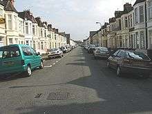
Cathays (/kəˈteɪz/ kə-TAYZ; Welsh: Cathays) is a district and community in the centre of Cardiff, capital of Wales. It is an old suburb of Cardiff established in 1875. It is very densely populated and contains many older terraced houses giving it a Victorian era atmosphere. The area falls into the Cathays ward.
Etymology
The name Cathays may be a corruption of two words - Cad Hayes - Cat possibly being a corruption of Cad, the Welsh for Battle, and Hayes meaning 'open area'. Alternatively, it could mean 'Enclosure where wildcats are seen' because of the old English definitions of catt, meaning 'wildcat', and haga, meaning 'enclosure'.
History
Originally farmland outside the old Cardiff Castle, the northern limit of mediaeval Cardiff was marked by the cross where Fairoak Road and Crwys Road now meet.
After John Stuart, 1st Marquess of Bute married The Hon. Charlotte Hickman-Windsor (daughter of Herbert Windsor, 2nd Viscount Windsor) on 12 November 1766, he inherited lands in Cathays that lay to the north of his existing Bute Estate. He then purchased other properties and farms to extend his land further north and east, including Cathays Park. There he built Cathays House at a cost of £40,000 and at further cost landscaped Cathays Park. But after John Crichton-Stuart, 2nd Marquess of Bute took over the title, he preferred to use Cardiff Castle as his residence, so chose to demolish the house in 1815, and turned Cathays Park into enclosed parkland.
Suburb of Cardiff

Following the 2nd Marquis development of Cardiff Docks, and the resultant number of new workers flocking to Cardiff, in 1875 the then rural Cathays became a suburb of Cardiff. At that time, a few streets led off Woodville Road and Cathays Terrace, but by 1900, the urbanisation of Cathays was virtually completed. Only Allensbank and Wedal farms survived, but, by 1914, even they became no more than local place names.[2]
Maindy Barracks was opened in 1871, and with United States Army troops temporarily stationed in transit in Cardiff during both World War I and World War II, the footpath between Gelligaer Street and New Zealand Road resultantly became known as "BURMA Road" (Be Undressed and Ready My Angel), as they came to meet prostitutes.[2]
Buildings and structures in Cathays
From 1840, the Taff Vale Railway company developed a railway line through Cathays, where they also developed the Cathays railway works. A major carriage and wagon construction and maintenance facility, it and the associated locomotive depot were taken over and maintained by the Great Western Railway. Post nationalisation in 1946, British Railways sold the business and leased the site to the Pullman Company Ltd, where they maintained their carriages until the 1970s. The depot was closed from the late 1960s, redeveloped for buildings now used by the University of Cardiff. The carriage and wagon works was redeveloped in the early 2000s, and now houses a Lidl store and a student accommodation block. Cathays railway station opened in 1983, adjacent to the Student's Union building which encloses the railway tracks.
In 1875 Nazareth House was opened, to provide accommodation for orphans and the elderly. A popular local charity, one of its many benefactors was the boxer Jim Driscoll, who after burial in Cathays cemetery in 1925 has had his grave tended to this day by the nuns of Nazareth House.
In 1898, John Crichton-Stuart, 3rd Marquess of Bute sold a large piece of land to Cardiff Council for the building of a new City Hall, imposing strict conditions regarding what purpose and where development could take place. As a result, the city hall was built as far south in the purchased block of land as was possible, and the residual area to its north used for civic, cultural and educational purposes only. The City Hall, which cost £129,000, was completed in 1905 when Cardiff was awarded city status.
The land purchased by the council to the north of the city hall has since become one of the finest civic centres in the world, and now houses:
- Cardiff University, which moved from Newport Road to Cathays Park in 1909
- National Museum Cardiff, opened in 1927
- Welsh National War Memorial, unveiled in 1928
- Crown Buildings, the Welsh Government's main offices in Cardiff. The largest building in Cathays Park
Maindy Pool was a clay pit that had gradually filled with water. After the death by drowning of ten children and adults it was filled in by using it as a rubbish tip. In 1948 the building of Maindy Stadium began on the same site, completed in 1951, which held cycling races in the 1958 British Empire and Commonwealth Games. When the stadium was closed and replaced with a leisure centre, part of the site became a swimming pool.
Cathays Library is a Carnegie library built in 1906 and refurbished in 2009-10.
Companies House holds the registration records of all companies registered in England or Wales.
Today
The area of Cathays, given its proximity to most of Cardiff University's teaching sites and University Hospital of Wales, has seen a dramatic fall in owner-occupation, with a high proportion of houses in multiple occupation (HMOs) which are let through private landlords and letting agencies to the large student population. 2012 figures available under the Freedom of Information Act show that over 70% of the houses in Cathays are now HMOs. The buy-to-let market has deterred young couples, families and first time buyers from setting up home in the area.
Arsenal and Wales footballer John Parsons and Wales International Rugby player Richie Rees both lived in Robert Street.
Cathays High School is an 11-18 mixed comprehensive school that started as a boys Grammar school in 1903 and became a comprehensive high school in 1973.[3]
Despite the urbanisation of Cathays there is extensive parkland around the civic centre, including Gorsedd Gardens, Queen Alexandra Gardens, Bute Park and Blackweir.
Transport

The area is served by Cathays railway station in the east of the area with frequent services south to Cardiff Queen Street and Cardiff Central or north to Aberdare, Merthyr Tydfil or Treherbert via Pontypridd. Cardiff Bus provides many services in the area. The following bus services run along North Road (in the west) going to Cardiff central bus station in the reverse direction:
- 21 (Rhiwbina-Pantmawr-Whitchurch)
- 23 (Whitchurch-Pantmawr-Rhiwbina)
- 24 (Whitchurch-Llandaff North-Llandaff-Central Stn)
- 25 (Central Stn)
- 27 Capital City Green (Birchgrove-Thornhill)
Likewise, the following services run north along Crwys Road and/or Whitchurch Road (in the east):
- 1 Bay Circle (Roath-Tremorfa-Splott-Adamsdown-Central Stn-Bay-Grangetown-Canton-Fairwater-Llandaff-Gabalfa)
- 2 Bay Circle (As 1 but reversed)
- 8/9/9A (Heath-University Hospital of Wales) or (Central Stn-Grangetown-Cardiff Bay)
- 35 (Gabalfa) or (Central Stn-Cardiff Bay)
The area is close to the busy Gabalfa Interchange, connecting it with the A48 and the M4 motorway.
References
- ↑ "Ward population 2011". Retrieved 8 April 2015.
- 1 2 "Cathays". cardiffians.co.uk. Retrieved 2008-11-30.
- ↑ http://www.cathays.cardiff.sch.uk/
External links
| NW | Heath | Roath Park |
| Pontcanna | Cathays | Roath |
| Riverside | City centre | Adamsdown |
| About Cardiff |  | |
|---|---|---|
| Cardiff templates |
| |
| Neighbourhoods |
| |
Principal areas of Wales | ||