Pontprennau
| Pontprennau | |
| Welsh: Pontprennau "Bridge of Trees" | |
 Pontprennau |
|
| Population | 8,564 |
|---|---|
| OS grid reference | ST214824 |
| Principal area | Cardiff |
| Ceremonial county | South Glamorgan |
| Country | Wales |
| Sovereign state | United Kingdom |
| Post town | CARDIFF |
| Postcode district | CF23 |
| Dialling code | 029 |
| Police | South Wales |
| Fire | South Wales |
| Ambulance | Welsh |
| EU Parliament | Wales |
| UK Parliament | Cardiff North |
| Welsh Assembly | Cardiff North |
Coordinates: 51°32′11″N 3°08′27″W / 51.5365°N 3.1408°W

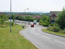
Pontprennau is a district and community in the east of the city of Cardiff, Wales, lying between the village of Old St Mellons and the A48 road to Newport.
History
Pontprennau is the Welsh for "Bridge of Trees". Lying east-west along the foot of the hills of the South Wales valleys, with Caerphilly directly north, the area is defined by a series of hills, intersected by shallow valleys created by streams which feed as tributaries into the Rhymney River.
Once a part of an area made up of several farms in Llanedeyrn, Pontprennau was designated in the 1970s for residential development, with the M4 Motorway Junction 30 developed for the purpose. It has expanded greatly since the early 1990s, driven primarily by private sector housing, and then corporate offices on Cardiff Gate.[1]
Today
According to the United Kingdom Census 2001, there were 8,037 people living in Pontprennau. However, this has expanded greatly since, due to sustained housing development both in West Pontprennau and on further pieces of unused land.
There are now only two sites remaining within the area with potential to be developed. The first is to the east in a plot east of the linkroad between Pontprenau and Old St Mellons. Scheduled to provide an additional 50 or more houses, this has now been turned down twice on planning permission. Developments further east would be barred, due to the scheduled green land space between Cardiff and Newport, in which Old St Mellons lies.
Proposed expansion
A proposed major expansion of the area to the west by the Welsh Assembly Government is opposed by Cardiff Council. This would see a development by Redrow plc of a further 4,000 houses in the farmland lying between Pontprennau and Lisvane. However, since the late-2000s financial crisis, and with apartments lying empty in Cardiff Bay and the councils pressing for development of brown field sites within the city first, development is delayed with no timescale.[2]
In July 2012, Cardiff Council's preferred new Local Development Plan was released. The plan proposed 45,000 new homes to be built in Cardiff by 2026, allowing the city's population to rise by a quarter to more than 400,000. The proposal encompasses: 7,500 homes in a new suburb west of Pentrebane; 2,000 homes on land north of junction 33 on the M4; and 6,000 east and 2,000 west of Pontprennau.[3]
The Pontprennau development would extend:
- East: 6,000 homes between Pontprennau to Lisvane, stretching as far north as the M4
- West: 2,000 homes in the green land, defined by a border south of the M4 and east to the border with Newport, connecting or subsumming Pontprennau and Old St Mellons
Community
East Pontprennau, adjacent to the M4 motorway junction 30, is the commercial sector of the development, housing Cardiff Gate Business Park, Cardiff Gate services, and Cardiff Gate Retail Park. The 100 acres (40 ha) business park provides office accommodation to regional representation for many multinational companies and is also home to the Emergency Control Centre for South Wales, as well as the fire training centre. The retail park is home to a large 24/7 Asda supermarket and petrol station,[4] a B&Q DIY store, a McDonalds restaurant and several home furniture stores.
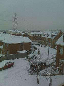
Central Pontprennau is mainly devoted to housing development. The northern edge and highest point in the community is where the community centre, the church and Pontprennau Medical Centre are located. At the bottom of the hill is the western edge, which has a small commercial area, with a large proportion of the land dedicated to industrial use now being converted to private sector housing. It also houses Pontprennau's only public house, a Waitrose supermarket, Cardiff's BUPA hospital (now owned by Spire Healthcare), and a Jaguar cars retail garage.
West Pontprennau is the newest of the three areas. It consists mainly of residential housing, but it also contains an Aldi supermarket and Cyncoed Medical Centre, which transferred from Cyncoed to Pontprennau in 2005.
School
The long awaited Pontprennau Primary school opened in September 2015. It is a 2 Form of Entry school with 48 Full time equivalent nursery places.
The school was completed in two phases. The first phase was ready in time for the school year starting September 2015. At this stage the school had two reception classs plus a nursery. The school was then fully open in time for the school year commencing September 2016. The school will grow year on year with the 2015 Reception classes progressing to Year One from September 2016, Year Two from September 2017, and so on, with new intakes of nursery and reception children each year.
The establishment of a primary school within Pontprennau aims to stop the over subscription of children attending schools in Lisvane and Llanishen. This project forms part of Cardiff Councils 21st Century Schools Programme which is 50% funding by Welsh Government.
Transport
Pontprennau has good transportation links, being located next to the M4 motorway junction 30. Public transport is provided by Cardiff Bus, which serves Pontprennau with services 57 and 58, with buses running approximately every 7–8 minutes during peak time, taking around 40 minutes to reach Central Station via Pentwyn, Llanedeyrn, Penylan and Roath.
On the council's bicycle network plan, Pontprennau is linked directly to the city centre via onroad routes via Pentwyn. However, to the south a gravel trail path runs along the flood plain of the Rhymney River on the Llanrumney side of the A48 link road, which is easily accessible via tarmac paths which run north-south within the Pontprennau community. The Rhymney River trail gives both walkers and cyclists easy access to the Newport Road both west and east of Llanrumney, and hence via the eastern entrance through Llanrumney Bowls club to the extensive retail park on Newport Road West.
Pontprennau has never had a railway station, and is equi-distant at around 5 miles (8.0 km) from both Cardiff Central and Newport. The nearest airport is Cardiff, a distance of 16 miles (26 km).
Sport
The field is the home of the "Pontprennau Pumas", the local football team, running two adult teams in the Cardiff Combination Leagues. They also have teams at under 12's and under 11's. The club are sponsored by Cardiff Gate Business Park.[5] Pontprennau Community Centre playing fields (allocated to the school, but open for community use) provides one of many "green-grass-expanse" family activity areas within the community, and a standard sized football field.
Local services
Police Station
- Llanedeyrn Police Station, The Maelfa, Llanedeyrn.
Fire Station
- Roath Fire Station, Colchester Avenue.
GP Surgeries
- Cyncoed Medical Practice, Darlington Drive, Pontprennau.
- The Pontprennau Medical Centre, 33 Kenmare Mews.
Dentist
- Elisha Dental Care, 31 Kenmare Mews, Pontprennau.
Pharmacies/Chemists
- Pontprennau Medical Centre, Kenmare Mews, Pontprennau.
- Asda Pharmacy, Derring Road, Pontprennau.
Post Office
- Pontprennau Office @ Asda, Derring Road, Pontprennau.
Community Centre
- Pontprennau Community Education Centre, Heol Pontprennau, Pontprennau.
- The community centre houses a children's playgroup, and it is used by local political representatives for residents' surgeries.
Church
- The church has suite of meeting rooms, a coffee shop, and a lounge. The coffee shop (PCs) is open every week day from 10.00 to 14.00.
- Highfields Church Pontprennau is an evangelical church that meets every Sunday morning at 9.30am for coffee and 10am for the main service. It is located in Corpus Christi High School on Ty Draw Road.
Library
- There is no library located in Pontprennau, but a mobile library service visits once a week.[6]
Leisure Centre
- Pentwyn Leisure Centre, Bryn Celyn Road, Pentwyn.
Supermarket
Local Council
Cardiff Council the local authority which covers Pontprennau, the main council offices are at County Hall, Atlantic Wharf, Cardiff.
Representation
Pontprennau & Old St. Mellons is an electoral division located in the North East of Cardiff. It is represented by Dianne Rees of the Welsh Conservative Party, and Georgina Phillips of Welsh Labour.[7]
Government
National Assembly
Pontprennau is in the Cardiff North constituency for the National Assembly for Wales, represented by Julie Morgan AM, a member of the Welsh Labour Party.
Westminster
Cardiff North is represented by Craig Williams MP a member of the Conservative Party.
References
- ↑ History of Pontprennau
- ↑ David James (February 11, 2010). "Battle is on over city's green space". South Wales Echo. Retrieved 2012-01-31.
- ↑ "Cardiff earmarks space for 45,000 new homes by 2026". BBC Wales. 13 July 2012. Retrieved 26 July 2012.
- ↑ Asda Pentwyn
- ↑ "Pontprennau Pumas". Pontprennau Pumas. Retrieved 2010-05-10.
- ↑ Cardiff Libraries
- ↑ "Election results for the division of Pontprennau & Old St Mellons / Pontprennau a Phentref Llaneirwg". Cardiff Council. 4 May 2012. Retrieved 4 May 2012.
External links
| Wikimedia Commons has media related to Pontprennau. |
| About Cardiff |  | |
|---|---|---|
| Cardiff templates |
| |
| Neighbourhoods |
| |
Principal areas of Wales | ||