Cato, Wisconsin
| Cato, Wisconsin | |
|---|---|
| Town | |
|
Town Hall in Clarks Mills | |
 Location of Cato, Wisconsin | |
| Coordinates: 44°6′12″N 87°51′28″W / 44.10333°N 87.85778°W | |
| Country | United States |
| State | Wisconsin |
| County | Manitowoc |
| Area | |
| • Total | 35.3 sq mi (91.6 km2) |
| • Land | 35.1 sq mi (91.0 km2) |
| • Water | 0.2 sq mi (0.6 km2) |
| Elevation[1] | 833 ft (254 m) |
| Population (2000) | |
| • Total | 1,616 |
| • Density | 46.0/sq mi (17.8/km2) |
| Time zone | Central (CST) (UTC-6) |
| • Summer (DST) | CDT (UTC-5) |
| Area code(s) | 920 |
| FIPS code | 55-13237[2] |
| GNIS feature ID | 1582933[1] |
| Website |
www |

Cato is a town in Manitowoc County, Wisconsin, United States. The population was 1,616 at the 2000 census. The unincorporated communities of Cato, Cato Falls, Clarks Mills, Grimms, Madsen, and North Grimms are located within the town. A Manitowoc County park is located in the town which is called "Cato Falls" for a waterfall on the Manitowoc River.
History
A post office called Cato was established in 1870, and remained in operation until it was discontinued in 1998.[3] The town was named after Cato, New York, the former hometown of an early settler.[4]
Geography
According to the United States Census Bureau, the town has a total area of 35.3 square miles (91.6 km²), of which, 35.1 square miles (91.0 km²) of it is land and 0.2 square miles (0.6 km²) of it (0.62%) is water.
Demographics
As of the census[2] of 2000, there were 1,616 people, 548 households, and 458 families residing in the town. The population density was 46.0 people per square mile (17.8/km²). There were 571 housing units at an average density of 16.3 per square mile (6.3/km²). The racial makeup of the town was 97.59% White, 0.50% Native American, 0.68% Asian, 0.62% from other races, and 0.62% from two or more races. Hispanic or Latino of any race were 1.67% of the population.
There were 548 households out of which 36.1% had children under the age of 18 living with them, 73.4% were married couples living together, 5.7% had a female householder with no husband present, and 16.4% were non-families. 13.7% of all households were made up of individuals and 5.7% had someone living alone who was 65 years of age or older. The average household size was 2.95 and the average family size was 3.24.
In the town the population was spread out with 28.1% under the age of 18, 8.5% from 18 to 24, 30.6% from 25 to 44, 22.6% from 45 to 64, and 10.2% who were 65 years of age or older. The median age was 36 years. For every 100 females there were 106.1 males. For every 100 females age 18 and over, there were 108.6 males.
The median income for a household in the town was $53,462, and the median income for a family was $59,145. Males had a median income of $36,384 versus $23,750 for females. The per capita income for the town was $21,434. About 3.3% of families and 4.9% of the population were below the poverty line, including 5.7% of those under age 18 and 6.8% of those age 65 or over.
-
The unincorporated community of Cato
-

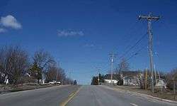
Clarks Mills
Notable people
- Maurice B. Brennan, Wisconsin State Assemblyman and farmer, lived in the town.[5]
- Peter J. Murphy, Wisconsin State Assemblyman and farmer, was born in the town.[6]
- Thorstein Veblen, a late 19th-century economist, was born in the town.[7]
References
- 1 2 "US Board on Geographic Names". United States Geological Survey. 2007-10-25. Retrieved 2008-01-31.
- 1 2 "American FactFinder". United States Census Bureau. Archived from the original on 2013-09-11. Retrieved 2008-01-31.
- ↑ "Manitowoc County". Jim Forte Postal History. Retrieved 28 February 2015.
- ↑ Chicago and North Western Railway Company (1908). A History of the Origin of the Place Names Connected with the Chicago & North Western and Chicago, St. Paul, Minneapolis & Omaha Railways. p. 53.
- ↑ 'Farmer Well Known In Two Counties Dies,' Manitowoc Herald Times, August 8, 1924, pg. 1
- ↑ 'Wisconsin Blue Book 1915,' Biographical Sketch of Peter J. Murphy, pg. 518
- ↑ Dorfman, Joseph (1934). Thorstein Veblen and His America. Harvard University Press. ISBN 0-678-00007-7.
External links
Municipalities and communities of Manitowoc County, Wisconsin, United States | ||
|---|---|---|
| Cities | 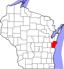 | |
| Villages | ||
| Towns | ||
| CDP | ||
| Unincorporated communities |
| |
| Footnotes | ‡This populated place also has portions in an adjacent county or counties | |
Coordinates: 44°08′34″N 87°51′40″W / 44.14278°N 87.86111°W