Celestia, South Carolina
| Celestia, South Carolina | |
|---|---|
| Ghost town | |
 Celestia, South Carolina | |
| Coordinates: 34°00′21″N 81°57′24″W / 34.00583°N 81.95667°WCoordinates: 34°00′21″N 81°57′24″W / 34.00583°N 81.95667°W | |
| Country | United States |
| State | South Carolina |
| County | Saluda |
| Elevation | 492 ft (150 m) |
| GNIS feature ID | 1232548[1] |
Celestia is a ghost town in Saluda County, South Carolina, United States. Celestia was 10.6 miles (17.1 km) west of Saluda. Celestia appeared on Soil Conservation Service maps as late as 1909.[1]
References
Municipalities and communities of Saluda County, South Carolina, United States | ||
|---|---|---|
| Towns | 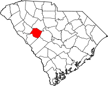 | |
| Ghost towns | ||
| Unincorporated community | ||
| Footnotes | ‡This populated place also has portions in an adjacent county or counties | |
This article is issued from Wikipedia - version of the 10/4/2012. The text is available under the Creative Commons Attribution/Share Alike but additional terms may apply for the media files.