Ward, South Carolina
| Ward, South Carolina | |
|---|---|
| Town | |
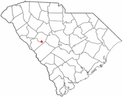 Location in Saluda County, South Carolina | |
| Coordinates: 33°51′28″N 81°43′56″W / 33.85778°N 81.73222°WCoordinates: 33°51′28″N 81°43′56″W / 33.85778°N 81.73222°W | |
| Country | United States |
| State | South Carolina |
| County | Saluda |
| Area | |
| • Total | 0.8 sq mi (2 km2) |
| • Land | 0.8 sq mi (2 km2) |
| • Water | 0.0 sq mi (0 km2) |
| Elevation | 666 ft (203 m) |
| Population (2000) | |
| • Total | 110 |
| • Density | 141/sq mi (54.5/km2) |
| Time zone | EST (UTC-5) |
| • Summer (DST) | EDT (UTC-4) |
| ZIP code | 29166 |
| Area code(s) | 803 |
| FIPS code | 45-74590[1] |
| GNIS feature ID | 1251321[2] |
Ward is a town in Saluda County, South Carolina, United States. The population was 110 at the 2000 census. It is part of the Augusta,Ga-Sc Metropolitan Area.
History
Spann Methodist Church and Cemetery was added to the National Register of Historic Places in 2003.[3]
Geography
Ward is located at 33°51′28″N 81°43′56″W / 33.85778°N 81.73222°W (33.857891, -81.732286).[4]
According to the United States Census Bureau, the town has a total area of 0.8 square miles (2.1 km2), all land.
Ward is on County Road 23, west of U.S. Route 1, and is just north of the Edgefield County line.
Demographics
| Historical population | |||
|---|---|---|---|
| Census | Pop. | %± | |
| 1890 | 161 | — | |
| 1900 | 135 | −16.1% | |
| 1910 | 183 | 35.6% | |
| 1920 | 234 | 27.9% | |
| 1930 | 233 | −0.4% | |
| 1940 | 204 | −12.4% | |
| 1950 | 122 | −40.2% | |
| 1960 | 162 | 32.8% | |
| 1970 | 150 | −7.4% | |
| 1980 | 98 | −34.7% | |
| 1990 | 132 | 34.7% | |
| 2000 | 110 | −16.7% | |
| 2010 | 91 | −17.3% | |
| Est. 2015 | 92 | [5] | 1.1% |
As of the census[1] of 2000, there were 110 people, 51 households, and 27 families residing in the town. The population density was 141.3 people per square mile (54.5/km²). There were 62 housing units at an average density of 79.7 per square mile (30.7/km²). The racial makeup of the town was 68.18% White and 31.82% Black.
There were 51 households out of which 27.5% had children under the age of 18 living with them, 39.2% were married couples living together, 11.8% had a female householder with no husband present, and 45.1% were non-families. 45.1% of all households were made up of individuals and 33.3% had someone living alone who was 65 years of age or older. The average household size was 2.16 and the average family size was 3.07.
In the town the population was spread out with 21.8% under the age of 18, 6.4% from 18 to 24, 28.2% from 25 to 44, 21.8% from 45 to 64, and 21.8% who were 65 years of age or older. The median age was 40 years. For every 100 females there were 77.4 males. For every 100 females age 18 and over, there were 75.5 males.
The median income for a household in the town was $21,000, and the median income for a family was $41,250. Males had a median income of $31,667 versus $23,594 for females. The per capita income for the town was $13,026. There were 23.1% of families and 15.3% of the population living below the poverty line, including 15.8% of under eighteens and 21.1% of those over 64.
References
- 1 2 "American FactFinder". United States Census Bureau. Retrieved 2008-01-31.
- ↑ "US Board on Geographic Names". United States Geological Survey. 2007-10-25. Retrieved 2008-01-31.
- ↑ National Park Service (2010-07-09). "National Register Information System". National Register of Historic Places. National Park Service.
- ↑ "US Gazetteer files: 2010, 2000, and 1990". United States Census Bureau. 2011-02-12. Retrieved 2011-04-23.
- ↑ "Annual Estimates of the Resident Population for Incorporated Places: April 1, 2010 to July 1, 2015". Retrieved July 2, 2016.
- ↑ "Census of Population and Housing". Census.gov. Retrieved June 4, 2015.
Municipalities and communities of Saluda County, South Carolina, United States | ||
|---|---|---|
| Towns | 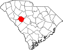 | |
| Ghost towns | ||
| Unincorporated community | ||
| Footnotes | ‡This populated place also has portions in an adjacent county or counties | |