Saluda, South Carolina
| Saluda, South Carolina | |
|---|---|
| Town | |
 Location in Saluda County, South Carolina | |
| Coordinates: 34°0′11″N 81°46′18″W / 34.00306°N 81.77167°WCoordinates: 34°0′11″N 81°46′18″W / 34.00306°N 81.77167°W | |
| Country | United States |
| State | South Carolina |
| County | Saluda |
| Area | |
| • Total | 3.3 sq mi (8.5 km2) |
| • Land | 3.2 sq mi (8.4 km2) |
| • Water | 0.0 sq mi (0.1 km2) |
| Elevation | 479 ft (146 m) |
| Population (2000) | |
| • Total | 3,066 |
| • Density | 946/sq mi (365.4/km2) |
| Time zone | EST (UTC-5) |
| • Summer (DST) | EDT (UTC-4) |
| ZIP code | 29138 |
| Area code(s) | 864 |
| FIPS code | 45-63250[1] |
| GNIS feature ID | 1250737[2] |
| Website | www.townofsaluda.com |
Saluda is a town in Saluda County, South Carolina, along the Little Saluda River. The population was 3,565 at the 2010 census. It is the county seat of Saluda County.[3]
Saluda is part of the Augusta-Richmond County Metropolitan Statistical Area
Geography
Saluda is located at 34°0′11″N 81°46′18″W / 34.00306°N 81.77167°W (34.003131, -81.771691).[4]
According to the United States Census Bureau, the town has a total area of 3.3 square miles (8.5 km2), of which, 3.2 square miles (8.3 km2) of it is land and 0.04 square miles (0.10 km2) of it (1.22%) is water.
Demographics
| Historical population | |||
|---|---|---|---|
| Census | Pop. | %± | |
| 1900 | 289 | — | |
| 1910 | 610 | 111.1% | |
| 1920 | 1,203 | 97.2% | |
| 1930 | 1,381 | 14.8% | |
| 1940 | 1,516 | 9.8% | |
| 1950 | 1,594 | 5.1% | |
| 1960 | 2,089 | 31.1% | |
| 1970 | 2,442 | 16.9% | |
| 1980 | 2,752 | 12.7% | |
| 1990 | 2,798 | 1.7% | |
| 2000 | 3,066 | 9.6% | |
| 2010 | 3,565 | 16.3% | |
| Est. 2015 | 3,596 | [5] | 0.9% |
As of the census[1] of 2000, there were 3,066 people, 1,103 households, and 788 families residing in the town. The population density was 947.1 people per square mile (365.4/km²). There were 1,211 housing units at an average density of 374.1 per square mile (144.3/km²). The racial makeup of the town was 48.76% White, 40.48% African American, 0.23% Native American, 9.95% from other races, and 0.59% from two or more races. Hispanic or Latino of any race were 19.37% of the population.
There were 1,103 households out of which 33.6% had children under the age of 18 living with them, 40.8% were married couples living together, 24.6% had a female householder with no husband present, and 28.5% were non-families. 24.5% of all households were made up of individuals and 11.4% had someone living alone who was 65 years of age or older. The average household size was 2.75 and the average family size was 3.21.
In the town the population was spread out with 28.0% under the age of 18, 12.2% from 18 to 24, 28.1% from 25 to 44, 18.6% from 45 to 64, and 13.1% who were 65 years of age or older. The median age was 31 years. For every 100 females there were 97.9 males. For every 100 females age 18 and over, there were 93.9 males.
The median income for a household in the town was $26,964, and the median income for a family was $31,042. Males had a median income of $25,208 versus $19,921 for females. The per capita income for the town was $13,032. About 22.9% of families and 28.5% of the population were below the poverty line, including 37.4% of those under age 18 and 18.5% of those age 65 or over.
History
Prior to the formation of Saluda County in 1896, the town was named Redbank and was renamed to match the county it became the seat of.
The Bonham House, Butler Family Cemetery, Marsh-Johnson House, Old Strother Place, Saluda Old Town Site, Saluda Theatre, Stevens-Dorn Farmstead, and Whitehall are listed on the National Register of Historic Places.[7]
Notable people
- Lyndon Amick, former NASCAR driver turned soldier
- James Bonham, who fought and died at the Battle of the Alamo (his boyhood home is the only home of an Alamo defender known to still exist today)
- Milledge Luke Bonham (younger brother of James), former Governor of South Carolina
- David Beihl,1999 National Geographic Bee champion.
References
- 1 2 "American FactFinder". United States Census Bureau. Retrieved 2008-01-31.
- ↑ "US Board on Geographic Names". United States Geological Survey. 2007-10-25. Retrieved 2008-01-31.
- ↑ "Find a County". National Association of Counties. Retrieved 2011-06-07.
- ↑ "US Gazetteer files: 2010, 2000, and 1990". United States Census Bureau. 2011-02-12. Retrieved 2011-04-23.
- ↑ "Annual Estimates of the Resident Population for Incorporated Places: April 1, 2010 to July 1, 2015". Retrieved July 2, 2016.
- ↑ "Census of Population and Housing". Census.gov. Retrieved June 4, 2015.
- ↑ National Park Service (2010-07-09). "National Register Information System". National Register of Historic Places. National Park Service.
External links
Municipalities and communities of Saluda County, South Carolina, United States | ||
|---|---|---|
| Towns | 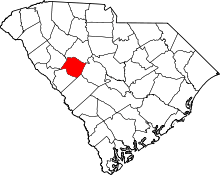 | |
| Ghost towns | ||
| Unincorporated community | ||
| Footnotes | ‡This populated place also has portions in an adjacent county or counties | |