Center Township, Benton County, Indiana
| Center Township | |
|---|---|
| Township | |
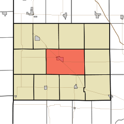 Location of Center Township in Benton County | |
| Coordinates: 40°36′15″N 87°17′43″W / 40.60417°N 87.29528°WCoordinates: 40°36′15″N 87°17′43″W / 40.60417°N 87.29528°W | |
| Country | United States |
| State | Indiana |
| County | Benton |
| Organized | June 1875 |
| Government | |
| • Type | Indiana township |
| Area | |
| • Total | 53.82 sq mi (139.4 km2) |
| • Land | 53.81 sq mi (139.4 km2) |
| • Water | 0.01 sq mi (0.03 km2) |
| Elevation[1] | 801 ft (244 m) |
| Population (2010) | |
| • Total | 2,757 |
| • Density | 51.2/sq mi (19.8/km2) |
| Time zone | EST (UTC-5) |
| • Summer (DST) | EDT (UTC-4) |
| FIPS code | 18-11224[2] |
| GNIS feature ID | 453172 |
Center Township is one of eleven townships in Benton County, Indiana. As of the 2010 census, its population was 2,757 and it contained 1,251 housing units.[3] It was organized in June 1875 and was originally known as Prairie Township.[4]
Geography
According to the 2010 census, the township has a total area of 53.82 square miles (139.4 km2), of which 53.81 square miles (139.4 km2) (or 99.98%) is land and 0.01 square miles (0.026 km2) (or 0.02%) is water.[3]
Cities and towns
- Fowler (the county seat)
Unincorporated towns
- Atkinson
- Barce
- Gravel Hill
- Swanington
(This list is based on USGS data and may include former settlements.)
Adjacent townships
- Bolivar (southeast)
- Gilboa (northeast)
- Grant (southwest)
- Oak Grove (south)
- Parish Grove (west)
- Pine (east)
- Richland (northwest)
- Union (north)
Major highways
Education
References
- "Center Township, Benton County, Indiana". Geographic Names Information System. United States Geological Survey. Retrieved 2009-09-24.
- United States Census Bureau cartographic boundary files
- ↑ "US Board on Geographic Names". United States Geological Survey. 2007-10-25. Retrieved 2008-01-31.
- ↑ "American FactFinder". United States Census Bureau. Archived from the original on 2013-09-11. Retrieved 2008-01-31.
- 1 2 "Population, Housing Units, Area, and Density: 2010 - County -- County Subdivision and Place -- 2010 Census Summary File 1". United States Census. Retrieved 2013-05-10.
- ↑ Birch, Jesse Setlington (1942) [1928]. History of Benton County and Historic Oxford. Oxford, Indiana: Craw & Craw, Inc. p. 21.
External links
Municipalities and communities of Benton County, Indiana, United States | ||
|---|---|---|
| Towns | ||
| Townships | ||
| Unincorporated communities | ||
| Footnotes | ‡This populated place also has portions in an adjacent county or counties | |
This article is issued from Wikipedia - version of the 11/18/2016. The text is available under the Creative Commons Attribution/Share Alike but additional terms may apply for the media files.