Lochiel, Indiana
| Lochiel | |
|---|---|
| Unincorporated community | |
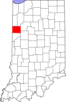 Benton County's location in Indiana | |
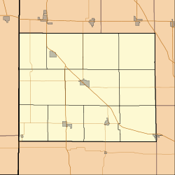 Lochiel Lochiel's location in Benton County | |
| Coordinates: 40°39′51″N 087°16′26″W / 40.66417°N 87.27389°WCoordinates: 40°39′51″N 087°16′26″W / 40.66417°N 87.27389°W | |
| Country | United States |
| State | Indiana |
| County | Benton County |
| Township | Union Township |
| Elevation[1] | 801 ft (244 m) |
| ZIP code | 47944 |
| GNIS feature ID | 0438196[2] |
Lochiel is an unincorporated community in Union Township, Benton County, Indiana, United States.
Geography
Lochiel is located at 40°39′51″N 087°16′26″W / 40.66417°N 87.27389°W at an elevation of 801 feet.
History
A post office at Lochiel was established in 1883, and remained in operation until it was discontinued in 1907.[3] The community was named after Clan Cameron, also known as Lochiel.[4]
References
- ↑ "USGS detail on Lochiel". Retrieved 2009-04-20.
- ↑ "Lochiel, Indiana". Geographic Names Information System. United States Geological Survey. Retrieved 2009-10-17.
- ↑ "Benton County". Jim Forte Postal History. Retrieved 26 August 2014.
- ↑ Baker, Ronald L. (October 1995). From Needmore to Prosperity: Hoosier Place Names in Folklore and History. Indiana University Press. p. 200. ISBN 978-0-253-32866-3.
Lochiel is the title of the Camerons.
Municipalities and communities of Benton County, Indiana, United States | ||
|---|---|---|
| Towns | ||
| Townships | ||
| Unincorporated communities | ||
| Footnotes | ‡This populated place also has portions in an adjacent county or counties | |
This article is issued from Wikipedia - version of the 10/25/2016. The text is available under the Creative Commons Attribution/Share Alike but additional terms may apply for the media files.