Central (neighborhood), Minneapolis
- This article is about the neighborhood in south Minneapolis. For the Central community of Minneapolis, which includes downtown, see Central, Minneapolis
| Central | |
|---|---|
| Neighborhood | |
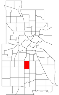 Location of Central within the U.S. city of Minneapolis | |
| Country | United States |
| State | Minnesota |
| County | Hennepin |
| City | Minneapolis |
| Community | Powderhorn |
| Area[1] | |
| • Total | 0.582 sq mi (1.51 km2) |
| Population (2010)[2] | |
| • Total | 8,307 |
| • Density | 14,000/sq mi (5,500/km2) |
| Time zone | CST (UTC-6) |
| • Summer (DST) | CDT (UTC-5) |
| ZIP code | 55407, 55408, 55409 |
| Area code(s) | 612 |
| Historical population | |||
|---|---|---|---|
| Census | Pop. | %± | |
| 1980 | 7,147 | — | |
| 1990 | 7,521 | 5.2% | |
| 2000 | 8,150 | 8.4% | |
| 2010 | 8,307 | 1.9% | |
The Central neighborhood (part of the larger Powderhorn community) of Minneapolis, Minnesota is located south of the downtown region of the city. It is bounded by Lake Street on the north, Chicago Avenue on the east, 38th Street on the south, and Interstate 35W on the west. It should not be confused with the Central community, which covers Downtown and some surrounding neighborhoods.
Developed mostly between 1900 and 1930, the Central neighborhood is racially diverse and has drawn African-American residents since the 1920s. Until it was closed in 1982 and later razed, Central High School was located here (Prince graduated from Central in 1976). Coordinates: 44°56′29″N 93°16′15″W / 44.9415°N 93.2709°W[3]
In 2010, the population of the neighborhood was 8,307. The neighborhood was 21.1% White, 25.1% Black or African American, 2.2% American Indian or Alaska Native, 3.6% Asian or Pacific Islander, 44.3% Hispanic or Latino, 3.4% two or more races, and 0.2% other race. The percentage of households with children was higher than the city average, and the percentage of single households was lower than the city average. The median household income was $36,988, which was $8,637 lower than the city average.[2]
References
- ↑ "Central neighborhood in Minneapolis, Minnesota (MN), 55407, 55408, 55409 detailed profile". City-Data. 2011. Retrieved 2013-11-12.
- 1 2 "Minneapolis Neighborhood Profile: Central" (PDF). Minnesota Compass. October 2011. Retrieved 2013-11-12.
- ↑ Central, Minneapolis, MN. Google Earth. Retrieved 2011-03-09.
External links
 |
Phillips West | | ||
| Lyndale | |
Powderhorn Park | ||
| ||||
| | ||||
| King Field | Bryant |