Central Township, Bond County, Illinois
| Central Township | |
|---|---|
| Township | |
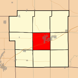 Location in Bond County | |
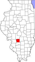 Bond County's location in Illinois | |
| Coordinates: 38°52′14″N 89°25′52″W / 38.87056°N 89.43111°WCoordinates: 38°52′14″N 89°25′52″W / 38.87056°N 89.43111°W | |
| Country | United States |
| State | Illinois |
| County | Bond |
| Settlement | November 6, 1888 |
| Area | |
| • Total | 37.17 sq mi (96.3 km2) |
| • Land | 37.14 sq mi (96.2 km2) |
| • Water | 0.04 sq mi (0.1 km2) 0.11% |
| Elevation | 568 ft (173 m) |
| Population (2010) | |
| • Total | 8,013 |
| • Density | 215.8/sq mi (83.3/km2) |
| Time zone | CST (UTC-6) |
| • Summer (DST) | CDT (UTC-5) |
| ZIP codes | 62246, 62275, 62284 |
| GNIS feature ID | 0428780 |
Central Township is one of nine townships in Bond County, Illinois, USA. As of the 2010 census, its population was 8,013 and it contained 2,769 housing units.[1]
Geography
According to the 2010 census, the township has a total area of 37.17 square miles (96.3 km2), of which 37.14 square miles (96.2 km2) (or 99.92%) is land and 0.04 square miles (0.10 km2) (or 0.11%) is water.[1]
Cities
- Greenville (the county seat) (west three-quarters)
Unincorporated towns
(This list is based on USGS data and may include former settlements.)
Cemeteries
The township contains these nine cemeteries: Hazel Dell, Hazel Dell, Montrose, Mount Auburn, Mount Gilead, Mount Moriah, Old City, Saint Lawrence Catholic and Smith Grove.
Major highways
Airports and landing strips
- Edw A Utlaut Memorial Heliport
- Greenville Airport
Lakes
- Greenville Lake
Landmarks
- Greenville Correctional Institution
School districts
- Bond County Community Unit School District 2
Political districts
- Illinois' 19th congressional district
- State House District 102
- State Senate District 51
References
- "Central Township, Bond County, Illinois". Geographic Names Information System. United States Geological Survey. Retrieved 2010-01-04.
- United States Census Bureau 2007 TIGER/Line Shapefiles
- United States National Atlas
- 1 2 "Population, Housing Units, Area, and Density: 2010 - County -- County Subdivision and Place -- 2010 Census Summary File 1". United States Census. Retrieved 2013-05-28.
External links
 |
Shoal Creek Township | Lagrange Township | Mulberry Grove Township | |
| Old Ripley Township | |
Pleasant Mound Township | ||
| ||||
| | ||||
| Burgess Township | Mills Township | Tamalco Township |
Municipalities and communities of Bond County, Illinois, United States | ||
|---|---|---|
| City | ||
| Villages | ||
| Townships | ||
| Unincorporated communities | ||
| Ghost town | ||
| Footnotes | ‡This populated place also has portions in an adjacent county or counties | |
This article is issued from Wikipedia - version of the 11/18/2016. The text is available under the Creative Commons Attribution/Share Alike but additional terms may apply for the media files.