Chai Nat
For other uses, see Chai Nat (disambiguation).
| Chai Nat ชัยนาท | |
|---|---|
|
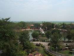
Bird Park of Chai Nat | |
 Chai Nat Location in Thailand | |
| Coordinates: 15°11′14″N 100°7′42″E / 15.18722°N 100.12833°E | |
| Country | Thailand |
| Province | Chai Nat Province |
| District | Amphoe Mueang Chai Nat |
| Population (2006) | |
| • Total | 14,469 |
| Time zone | ICT (UTC+7) |
Chai Nat (Thai: ชัยนาท) is a town (thesaban mueang) in central Thailand, capital of Chai Nat Province.[1] It covers the whole tambon tambon Nai Mueang and parts of Ban Kluai, Tha Chai and Khao Tha Phra, all in Mueang Chai Nat district. As of 2006 it had a population of 14,469.
The town is on the banks of the Chao Phraya River. The main road through the town is Phahonyothin Road (Highway 1). Bangkok lies 188 km to the south.[2]
References
- ↑ "Chainat". Tourism Authority of Thailand (TAT). Retrieved 29 May 2015.
- ↑ "Distance: Bangkok to Chai Nat". Google Maps. Retrieved 29 May 2015.
External links
 Chai Nat travel guide from Wikivoyage
- http://www.chainatcity.go.th (Thai)
Coordinates: 15°11′14″N 100°07′42″E / 15.18722°N 100.12833°E
| ||
This article is issued from Wikipedia - version of the 11/20/2016. The text is available under the Creative Commons Attribution/Share Alike but additional terms may apply for the media files.