Chapada de Areia
| Chapada de Areia | |
|---|---|
| Municipality | |
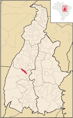 Location in Tocantins state | |
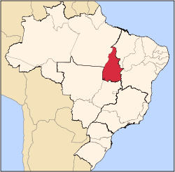
 Chapada de Areia Location in Brazil | |
| Coordinates: 10°08′38″S 49°08′24″W / 10.14389°S 49.14000°WCoordinates: 10°08′38″S 49°08′24″W / 10.14389°S 49.14000°W | |
| Country |
|
| Region | North Region |
| State | Tocantins |
| Area | |
| • Total | 659 km2 (254 sq mi) |
| Population (2005) | |
| • Total | 1,197 |
| • Density | 1.8/km2 (4.7/sq mi) |
| Time zone | BRT (UTC-3) |
Chapada de Areia is a municipality located in the Brazilian state of Tocantins. Its population was 1,197 (2005) and its area is 659 km².[1]
The municipality contains 2% of the 1,678,000 hectares (4,150,000 acres) Ilha do Bananal / Cantão Environmental Protection Area, created in 1997.[2]
References
- ↑ IBGE - "Archived copy". Archived from the original on 2008-06-11. Retrieved 2008-06-11.
- ↑ APA Leandro (Ilha do Bananal/Cantão) (in Portuguese), ISA: Instituto Socioambiental, retrieved 2016-10-31
This article is issued from Wikipedia - version of the 11/19/2016. The text is available under the Creative Commons Attribution/Share Alike but additional terms may apply for the media files.