Babaçulândia
| Babaçulândia | |
|---|---|
| Municipality | |
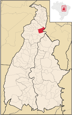
 Location in Tocantins state | |
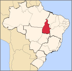
 Babaçulândia Location in Brazil | |
| Coordinates: 7°12′18″S 47°45′25″W / 7.20500°S 47.75694°WCoordinates: 7°12′18″S 47°45′25″W / 7.20500°S 47.75694°W | |
| Country |
|
| Region | North Region |
| State | Tocantins |
| Area | |
| • Total | 1,788 km2 (690 sq mi) |
| Population (2016) | |
| • Total | 10,424 |
| • Density | 5.8/km2 (15/sq mi) |
| Time zone | BRT (UTC-3) |
Babaçulândia is a municipality in the state of Tocantins, Brazil.
Babaçulândia was founded on 1 January 1954. It has an area of 1,788.461 square kilometres (690.529 sq mi). The most recent population figure as of 2016 was 10,424 people.[1] The municipality includes the buffer zone of the Tocantins Fossil Trees Natural Monument.[2]
References
- ↑ Prefeitura Municipal de Babaçulândia - TO (in Portuguese), Babaçulândia municipality, retrieved 2016-05-06
- ↑ Tânia Caldas (27 February 2016), "Monumento natural das árvores fossilizadas do Tocantins renova conselho consultivo", Surgiu (in Portuguese), retrieved 2016-05-06
This article is issued from Wikipedia - version of the 6/15/2016. The text is available under the Creative Commons Attribution/Share Alike but additional terms may apply for the media files.
