Chester, Arkansas
| Chester, Arkansas | |
|---|---|
| Town | |
|
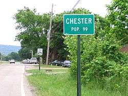
Entrance sign to Chester | |
 Location in Crawford County and the state of Arkansas | |
| Coordinates: 35°40′48″N 94°10′34″W / 35.68000°N 94.17611°WCoordinates: 35°40′48″N 94°10′34″W / 35.68000°N 94.17611°W | |
| Country | United States |
| State | Arkansas |
| County | Crawford |
| Area | |
| • Total | 0.5 sq mi (1.3 km2) |
| • Land | 0.5 sq mi (1.3 km2) |
| • Water | 0 sq mi (0 km2) |
| Elevation | 840 ft (256 m) |
| Population (2010) | |
| • Total | 159 |
| • Density | 198/sq mi (76.2/km2) |
| Time zone | Central (CST) (UTC-6) |
| • Summer (DST) | CDT (UTC-5) |
| ZIP code | 72934 |
| Area code(s) | 479 |
| FIPS code | 05-13570 |
| GNIS feature ID | 0071128 |
Chester is a town in Crawford County, Arkansas, United States. It is part of the Fort Smith, Arkansas-Oklahoma Metropolitan Statistical Area. As of the 2010 Census the population was 159.[1] The population was 99 at the 2000 census.
Geography
Chester is located at 35°40′48″N 94°10′34″W / 35.68000°N 94.17611°W (35.679917, -94.175992).[2]
According to the United States Census Bureau, the town has a total area of 1.3 km² (0.5 mi²), all land.
Demographics
| Historical population | |||
|---|---|---|---|
| Census | Pop. | %± | |
| 1890 | 222 | — | |
| 1900 | 174 | −21.6% | |
| 1910 | 162 | −6.9% | |
| 1920 | 223 | 37.7% | |
| 1930 | 196 | −12.1% | |
| 1940 | 207 | 5.6% | |
| 1950 | 120 | −42.0% | |
| 1960 | 99 | −17.5% | |
| 1970 | 82 | −17.2% | |
| 1980 | 139 | 69.5% | |
| 1990 | 125 | −10.1% | |
| 2000 | 99 | −20.8% | |
| 2010 | 159 | 60.6% | |
| Est. 2015 | 160 | [3] | 0.6% |
2014 Estimate[5] | |||
As of the census[6] of 2000, there were 99 people, 35 households, and 26 families residing in the town. The population density was 76.4/km² (197.1/mi²). There were 46 housing units at an average density of 35.5/km² (91.6/mi²). The racial makeup of the town was 89.90% White and 10.10% Native American. 2.02% of the population were Hispanic or Latino of any race.
There were 35 households out of which 34.3% had children under the age of 18 living with them, 48.6% were married couples living together, 20.0% had a female householder with no husband present, and 25.7% were non-families. 14.3% of all households were made up of individuals and 2.9% had someone living alone who was 65 years of age or older. The average household size was 2.83 and the average family size was 3.15.
In the town the population was spread out with 31.3% under the age of 18, 8.1% from 18 to 24, 28.3% from 25 to 44, 20.2% from 45 to 64, and 12.1% who were 65 years of age or older. The median age was 31 years. For every 100 females there were 83.3 males. For every 100 females age 18 and over, there were 88.9 males.
The median income for a household in the town was $27,500, and the median income for a family was $31,667. Males had a median income of $26,250 versus $14,583 for females. The per capita income for the town was $11,269. There were 23.1% of families and 38.9% of the population living below the poverty line, including 48.6% of under eighteens and 25.0% of those over 64.
Notable natives
Country music singer Royal Wade Kimes is a native of Chester.
References
- ↑ "American Fact Finder". Retrieved 29 April 2014.
- ↑ "US Gazetteer files: 2010, 2000, and 1990". United States Census Bureau. 2011-02-12. Retrieved 2011-04-23.
- ↑ "Annual Estimates of the Resident Population for Incorporated Places: April 1, 2010 to July 1, 2015". Retrieved July 2, 2016.
- ↑ "Census of Population and Housing". Census.gov. Archived from the original on May 11, 2015. Retrieved June 4, 2015.
- ↑ "Annual Estimates of the Resident Population for Incorporated Places: April 1, 2010 to July 1, 2014". Retrieved June 4, 2015.
- ↑ "American FactFinder". United States Census Bureau. Archived from the original on 2013-09-11. Retrieved 2008-01-31.
Municipalities and communities of Crawford County, Arkansas, United States | ||
|---|---|---|
| Cities | 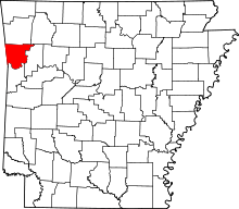 | |
| Towns | ||
| Unincorporated communities | ||