Chester, Montana
| Chester, Montana | |
|---|---|
| Town | |
|
Liberty County Courthouse in Chester | |
 Location of Chester, Montana | |
| Coordinates: 48°30′40″N 110°58′2″W / 48.51111°N 110.96722°WCoordinates: 48°30′40″N 110°58′2″W / 48.51111°N 110.96722°W | |
| Country | United States |
| State | Montana |
| County | Liberty |
| Area[1] | |
| • Total | 0.48 sq mi (1.24 km2) |
| • Land | 0.48 sq mi (1.24 km2) |
| • Water | 0 sq mi (0 km2) |
| Elevation | 3,133 ft (955 m) |
| Population (2010)[2] | |
| • Total | 847 |
| • Estimate (2015)[3] | 883 |
| • Density | 1,764.6/sq mi (681.3/km2) |
| Time zone | Mountain (MST) (UTC-7) |
| • Summer (DST) | MDT (UTC-6) |
| ZIP code | 59522 |
| Area code(s) | 406 |
| FIPS code | 30-14200 |
| GNIS feature ID | 0769799 |

Chester is a town in and the county seat of Liberty County, Montana, United States.[4] The population was 847 at the 2010 census, but is now believed to be about 1,025 people.
Geography
Chester is located at 48°30′40″N 110°58′2″W / 48.51111°N 110.96722°W (48.511105, -110.967126).[5]
According to the United States Census Bureau, the town has a total area of 0.48 square miles (1.24 km2), all of it land.[1]
Demographics
| Historical population | |||
|---|---|---|---|
| Census | Pop. | %± | |
| 1920 | 402 | — | |
| 1930 | 387 | −3.7% | |
| 1940 | 548 | 41.6% | |
| 1950 | 733 | 33.8% | |
| 1960 | 1,158 | 58.0% | |
| 1970 | 936 | −19.2% | |
| 1980 | 963 | 2.9% | |
| 1990 | 942 | −2.2% | |
| 2000 | 871 | −7.5% | |
| 2010 | 847 | −2.8% | |
| Est. 2015 | 883 | [6] | 4.3% |
| U.S. Decennial Census[7][8] 2015 Estimate[3] | |||
2010 census
As of the census[2] of 2010, there were 847 people, 395 households, and 223 families residing in the town. The population density was 1,764.6 inhabitants per square mile (681.3/km2). There were 462 housing units at an average density of 962.5 per square mile (371.6/km2). The racial makeup of the town was 97.3% White, 0.2% African American, 0.2% Native American, 0.2% Asian, and 2.0% from two or more races.
There were 395 households of which 21.3% had children under the age of 18 living with them, 48.4% were married couples living together, 7.3% had a female householder with no husband present, 0.8% had a male householder with no wife present, and 43.5% were non-families. 41.8% of all households were made up of individuals and 21.7% had someone living alone who was 65 years of age or older. The average household size was 2.09 and the average family size was 2.86.
The median age in the town was 51 years. 21.3% of residents were under the age of 18; 4.3% were between the ages of 18 and 24; 17.2% were from 25 to 44; 29.3% were from 45 to 64; and 27.9% were 65 years of age or older. The gender makeup of the town was 45.5% male and 54.5% female.
2000 census
As of the census[9] of 2000, there were 871 people, 384 households, and 228 families residing in the town. The population density was 1,668.2 people per square mile (715.5/km²). There were 471 housing units at an average density of 1,010.2 per square mile (386.9/km²). The racial makeup of the town was 98.74% White, 0.23% Native American, 0.57% Asian, and 0.46% from two or more races.
There were 384 households out of which 24.7% had children under the age of 18 living with them, 50.5% were married couples living together, 7.6% had a female householder with no husband present, and 40.6% were non-families. 37.2% of all households were made up of individuals and 18.8% had someone living alone who was 65 years of age or older. The average household size was 2.11 and the average family size was 2.79.
In the town the population was spread out with 20.7% under the age of 18, 4.4% from 18 to 24, 20.1% from 25 to 44, 27.2% from 45 to 64, and 27.7% who were 65 years of age or older. The median age was 47 years. For every 100 females there were 84.1 males. For every 100 females age 18 and over, there were 81.8 males.
The median income for a household in the town was $27,578, and the median income for a family was $42,639. Males had a median income of $26,154 versus $17,417 for females. The per capita income for the town was $16,077. About 14.6% of families and 13.5% of the population were below the poverty line, including 17.1% of those under age 18 and 13.5% of those age 65 or over.
Climate
Chester experiences a semi-arid climate (Köppen BSk) with long, cold, dry winters and short, hot, wetter summers. This type of a semi-arid climate is a dry continental variety with similar temperatures as the more humid ones, albeit with less precipitation.
| Climate data for Chester, Montana | |||||||||||||
|---|---|---|---|---|---|---|---|---|---|---|---|---|---|
| Month | Jan | Feb | Mar | Apr | May | Jun | Jul | Aug | Sep | Oct | Nov | Dec | Year |
| Record high °F (°C) | 66 (19) |
74 (23) |
79 (26) |
88 (31) |
94 (34) |
100 (38) |
104 (40) |
105 (41) |
97 (36) |
89 (32) |
75 (24) |
64 (18) |
105 (41) |
| Average high °F (°C) | 28.1 (−2.2) |
35.1 (1.7) |
45.1 (7.3) |
58.0 (14.4) |
67.7 (19.8) |
75.4 (24.1) |
82.6 (28.1) |
82.2 (27.9) |
71.2 (21.8) |
59.3 (15.2) |
40.5 (4.7) |
30.4 (−0.9) |
56.3 (13.49) |
| Daily mean °F (°C) | 16.0 (−8.9) |
22.1 (−5.5) |
32.0 (0) |
43.4 (6.3) |
53.4 (11.9) |
61.0 (16.1) |
66.6 (19.2) |
65.8 (18.8) |
55.1 (12.8) |
43.8 (6.6) |
28.1 (−2.2) |
18.3 (−7.6) |
42.13 (5.62) |
| Average low °F (°C) | 3.9 (−15.6) |
9.1 (−12.7) |
18.8 (−7.3) |
28.7 (−1.8) |
39.1 (3.9) |
46.5 (8.1) |
50.5 (10.3) |
49.3 (9.6) |
39.0 (3.9) |
28.3 (−2.1) |
15.6 (−9.1) |
6.2 (−14.3) |
27.92 (−2.26) |
| Record low °F (°C) | −57 (−49) |
−44 (−42) |
−38 (−39) |
−19 (−28) |
14 (−10) |
24 (−4) |
31 (−1) |
28 (−2) |
13 (−11) |
−17 (−27) |
−31 (−35) |
−52 (−47) |
−57 (−49) |
| Average precipitation inches (mm) | 0.38 (9.7) |
0.26 (6.6) |
0.51 (13) |
0.71 (18) |
1.77 (45) |
2.20 (55.9) |
1.47 (37.3) |
1.21 (30.7) |
0.84 (21.3) |
0.48 (12.2) |
0.36 (9.1) |
0.39 (9.9) |
10.58 (268.7) |
| Source #1: NOAA (normals, 1971–2000) [10] | |||||||||||||
| Source #2: The Weather Channel (Records) [11] | |||||||||||||
Notable People
- Philip Aaberg, a pianist, keyboardist, and composer was born in Chester in 1949.[12]
References
- 1 2 "US Gazetteer files 2010". United States Census Bureau. Archived from the original on 2012-01-24. Retrieved 2012-12-18.
- 1 2 "American FactFinder". United States Census Bureau. Retrieved 2012-12-18.
- 1 2 "Population Estimates". United States Census Bureau. Retrieved July 23, 2016.
- ↑ "Find a County". National Association of Counties. Archived from the original on May 10, 2015. Retrieved June 7, 2011.
- ↑ "US Gazetteer files: 2010, 2000, and 1990". United States Census Bureau. 2011-02-12. Retrieved 2011-04-23.
- ↑ "Annual Estimates of the Resident Population for Incorporated Places: April 1, 2010 to July 1, 2015". Retrieved July 2, 2016.
- ↑ "Census of Population and Housing". Census.gov. Archived from the original on May 11, 2015. Retrieved June 4, 2015.
- ↑ "Census & Economic Information Center". Retrieved July 3, 2015.
- ↑ "American FactFinder". United States Census Bureau. Archived from the original on 2013-09-11. Retrieved 2008-01-31.
- ↑ "Climatography of the United States NO.81" (PDF). National Oceanic and Atmospheric Administration. Retrieved January 15, 2011.
- ↑ "Monthly Averages for Chester, MT". The Weather Channel. Retrieved January 15, 2011.
- ↑ Fallows, Deborah. "Listening to Montana: In Chester, Montana, a world away from city life inspires an artist's music.". The Atlantic. Retrieved March 18, 2016.
Municipalities and communities of Liberty County, Montana, United States | ||
|---|---|---|
| Town | 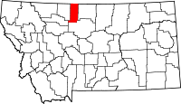 | |
| CDP | ||
| Unincorporated communities | ||