Clay Township, Ottawa County, Ohio
| Clay Township, Ottawa County, Ohio | |
|---|---|
| Township | |
|
Broad fields typical of Clay Township | |
 Location of Clay Township in Ottawa County | |
| Coordinates: 41°31′32″N 83°21′20″W / 41.52556°N 83.35556°WCoordinates: 41°31′32″N 83°21′20″W / 41.52556°N 83.35556°W | |
| Country | United States |
| State | Ohio |
| County | Ottawa |
| Area | |
| • Total | 26.0 sq mi (67.4 km2) |
| • Land | 26.0 sq mi (67.3 km2) |
| • Water | 0.0 sq mi (0.1 km2) |
| Elevation[1] | 633 ft (193 m) |
| Population (2000) | |
| • Total | 5,118 |
| • Density | 197.0/sq mi (76.0/km2) |
| Time zone | Eastern (EST) (UTC-5) |
| • Summer (DST) | EDT (UTC-4) |
| FIPS code | 39-15546[2] |
| GNIS feature ID | 1086759[1] |

Clay Township is one of the twelve townships of Ottawa County, Ohio, United States. The 2000 census found 5,118 people in the township, 2,888 of whom lived in the unincorporated portions of the township.[3]
Geography
Located in the southwestern corner of the county, it borders the following townships:
- Allen Township - north
- Benton Township - northeast
- Harris Township - southeast
- Woodville Township, Sandusky County - south
- Lake Township, Wood County - southwest
- Troy Township, Wood County - west
The village of Genoa is located in the center of the township, and the unincorporated communities of Forest Park and Martin lie in the township's northwest and northeast respectively.
Name and history
Clay Township was named after statesman Henry Clay.[4] It is one of nine Clay Townships statewide.[5]
Government
The township is governed by a three-member board of trustees, who are elected in November of odd-numbered years to a four-year term beginning on the following January 1. Two are elected in the year after the presidential election and one is elected in the year before it. There is also an elected township fiscal officer,[6] who serves a four-year term beginning on April 1 of the year after the election, which is held in November of the year before the presidential election. Vacancies in the fiscal officership or on the board of trustees are filled by the remaining trustees.
References
- 1 2 "US Board on Geographic Names". United States Geological Survey. 2007-10-25. Retrieved 2008-01-31.
- ↑ "American FactFinder". United States Census Bureau. Archived from the original on 2013-09-11. Retrieved 2008-01-31.
- ↑ Ottawa County, Ohio — Population by Places Estimates Ohio State University, 2007. Accessed 15 May 2007.
- ↑ Overman, William Daniel (1958). Ohio Town Names. Akron, OH: Atlantic Press. p. 29.
- ↑ "Detailed map of Ohio" (PDF). United States Census Bureau. 2000. Retrieved 2007-02-16.
- ↑ §503.24, §505.01, and §507.01 of the Ohio Revised Code. Accessed 4/30/2009.
External links
Municipalities and communities of Ottawa County, Ohio, United States | ||
|---|---|---|
| City | 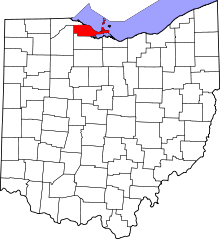 | |
| Villages | ||
| Townships | ||
| CDPs | ||
| Unincorporated communities | ||
| Footnotes | ‡This populated place also has portions in an adjacent county or counties | |