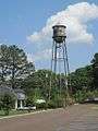
Coldwater, Mississippi
| Coldwater, Mississippi | |
|---|---|
| Town | |
 | |
| Nickname(s): C-Town | |
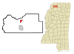 Location of Coldwater, Mississippi | |
 Coldwater, Mississippi Location in the United States | |
| Coordinates: 34°41′23″N 89°58′26″W / 34.68972°N 89.97389°WCoordinates: 34°41′23″N 89°58′26″W / 34.68972°N 89.97389°W | |
| Country | United States |
| State | Mississippi |
| County | Tate |
| Government | |
| Area | |
| • Total | 2.4 sq mi (6.2 km2) |
| • Land | 2.4 sq mi (6.1 km2) |
| • Water | 0.0 sq mi (0.0 km2) |
| Elevation | 249 ft (76 m) |
| Population (2000) | |
| • Total | 1,674 |
| • Density | 705.5/sq mi (272.4/km2) |
| Time zone | Central (CST) (UTC-6) |
| • Summer (DST) | CDT (UTC-5) |
| ZIP code | 38618 |
| Area code(s) | 662 |
| FIPS code | 28-14900 |
| GNIS feature ID | 0668665 |
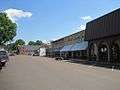
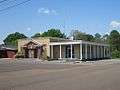
Coldwater is a small town in Tate County, Mississippi. It is in the Memphis Metropolitan Area. The population was 1,674 at the 2000 census.
History
The current town square of Coldwater is about two miles south of the Coldwater River, hence the name. The original town began as the village of Elm Grove in 1856. With the coming of the Mississippi and Tennessee Railroad in 1858, rows of stores and other businesses developed on both sides of the tracks, along with houses of worship. Coldwater was officially incorporated in 1872. At that time, the Town was located in DeSoto County and was a mile square with the railroad depot at the center. When another Mississippi county was created in 1873 from land originally located in DeSoto, Marshall, and Tunica counties, Coldwater found itself to be a part of the newly formed Tate County.
The Town began to grow with an influx of settlers from Virginia, the Carolinas, Alabama, and other areas seeking a better life for themselves and their families. There were 397 residents of Coldwater according to the 1890 census. By 1884, there were 96 small schools in Tate County, 54 white and 42 black. They were mostly one teacher, one-room log houses with split logs for seats.
Over the course of its history, Coldwater steadily grew in numbers. However, periodic river flooding plagued the town, as the river would too often swell its banks, spilling onto area farmland. When the Arkabutla Lake and Dam project was built in the early 1940s, the Town felt it had to move. So, in 1942, the Town of Coldwater moved, to land about a mile and a half south of its original location.
The site of the old town of Coldwater is 229 feet (70 m) MSL and parts of it are underwater year round.
Geography
According to the United States Census Bureau, the town has a total area of 2.4 square miles (6.2 km2), of which 2.4 square miles (6.1 km²) is land and 0.42% water.
Demographics
| Historical population | |||
|---|---|---|---|
| Census | Pop. | %± | |
| 1880 | 397 | — | |
| 1890 | 518 | 30.5% | |
| 1900 | 557 | 7.5% | |
| 1910 | 774 | 39.0% | |
| 1920 | 856 | 10.6% | |
| 1930 | 664 | −22.4% | |
| 1940 | 690 | 3.9% | |
| 1950 | 949 | 37.5% | |
| 1960 | 1,264 | 33.2% | |
| 1970 | 1,450 | 14.7% | |
| 1980 | 1,505 | 3.8% | |
| 1990 | 1,502 | −0.2% | |
| 2000 | 1,674 | 11.5% | |
| 2010 | 1,677 | 0.2% | |
| Est. 2015 | 1,603 | [1] | −4.4% |
As of the census[3] of 2000, there were 1,674 people, 598 households, and 429 families residing in the town. The population density was 705.5 people per square mile (272.7/km²). There were 642 housing units at an average density of 270.6 per square mile (104.6/km²). The racial makeup of the town was 69.71% African American, 29.45% White, 0.06% Native American, 0.12% Asian, and 0.66% from two or more races. Hispanic or Latino of any race were 0.42% of the population.
There were 598 households out of which 36.6% had children under the age of 18 living with them, 39.1% were married couples living together, 28.6% had a female householder with no husband present, and 28.1% were non-families. 25.1% of all households were made up of individuals and 10.4% had someone living alone who was 65 years of age or older. The average household size was 2.80 and the average family size was 3.35.
In the town the population was spread out with 31.5% under the age of 18, 8.0% from 18 to 24, 29.0% from 25 to 44, 20.3% from 45 to 64, and 11.2% who were 65 years of age or older. The median age was 32 years. For every 100 females there were 79.8 males. For every 100 females age 18 and over, there were 72.6 males.
The median income for a household in the town was $26,058, and the median income for a family was $31,364. Males had a median income of $28,472 versus $19,444 for females. The per capita income for the town was $12,330. About 21.1% of families and 23.5% of the population were below the poverty line, including 26.9% of those under age 18 and 26.7% of those age 65 or over.
Education
The Town of Coldwater is served by the Tate County School District. It has two schools Coldwater Elementary and Coldwater High School. Coldwater High School has gone to the state championship in track and basketball numerous times. The girls basketball team have won state championships in 1996, 2007 and 2008 while also making it to the final two since 2003. The boys Basketball team also won in 2009, and 2012 and have also made appearances since 2003. The school mascot is known as the Mighty Coldwater Cougar, and the school colors are blue, gold, and white.
Notable people
- James Kamala Harris, WWF professional wrestler
- Dumas Malone, Pulitzer prize-winning historian and noted Jeffersonian scholar.
- Dorris Bowdon, actress best known for her role as Rosasharn in the film adaptation of John Steinbeck's novel The Grapes of Wrath
- Don Castle, baseball player.[4]
- Thomas Webber Wilson, three-term U.S. Congressional Representative from Mississippi from 1923-1929.
- Bill Coday, blues singer.
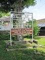
- Fred's, Inc., is a regional chain of discount retail stores, operating in the southeastern (and, to a lesser extent, midwestern) U.S.A.. It opened in 1947 in Coldwater and operates approximately 700 stores and 300 pharmacies in 15 states.
- WREC, is a radio station broadcasting a News Talk Information format.
- Big Time Sarah, blues singer.
- Clen "Damon" Moore, M.D., First African American Rhodes Scholar in the state of MS (Coldwater High School).
- Trell Kimmons, Olympic track and field runner.
- Mitch Young, gridiron football player
- Cameron Lawrence, NFL Linebacker for the Dallas Cowboys
References
| Wikimedia Commons has media related to Coldwater, Mississippi. |
- ↑ "Annual Estimates of the Resident Population for Incorporated Places: April 1, 2010 to July 1, 2015". Retrieved July 2, 2016.
- ↑ "Census of Population and Housing". Census.gov. Archived from the original on May 11, 2015. Retrieved June 4, 2015.
- ↑ "American FactFinder". United States Census Bureau. Archived from the original on 2013-09-11. Retrieved 2008-01-31.
- ↑ By Chuck Stewart
Gallery


Municipalities and communities of Tate County, Mississippi, United States | ||
|---|---|---|
| City |  | |
| Town | ||
| Unincorporated communities | ||