Corlay
| Corlay Korle | ||
|---|---|---|
|
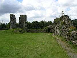
Ruins of the chateau | ||
| ||
 Corlay | ||
|
Location within Brittany region  Corlay | ||
| Coordinates: 48°19′05″N 3°03′20″W / 48.3180°N 3.0555°WCoordinates: 48°19′05″N 3°03′20″W / 48.3180°N 3.0555°W | ||
| Country | France | |
| Region | Brittany | |
| Department | Côtes-d'Armor | |
| Arrondissement | Saint-Brieuc | |
| Canton | Corlay | |
| Intercommunality | Pays de Corlay | |
| Government | ||
| • Mayor (2014–2020) | Pierre-Yvon Corbel | |
| Area1 | 13.80 km2 (5.33 sq mi) | |
| Population (2008)2 | 1,046 | |
| • Density | 76/km2 (200/sq mi) | |
| Time zone | CET (UTC+1) | |
| • Summer (DST) | CEST (UTC+2) | |
| INSEE/Postal code | 22047 / 22320 | |
| Elevation | 157–257 m (515–843 ft) | |
|
1 French Land Register data, which excludes lakes, ponds, glaciers > 1 km² (0.386 sq mi or 247 acres) and river estuaries. 2 Population without double counting: residents of multiple communes (e.g., students and military personnel) only counted once. | ||

Corlay (Breton: Korle, Gallo: Corlaè) is a commune in the Côtes-d'Armor department of Brittany in northwestern France.
Population
| Historical population | ||
|---|---|---|
| Year | Pop. | ±% |
| 1962 | 1,026 | — |
| 1968 | 1,088 | +6.0% |
| 1975 | 1,133 | +4.1% |
| 1982 | 1,071 | −5.5% |
| 1990 | 1,044 | −2.5% |
| 1999 | 978 | −6.3% |
| 2008 | 1,046 | +7.0% |
Inhabitants of Corlay are called corlaisiens in French.
See also
References
External links
| Wikimedia Commons has media related to Corlay. |
This article is issued from Wikipedia - version of the 11/9/2014. The text is available under the Creative Commons Attribution/Share Alike but additional terms may apply for the media files.