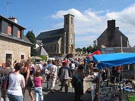
Kermaria-Sulard
| Kermaria-Sulard Kervaria-Sular | |
|---|---|
 | |
 Kermaria-Sulard | |
|
Location within Brittany region  Kermaria-Sulard | |
| Coordinates: 48°46′21″N 3°22′10″W / 48.7725°N 3.3694°WCoordinates: 48°46′21″N 3°22′10″W / 48.7725°N 3.3694°W | |
| Country | France |
| Region | Brittany |
| Department | Côtes-d'Armor |
| Arrondissement | Lannion |
| Canton | Perros-Guirec |
| Intercommunality | Lannion Trégor |
| Government | |
| • Mayor (2014–2020) | Dominique Boitel |
| Area1 | 9.02 km2 (3.48 sq mi) |
| Population (2008)2 | 958 |
| • Density | 110/km2 (280/sq mi) |
| Time zone | CET (UTC+1) |
| • Summer (DST) | CEST (UTC+2) |
| INSEE/Postal code | 22090 / 22450 |
| Elevation | 55–110 m (180–361 ft) |
|
1 French Land Register data, which excludes lakes, ponds, glaciers > 1 km² (0.386 sq mi or 247 acres) and river estuaries. 2 Population without double counting: residents of multiple communes (e.g., students and military personnel) only counted once. | |
Kermaria-Sulard (Breton: Kervaria-Sular) is a commune in the Côtes-d'Armor department of Brittany in northwestern France.
Population
| Historical population | ||
|---|---|---|
| Year | Pop. | ±% |
| 1962 | 537 | — |
| 1968 | 478 | −11.0% |
| 1975 | 460 | −3.8% |
| 1982 | 632 | +37.4% |
| 1990 | 648 | +2.5% |
| 1999 | 745 | +15.0% |
| 2008 | 958 | +28.6% |
Inhabitants of Kermaria-Sulard are called kermarianais in French.
Sister city
 Muhlbach-sur-Munster, France
See also
References
| Wikimedia Commons has media related to Kermaria-Sulard. |
This article is issued from Wikipedia - version of the 5/8/2014. The text is available under the Creative Commons Attribution/Share Alike but additional terms may apply for the media files.