Uzel
For other uses, see Uzel (disambiguation).
| Uzel Uzel | ||
|---|---|---|
 | ||
| ||
 Uzel | ||
|
Location within Brittany region  Uzel | ||
| Coordinates: 48°17′N 2°50′W / 48.28°N 2.84°WCoordinates: 48°17′N 2°50′W / 48.28°N 2.84°W | ||
| Country | France | |
| Region | Brittany | |
| Department | Côtes-d'Armor | |
| Arrondissement | Saint-Brieuc | |
| Canton | Uzel | |
| Intercommunality | Pays d'Uzel-près-l'Oust | |
| Government | ||
| • Mayor (2014–2020) | Yves Le Plénier | |
| Area1 | 6.79 km2 (2.62 sq mi) | |
| Population (2008)2 | 1,056 | |
| • Density | 160/km2 (400/sq mi) | |
| Time zone | CET (UTC+1) | |
| • Summer (DST) | CEST (UTC+2) | |
| INSEE/Postal code | 22384 / 22460 | |
| Elevation | 116–238 m (381–781 ft) | |
|
1 French Land Register data, which excludes lakes, ponds, glaciers > 1 km² (0.386 sq mi or 247 acres) and river estuaries. 2 Population without double counting: residents of multiple communes (e.g., students and military personnel) only counted once. | ||
.svg.png)
Uzel (or Uzel-près-l'Oust[1]) is a commune in the Côtes-d'Armor department in Brittany in northwestern France. It is about 100 km (62 mi) west-northwest of Rennes and 15 km (9.3 mi) north-northwest of Loudéac.
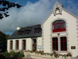
The old school, in the centre of Uzel, was the scene of torture and killings by the Nazis and by the collarborationist Bezen Perrot, in 1944.
Population
| Historical population | ||
|---|---|---|
| Year | Pop. | ±% |
| 1962 | 857 | — |
| 1968 | 899 | +4.9% |
| 1975 | 926 | +3.0% |
| 1982 | 990 | +6.9% |
| 1990 | 943 | −4.7% |
| 1999 | 897 | −4.9% |
| 2008 | 1,056 | +17.7% |
The inhabitants of Uzel are known in French as uzelais.
Personalities
- Fulgence Bienvenüe, chief engineer for the Paris Métro in 1896, was born in Uzel in 1852.
- Alphonse Guépin, architect, born in Uzel in 1808.
- Yves Morvan, romanesque art specialist, born in Uzel in 1932.
See also
References
- ↑ "Uzel-près-l'Oust". Service Public.fr (in French).
External links
| Wikimedia Commons has media related to Uzel. |
This article is issued from Wikipedia - version of the 7/16/2016. The text is available under the Creative Commons Attribution/Share Alike but additional terms may apply for the media files.