Cottonwood, South Dakota
| Cottonwood, South Dakota | |
|---|---|
| Town | |
 Location in Jackson County and the state of South Dakota | |
| Coordinates: 43°57′59″N 101°54′20″W / 43.96639°N 101.90556°WCoordinates: 43°57′59″N 101°54′20″W / 43.96639°N 101.90556°W | |
| Country | United States |
| State | South Dakota |
| County | Jackson |
| Incorporated | 1906[1] |
| Area[2] | |
| • Total | 0.92 sq mi (2.38 km2) |
| • Land | 0.92 sq mi (2.38 km2) |
| • Water | 0 sq mi (0 km2) |
| Elevation | 2,421 ft (738 m) |
| Population (2010)[3] | |
| • Total | 9 |
| • Estimate (2012[4]) | 10 |
| • Density | 9.8/sq mi (3.8/km2) |
| Time zone | Mountain (MST) (UTC-7) |
| • Summer (DST) | MDT (UTC-6) |
| Area code(s) | 605 |
| FIPS code | 46-14220 |
| GNIS feature ID | 1261490[5] |
Cottonwood is a town in Jackson County, South Dakota, United States. The population was 9 at the 2010 census.
History
Cottonwood was originally named Ingham, and under the latter name was laid out in 1906.[6] The present name comes from Cottonwood Creek.[6]
Residents voted 7 to 4 in 2016 opposing dissolution of the town.[7]
Geography
Cottonwood is located at 43°57′59″N 101°54′20″W / 43.96639°N 101.90556°W (43.966333, -101.905478).[8]
According to the United States Census Bureau, the town has a total area of 0.92 square miles (2.38 km2), all of it land.[2]
Demographics
| Historical population | |||
|---|---|---|---|
| Census | Pop. | %± | |
| 1920 | 121 | — | |
| 1930 | 191 | 57.9% | |
| 1940 | 118 | −38.2% | |
| 1950 | 102 | −13.6% | |
| 1960 | 38 | −62.7% | |
| 1970 | 16 | −57.9% | |
| 1980 | 4 | −75.0% | |
| 1990 | 12 | 200.0% | |
| 2000 | 6 | −50.0% | |
| 2010 | 9 | 50.0% | |
| Est. 2015 | 10 | [9] | 11.1% |
| U.S. Decennial Census[10] 2012 Estimate[11] | |||
2010 census
As of the census[3] of 2010, there were 9 people, 6 households, and 3 families residing in the town. The population density was 9.8 inhabitants per square mile (3.8/km2). There were 9 housing units at an average density of 9.8 per square mile (3.8/km2). The racial makeup of the town was 88.9% White and 11.1% Native American.
There were 6 households of which 33.3% were married couples living together, 16.7% had a male householder with no wife present, and 50.0% were non-families. 50.0% of all households were made up of individuals and 16.7% had someone living alone who was 65 years of age or older. The average household size was 1.50 and the average family size was 2.00.
The median age in the town was 60.8 years. 0.0% of residents were under the age of 18; 11.1% were between the ages of 18 and 24; 0.0% were from 25 to 44; 55.5% were from 45 to 64; and 33.3% were 65 years of age or older. The gender makeup of the town was 66.7% male and 33.3% female.
2000 census
As of the census of 2000, there were 6 people, 4 households, and 2 families residing in the town. The population density was 6.5 people per square mile (2.5/km²). There were 5 housing units at an average density of 5.4 per square mile (2.1/km²). The racial makeup of the town was 100.00% White.
There were 4 households out of which none had children under the age of 18 living with them, 50.0% were married couples living together, and 50.0% were non-families. 50.0% of all households were made up of individuals and 50.0% had someone living alone who was 65 years of age or older. The average household size was 1.50 and the average family size was 2.00.
In the town the population was spread out with 33.3% from 45 to 64, and 66.7% who were 65 years of age or older. The median age was 66 years. For every 100 females there were 100.0 males. For every 100 females age 18 and over, there were 100.0 males.
The median income for a household in the town was $75,487, and the median income for a family was $0. Males had a median income of $0 versus $0 for females. The per capita income for the town was $79,000. None of the population or families were below the poverty line.
References
- ↑ "SD Towns" (PDF). South Dakota State Historical Society. Archived from the original (PDF) on 2010-02-10. Retrieved 2010-02-11.
- 1 2 "US Gazetteer files 2010". United States Census Bureau. Archived from the original on 2012-07-14. Retrieved 2012-06-21.
- 1 2 "American FactFinder". United States Census Bureau. Retrieved 2012-06-21.
- ↑ "Population Estimates". United States Census Bureau. Archived from the original on 2013-06-17. Retrieved 2013-05-29.
- ↑ "US Board on Geographic Names". United States Geological Survey. 2007-10-25. Retrieved 2008-01-31.
- 1 2 Federal Writers' Project (1940). South Dakota place-names, v.1-3. University of South Dakota. p. 32.
- ↑ Tupper, Seth (June 14, 2016). "Cottonwood, population 12, survives dissolution vote". Rapid City Journal. Retrieved June 14, 2016.
- ↑ "US Gazetteer files: 2010, 2000, and 1990". United States Census Bureau. 2011-02-12. Retrieved 2011-04-23.
- ↑ "Annual Estimates of the Resident Population for Incorporated Places: April 1, 2010 to July 1, 2015". Retrieved July 2, 2016.
- ↑ United States Census Bureau. "Census of Population and Housing". Archived from the original on May 11, 2015. Retrieved September 23, 2013.
- ↑ "Annual Estimates of the Resident Population: April 1, 2010 to July 1, 2012". Retrieved September 23, 2013.
Municipalities and communities of Jackson County, South Dakota, United States | ||
|---|---|---|
| City | 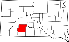 | |
| Towns | ||
| CDP | ||
| Unincorporated communities | ||
| Indian reservation | ||
| Ghost town | ||
| Footnotes | ‡This populated place also has portions in an adjacent county or counties | |