Covington, Ohio
| Covington, Ohio | |
|---|---|
| Village | |
|
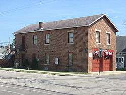
Covington's old village hall, now a museum | |
 Location of Covington, Ohio | |
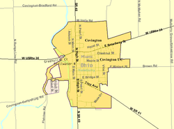 Detailed map of Covington | |
| Coordinates: 40°7′6″N 84°21′5″W / 40.11833°N 84.35139°WCoordinates: 40°7′6″N 84°21′5″W / 40.11833°N 84.35139°W | |
| Country | United States |
| State | Ohio |
| County | Miami |
| Township | Newberry |
| Area[1] | |
| • Total | 1.35 sq mi (3.50 km2) |
| • Land | 1.32 sq mi (3.42 km2) |
| • Water | 0.03 sq mi (0.08 km2) |
| Elevation[2] | 932 ft (284 m) |
| Population (2010)[3] | |
| • Total | 2,584 |
| • Estimate (2012[4]) | 2,593 |
| • Density | 1,957.6/sq mi (755.8/km2) |
| Time zone | Eastern (EST) (UTC-5) |
| • Summer (DST) | EDT (UTC-4) |
| ZIP code | 45318 |
| Area code(s) | 937 |
| FIPS code | 39-19050[5] |
| GNIS feature ID | 1056842[2] |
Covington is a village in Miami County, Ohio, United States. The population was 2,584 at the 2010 census. It is part of the Dayton Metropolitan Statistical Area. The village was incorporated as Covington in 1835 on the site of the 1793 Fort Rowdy.
History
Covington was laid out in 1816.[6] Early variant names were Friendship, Newberry, and Stillwater.[7] A post office called Stillwater was established in 1825, and the name was changed to Covington in 1836.[8]
Geography
Covington is located at 40°7′6″N 84°21′5″W / 40.11833°N 84.35139°W (40.118434, -84.351312).[9]
According to the United States Census Bureau, the village has a total area of 1.35 square miles (3.50 km2), of which 1.32 square miles (3.42 km2) is land and 0.03 square miles (0.08 km2) is water.[1] Portions of the west border follow along the Stillwater River and Greenville Creek.
Demographics
| Historical population | |||
|---|---|---|---|
| Census | Pop. | %± | |
| 1870 | 1,010 | — | |
| 1880 | 1,458 | 44.4% | |
| 1890 | 1,778 | 21.9% | |
| 1900 | 1,791 | 0.7% | |
| 1910 | 1,848 | 3.2% | |
| 1920 | 1,885 | 2.0% | |
| 1930 | 1,807 | −4.1% | |
| 1940 | 1,945 | 7.6% | |
| 1950 | 2,172 | 11.7% | |
| 1960 | 2,473 | 13.9% | |
| 1970 | 2,575 | 4.1% | |
| 1980 | 2,610 | 1.4% | |
| 1990 | 2,603 | −0.3% | |
| 2000 | 2,559 | −1.7% | |
| 2010 | 2,584 | 1.0% | |
| Est. 2015 | 2,625 | [10] | 1.6% |
2010 census
As of the census[3] of 2010, there were 2,584 people, 1,037 households, and 706 families residing in the village. The population density was 1,957.6 inhabitants per square mile (755.8/km2). There were 1,156 housing units at an average density of 875.8 per square mile (338.1/km2). The racial makeup of the village was 98.1% White, 0.3% African American, 0.1% Native American, 0.2% from other races, and 1.3% from two or more races. Hispanic or Latino of any race were 0.6% of the population.
There were 1,037 households of which 33.7% had children under the age of 18 living with them, 48.8% were married couples living together, 14.6% had a female householder with no husband present, 4.7% had a male householder with no wife present, and 31.9% were non-families. 26.8% of all households were made up of individuals and 11.7% had someone living alone who was 65 years of age or older. The average household size was 2.42 and the average family size was 2.93.
The median age in the village was 38.7 years. 24.9% of residents were under the age of 18; 7.7% were between the ages of 18 and 24; 25.1% were from 25 to 44; 23.3% were from 45 to 64; and 18.9% were 65 years of age or older. The gender makeup of the village was 48.3% male and 51.7% female.
2000 census
As of the census[5] of 2000, there were 2,559 people, 1,011 households, and 702 families residing in the village. The population density was 2,220.9 people per square mile (859.2/km²). There were 1,075 housing units at an average density of 933.0 per square mile (360.9/km²). The racial makeup of the village was 98.79% White, 0.16% African American, 0.04% Asian, 0.43% from other races, and 0.59% from two or more races. Hispanic or Latino of any race were 0.90% of the population.
There were 1,011 households out of which 30.6% had children under the age of 18 living with them, 56.2% were married couples living together, 9.7% had a female householder with no husband present, and 30.5% were non-families. 26.5% of all households were made up of individuals and 12.9% had someone living alone who was 65 years of age or older. The average household size was 2.44 and the average family size was 2.93.
In the village the population was spread out with 23.9% under the age of 18, 8.2% from 18 to 24, 28.2% from 25 to 44, 21.9% from 45 to 64, and 17.7% who were 65 years of age or older. The median age was 38 years. For every 100 females there were 90.5 males. For every 100 females age 18 and over, there were 84.0 males.
The median income for a household in the village was $41,042, and the median income for a family was $44,924. Males had a median income of $32,750 versus $24,387 for females. The per capita income for the village was $18,888. About 1.0% of families and 2.6% of the population were below the poverty line, including none of those under age 18 and 3.6% of those age 65 or over.
Education
Covington is served by the Covington Exempted Village School District, which includes Covington High School.
Culture
Covington's annual Fort Rowdy Gathering, held in October, celebrates the village's origin as a fort of that name, built by the forces of Mad Anthony Wayne during the Northwest Indian War.
Also in 1989 there was a television show placed in Covington, Ohio it is titled The People Next Door
References
- 1 2 "US Gazetteer files 2010". United States Census Bureau. Archived from the original on January 24, 2012. Retrieved 2013-01-06.
- 1 2 "US Board on Geographic Names". United States Geological Survey. 2007-10-25. Retrieved 2008-01-31.
- 1 2 "American FactFinder". United States Census Bureau. Retrieved 2013-01-06.
- ↑ "Population Estimates". United States Census Bureau. Archived from the original on June 17, 2013. Retrieved 2013-06-17.
- 1 2 "American FactFinder". United States Census Bureau. Archived from the original on September 11, 2013. Retrieved 2008-01-31.
- ↑ Harbaugh, T. C. (1909). Centennial history. Troy, Piqua and Miami county, Ohio. Chicago: Richmond-Arnold Publishing Co. p. 96.
- ↑ The History of Miami County, Ohio: Containing a History of the County; Its Cities, Towns, Etc. Windmill Publications. 1880. p. 463.
- ↑ "Miami County". Jim Forte Postal History. Archived from the original on 9 September 2005. Retrieved 9 January 2016.
- ↑ "US Gazetteer files: 2010, 2000, and 1990". United States Census Bureau. 2011-02-12. Retrieved 2011-04-23.
- ↑ "Annual Estimates of the Resident Population for Incorporated Places: April 1, 2010 to July 1, 2015". Retrieved July 2, 2016.
- ↑ "Census of Population and Housing". Census.gov. Archived from the original on May 11, 2015. Retrieved June 4, 2015.
Municipalities and communities of Miami County, Ohio, United States | ||
|---|---|---|
| Cities | 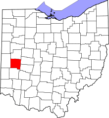 | |
| Villages | ||
| Townships | ||
| Unincorporated communities | ||
| Footnotes | ‡This populated place also has portions in an adjacent county or counties | |