Crișana
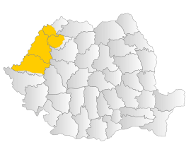
Crișana (Hungarian: Körösvidék; German: Kreischgebiet) is a geographical and historical region divided today between Romania and Hungary, named after the Criș (Körös) River and its three tributaries: the Crișul Alb, Crișul Negru, and Crișul Repede.
It is bounded to the east by the Apuseni Mountains, to the south by the Mureș River, to the north by the Someș River, and to the west by the Tisza River. The Romanian-Hungarian border cuts it in two.[1][2] It is part of the larger Tiszántúl (Transtisa) region.
Part of a series on the |
|---|
| History of Romania |
 |
|
Post-Revolution |
|
|
History
Ancient history
In ancient times, this area was settled by Celts, Dacians, Sarmatians, and Germanic peoples. In the first century BC, it was part of the Dacian Kingdom under Burebista.
Middle Ages
In the Middle Ages, it was ruled by the Hunnic Empire, the Kingdom of the Gepids, the Avar Empire, the Bulgarian Empire, and the Kingdom of Hungary.
Modern History
In the 16th-17th century, the region was divided between the Ottoman Empire and the Habsburg Monarchy. During Ottoman administration, the area was divided between Temeșvar Eyalet and the vassal Ottoman Principality of Transylvania. Within the Principality of Transylvania, the territory of Crișana was part of the area known as the Partium. Ottoman Varat Eyalet that was formed in the second half of the 17th century was centered on Crișana. Since the end of the 17th century, the whole region was incorporated into the Habsburg Monarchy and was administratively divided between the Habsburg Kingdom of Hungary, the Habsburg Principality of Transylvania and the Habsburg Military Frontier.
Following the abolition of the Theiß-Muresch section of the Habsburg Military Frontier (in 1750) and the abolition of the Principality of Transylvania (in 1867), the whole area was included in the Habsburg Kingdom of Hungary, which after 1867 became one of two autonomous parts of the dual monarchy of Austria-Hungary. During Habsburg administration, Crișana did not, on the whole, have special status such as that of Transylvania or the Banat; briefly, from 1850 to 1860, it was organized as the Military District of Großwardein. After disintegration of the Austro-Hungarian Empire in 1918, Crişana was divided between Romania (eastern part) and Hungary (western part).
Geography
Romanian Crișana is bounded in Romania by Maramureș to the north, Transylvania proper to the east, Banat to the south, and Hungary to the west. The region consists of the current Romanian counties of Arad (most of it), Bihor and some parts of Sălaj, Satu Mare, parts of Maramureș County(Codru, Chioar) and Hunedoara counties. Nowadays it is sometimes considered part of the historical region Transylvania, although it did not fall fully within the boundaries of the historical principality.
Hungarian Körösvidék is covered by the areas of Hajdú-Bihar County and Békés County. The southern part of Crișana, near the Mureș River, was called Pomorišje by the Serbs.
Cities
The most important cities are:
Gallery
 Arad - Orthodox Cathedral
 Arad - Ioan Slavici - Classic Theatre
 Arad - Administration Palace
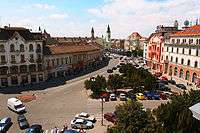 Oradea - The Ferdinand Square
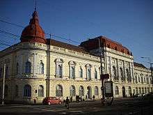 Oradea - The Faculty of Medicine
_-_pia%C5%A3a_Unirii.JPG) Oradea - The Black Eagle Palace
Oradea - The Black Eagle Palace
 Oradea -The Crişul Repede river
 Salonta - Reformed Cathedral
 Salonta - Orthodox Church
 Salonta- Arany Janos High School
 Salonta - The central park
 Salonta - Train monument and the railway station
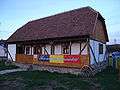 Salonta - The Peasantry Museum
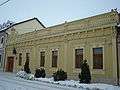 Salonta - Consulate of Slovakia
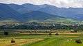 Wooden church in Brădet
See also
References
- ↑ Boia, Lucian (2001-01-01). Romania: Borderland of Europe. Reaktion Books. ISBN 9781861891037.
- ↑ White, George W. (2000-01-01). Nationalism and Territory: Constructing Group Identity in Southeastern Europe. Rowman & Littlefield. ISBN 9780847698097.
External links
| Wikimedia Commons has media related to Crișana. |
| Banat |
|
|---|---|
| Dobruja |
|
| Moldavia |
|
| Transylvania | |
| Wallachia | |