Croaghgorm
| Croaghgorm | |
|---|---|
| Cruach Ghorm | |
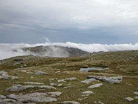 Summit of Croaghgorm | |
| Highest point | |
| Elevation | 674 m (2,211 ft) [1][2] |
| Prominence | 541 m (1,775 ft) [1] |
| Listing | Marilyn, Hewitt |
| Coordinates | 54°45′15″N 8°04′52″W / 54.754171°N 8.081031°WCoordinates: 54°45′15″N 8°04′52″W / 54.754171°N 8.081031°W |
| Naming | |
| Translation | blue stack (Irish) |
| Geography | |
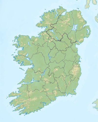 Croaghgorm Location in Ireland | |
| Location | County Donegal, Ireland |
| Parent range | Bluestack Mountains |
| OSI/OSNI grid | G948895 |
Croaghgorm or Bluestack (from Irish: an Chruach Gorm, meaning "the blue stack")[1] is a 674-metre (2,211 ft) mountain in County Donegal, Ireland. It is the highest of the Blue Stack Mountains (or Croaghgorms) and the third-highest mountain in County Donegal.[1]
On 31 January 1944, during World War II, a Royal Air Force (RAF) Sunderland plane crashed on the mountain. Seven RAF crewmen from 228 Squadron were killed. Wreckage from the plane can still be seen on the mountain's slopes. A memorial plaque was unveiled in 1988.[1]
See also
References
- 1 2 3 4 5 Croaghgorm MountainViews. Retrieved: 2013-03-19.
- ↑ Peakbagger
Mountains and hills of Ulster | ||
|---|---|---|
| Antrim Hills |  | |
| Antrim Plateau | ||
| Belfast Hills | ||
| Croaghgorms | ||
| Derryveagh | ||
| Inishowen | ||
| Mournes | ||
| Sperrins | ||
| Southwest Donegal | ||
| Others | ||
Lists of Marilyns | |
|---|---|
This article is issued from Wikipedia - version of the 3/11/2015. The text is available under the Creative Commons Attribution/Share Alike but additional terms may apply for the media files.