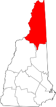
Cutt's Grant, New Hampshire
Coordinates: 44°12′24″N 71°20′15″W / 44.20667°N 71.33750°W Cutt's Grant is a township located in Coos County, New Hampshire, United States. It was granted by the New Hampshire legislature to Thomas Cutts of Maine in 1810. As of the 2010 census, the grant had a total population of 0.
In New Hampshire, locations, grants, townships (which are different from towns), and purchases are unincorporated portions of a county which are not part of any town and have limited self-government (if any, as many are uninhabited).
Geography
According to the United States Census Bureau, the grant has a total area of 11.4 square miles (29.5 km2), none of which is covered by water other than streams.[1] The highest point in Cutt's Grant is its northeastern corner, located just south of Gulf Peak on the southern slope of Mount Washington, where the elevation reaches 4,720 feet (1,440 m) above sea level.
Demographics
| Historical population | |||
|---|---|---|---|
| Census | Pop. | %± | |
| Est. 2015 | 0 | [2] | |
As of the census[4] of 2010, there are no people living in the grant.
References
- ↑ "Geographic Identifiers: 2010 Demographic Profile Data (G001) - Cutts grant, New Hampshire". U.S. Census Bureau American Factfinder. Archived from the original on September 11, 2013. Retrieved November 9, 2011.
- ↑ "Annual Estimates of the Resident Population for Incorporated Places: April 1, 2010 to July 1, 2015". Retrieved July 2, 2016.
- ↑ "Census of Population and Housing". Census.gov. Archived from the original on May 11, 2015. Retrieved June 4, 2016.
- ↑ "American FactFinder". United States Census Bureau. Archived from the original on 2013-09-11. Retrieved 2008-01-31.