Cyclone, Indiana
| Cyclone | |
|---|---|
| Unincorporated community | |
 Cyclone | |
| Coordinates: 40°13′42″N 86°25′57″W / 40.22833°N 86.43250°WCoordinates: 40°13′42″N 86°25′57″W / 40.22833°N 86.43250°W | |
| Country | United States |
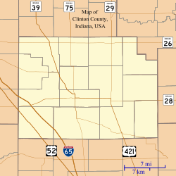
| State | Indiana |
| County | Clinton |
| Township | Jackson |
| Elevation | 925 ft (282 m) |
| ZIP code | 46041 |
| FIPS code | 18-16516[1] |
| GNIS feature ID | 433268[2] |
Cyclone is an unincorporated community in Jackson Township, Clinton County, Indiana.
History
The town's name commemorates a destructive tornado that struck the area on June 14, 1880. A 1913 county history states,
[It was] the most destructive storm that ever visited the county, either since its settlement or in traditional history. It was a genuine cyclone with a "funnel shaped cloud," which swept over a curved path of over forty miles in this and adjoining counties, leaving desolation in its wake. It was estimated to have done $200,000 damage in this county. The present town, which was located about that time as a railroad station, was in the path of the storm and was named for it.[3]
A post office was established at Cyclone in 1883, and remained in operation until it was discontinued in 1933.[4]
Geography
Cyclone is located at 40°13′42″N 86°25′57″W / 40.22833°N 86.43250°W.
References
- ↑ "American FactFinder". United States Census Bureau. Archived from the original on 2013-09-11. Retrieved 2008-01-31.
- ↑ "Cyclone, Indiana". Geographic Names Information System. United States Geological Survey. Retrieved 2009-10-10.
- ↑ Claybaugh, Joseph (1913). History of Clinton County, Indiana. Indianapolis: A. W. Bowen & Company. p. 33.
- ↑ "Clinton County". Jim Forte Postal History. Archived from the original on 3 September 2014. Retrieved 30 August 2014.
Municipalities and communities of Clinton County, Indiana, United States | ||
|---|---|---|
| City | ||
| Towns | ||
| Townships | ||
| Unincorporated communities |
| |